Frontier Creek & Coast Mountains Exploring

August 3-15, 2024

Last year, while working on digitizing the BCMC journals, Francis had met local mountaineering legend Glenn Woodsworth. Glenn has made hundreds of first ascents in the coast mountains including the first ascent of Serra V, among many, many other impressive feats. He seemed to recognize in Francis the same drive for adventure and interest in the unknown & unclimbed that he’d had when he was younger. And so it was through this friendship that Glenn divulged something of a secret: there still remain some unclimbed peaks in the Pantheon range.

For many climbers, this opportunity does not present itself very often, as the golden age of first ascents has long passed. So when Francis told me about this, I considered myself lucky to be a part of his team! This is the type of adventure that the two of us spend plenty of time dreaming about.

The trip was initially planned as a larger BCMC trip heading into Nirvana pass, where Francis and I and a few others would break off from the group to check out the Frontier Creek range before rejoining them for some other climbing. But when bad weather and fire season had the helis occupied, the trip fell through. Only Francis and I were able to shift our vacation by a week to coordinate with the Heli. Although this increased costs for us by a ton, at this point we were totally committed to our goal, and willing to spend some extra to do a trip of our dreams.

Day 1 (and 0) – First Ascent of Sedna Peak

On August 3, we joined long weekend traffic on the sea to sky, before making our way up through the countryside farther north in BC than we’d ever been. It took us 10 hours to arrive at WhiteSaddle air, but the latter half of the drive passed quickly, with some of the most pretty and peaceful landscapes we’d ever seen. If I was a painter, I would settle down in one of these small towns to capture the light on the trees, the towering mountains and the shimmering lakes.

We camped for the night by the hangar at WhiteSaddle air, and then made an early start to pack the rest of our gear, taking no chances on not being ready in time to fly. However a whole 45 minutes after we were ready, our pilot Mike rolled up in a side-by-side in his slippers, casually making small talk and getting set up for the day. We laughed at the laid-backness of his life, living on a beautiful property by a lake, a 10minute flight from the most incredible mountain range, with a very successful Heli business. He must be very happy out here! He can just get up and fly us climbers around before breakfast (in his slippers!), and then get back to making eggs and coffee. Wild! 

After a short lesson on their radios & a safety brief, we were lifting off and heading into the mountains. Almost immediately, it was apparent I’d never seen mountains like this before. Massive and very jagged spires went for as far as I could see, making everything look like no small feat to ascend. Mount Waddington and the Serras were especially impressive, towering high above the others. Immense glaciers covered the base of most mountains, while lower down, dense forests and turquoise rivers filled the valleys. Despite the hours of preparation, I suddenly felt very, very small. 

Mike landed along our ridge line at the closest flat area we could find, which conveniently made a nice campsite as well. As the Heli took off, we were met with the familiar all-encompassing silence of nature, and the feeling that we were now very much alone. Francis and I excitedly jogged up to the nearest high point to get a look around, and we could already see the summits of our first couple objectives!

We made a plan to go up the first one right away, so we could also get eyes on the rest of the ridge line. But not before some breakfast! I made the standard oatmeal, which was made much less appetizing by the swarm of bugs that insisted on accompanying my food into my mouth. As such, we ate quickly, and were happy to get moving on the trail and away from the masses of insects.

Huge amount of bags packed lol

Beautiful sunset on Bluff lake as we drove in

Bluff lake & the road

The WhiteSaddle heli!!

So dope. Helis are awesome

Mike dropping us kids off at school

Views at our campsite <3

At a nice leisurely 10am, we’d set up camp and were heading up the ridge line with a small amount of gear. As we neared the base of the first peak, it quickly became apparent that we wouldn’t be heading straight up the ridge line as intended since it looked steep, blocky and broken. Instead, we wrapped around the southwest side of the mountain, scrambling across a steep heather bench, and then found a gully system that looked more manageable. The rest of the mountain went something like this as well, where it always looked like it wouldn’t go, but with some creative route-finding we continued to find reasonable bypasses that didn’t require us to get out the rope. Our route went at no more than 3rd class with one or two easy or exposed 4th class moves, and we mostly followed loose gullies and interspersed benches. 

The crux of the day for me was actually what I like to call “being a woman” which very unfortunately comes with randomized side effects like dizzy spells and nausea. My body does not like to time its nonsense with vacation time and good weather windows, so I had the great pleasure of trying to make exposed 4th class moves while my vision was tilting sideways. Francis was very patient while I took way more breaks than normal to try to calm these dizzy spells, and eventually some painkillers kicked in and I was able to stop feeling so shaky. I always joke during these times that I wish I were a man, to which Francis will say something along the lines of “I don’t,” and I’m like “fair point” hahaha.

On the summit, we were delighted to find no sign of a summit cairn, which we hope means it has indeed never been climbed. We triumphantly built one of our own, and decided to follow the god-theme for the Pantheon range and call this one “Sedna” after the Inuit goddess of the ocean. It’s a beautiful name that we feel deserves a place in this beautiful sea of mountains.

The views were spectacular as well. We could see all the way to Waddington which poked out menacingly through a cloud, as well as Monarch Mountain in the other direction, another absolute monolith of a peak. The nearby mountains were not much less intimidating though. The aptly named spires of the Furies were tall and sharp, and there’s an unclimbed peak sitting to the right of Diana Mountain, with sheer vertical walls on every single side (which we climbed at the end of our trip!) These peaks would easily have a place among the Bugaboo Spires, and I would guess provide some harder and steeper climbing even than some of those. 

From the summit, we decided to push on a little ways, since the ridge line of our current peak was still blocking the view of our potential ascent line for the following days. We skirted around a couple gendarmes, making a few delicate and exposed moves, and then hiked up the rest of the gentle ridge line. From there, we were able to get more views, but they were not of what we’d hoped. There were two more large gendarmes on the way down to the notch, and then the potential for about 2 or 3 lines to the summit, none of which looked promising at all. This main peak would be no “gimme” for us.

After spending awhile discussing our route options and coming to no conclusions, we decided it was time to head back to camp.  We made our way back down the ridge, then down the same two gullies we’d come up. It was late when we got back, and after a quick dinner we happily dove into the tent and away from the bugs. It had been a short day stats wise, but with lots of mental effort we were still feeling pretty beat! 

Francis heading up the ridgeline

Looking towards our first summit

Me hiking along the ridgeline

Francis scoping out a bypass for the first set of gendarmes

The start of the loose rock hiking..

Following heather slopes

Scrambling up the gullies

More broken scrambling

And more… but with great views!

Me on the first false summit 🙂

Our first summit cairn!

The ridgelines were all a bit like this..

The one exposed move we made to bypass a gendarme

Beautiful open terrain now!

Francis scoping out the terrain ahead

Rock hopping and more rock hopping

Our first closer views of Culbert Crag

Heading back to camp

Francis descending a very picturesque gully of wildflowers

Arriving back at camp as the sun set

Day 2 – Wandering and Dreaming

On this day, the forecast said it was supposed to rain overnight, and then during the day, and then on the following night.. but in the end it didn’t rain at all.

Mid morning, after breakfast, we went down into the valley to check out some alternate route options for the following day; notably whether a buttress or some snow couloirs above the glacier may be an easier path. We figured the northeast side of the summits would be too steep, but it’s always worth having a look up from the base of it. As expected, we couldn’t see anything promising even from the far end of the valley, so we surrendered ourselves to the idea of climbing the southwest faces. 

I stopped numerous times along our little hike to admire the pretty moss and flowers growing on the slabs. I even found a waterfall to soak my head in, which always feels especially refreshing when you’re coated in layers of sticky sunscreen and bug spray.

After our excursion, we spent the rest of the day reading books, napping, admiring the views and packing for our overnight trip. We were surprised to have avoided the rain in the forecast, but we did hear some thunder and see some dark clouds a few valleys over. I guess the forecast for this area is quite broad. 

Hiking down into the valley

Looking up from the river at the Furies, Nemesis and Gilgamesh

The waterfall I found

Totally soaked but super refreshing!

Looking up at what we later named “Trident Tower” (left)

I liked this sandwich rock!

And I thought this rock was pretty cool too

Here is a whole gallery of pretty flowers and moss that I found!

Lounging around the slabs around lunchtime

I luv this guy so much 🙂

Hiking back up to the campsite

Looking over at Trident Tower, Diana and the Furies from our campsite ! very inspiring view!!

The rain clouds looked like they’d hit us but then went straight by 🙂

I’m obsessed with this campsite actually

Day 3 – First Ascent of Culbert Crag

Amped up for the big summit day and wanting to maximize the time we had, Francis and I set a bold alarm at 5am. Although it seemed early, the sky was already light when we began our trek back up the ridge and towards the summit we’d climbed on our first day. Now that we knew the best route up, we skipped a bunch of unnecessary elevation gain, and headed straight in the direction we needed to go. 

To make our descriptions easier, we’d taken to naming the sub summits #1, 2, 3 & 4. #1 being the closest to our campsite along the ridgeline as well as the true summit.

To get to #1, we’d decided the best (or maybe the only) way was to drop down almost to tree line, wrap around underneath #1 and #2, and gain a buttress on #3 that looked low angle enough for us to actually climb. Then, traverse back over the ridgeline to #1. From what we’d scoped out, the direct path to #1 didn’t look doable, being a knife edge ridgeline with vertical looking gendarmes breaking up the climbing. We figured there was too big a chance of us getting shut down by a blank face up that way, and wanted to find the easiest route we could. 

Our approx line up the mountain. In this photo you can see (Right to Left) #1, #2, #3, and then #4 just barely poking out behind. 
Photo from Glenn that he gave us before the trip!

Here’s another angle looking over and up towards the gullies we went up. It looks a little less insane from this angle I think..

Heading up the ridge with the sunrise

Excellent views of Mount Bell and her freaky looking hanging seracs

Repeating steps from the first day

I never get enough of the wildflowers 🙂

Back up the scrambling terrain

Same same, new day

Crossing over a short patch of snow

Francis going up the broken ridgeline

Contemplating our route down!

Going down some very steep heather

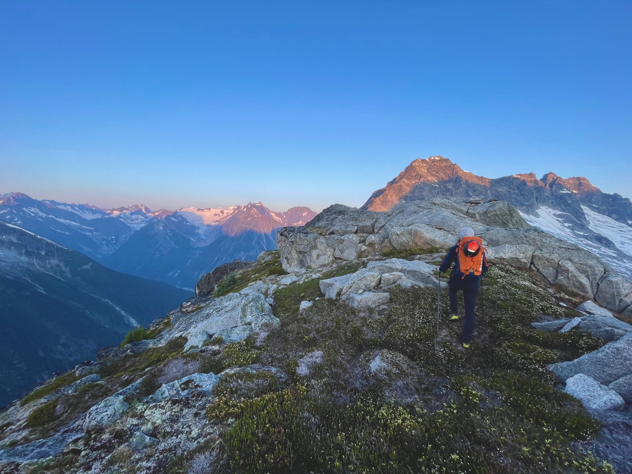
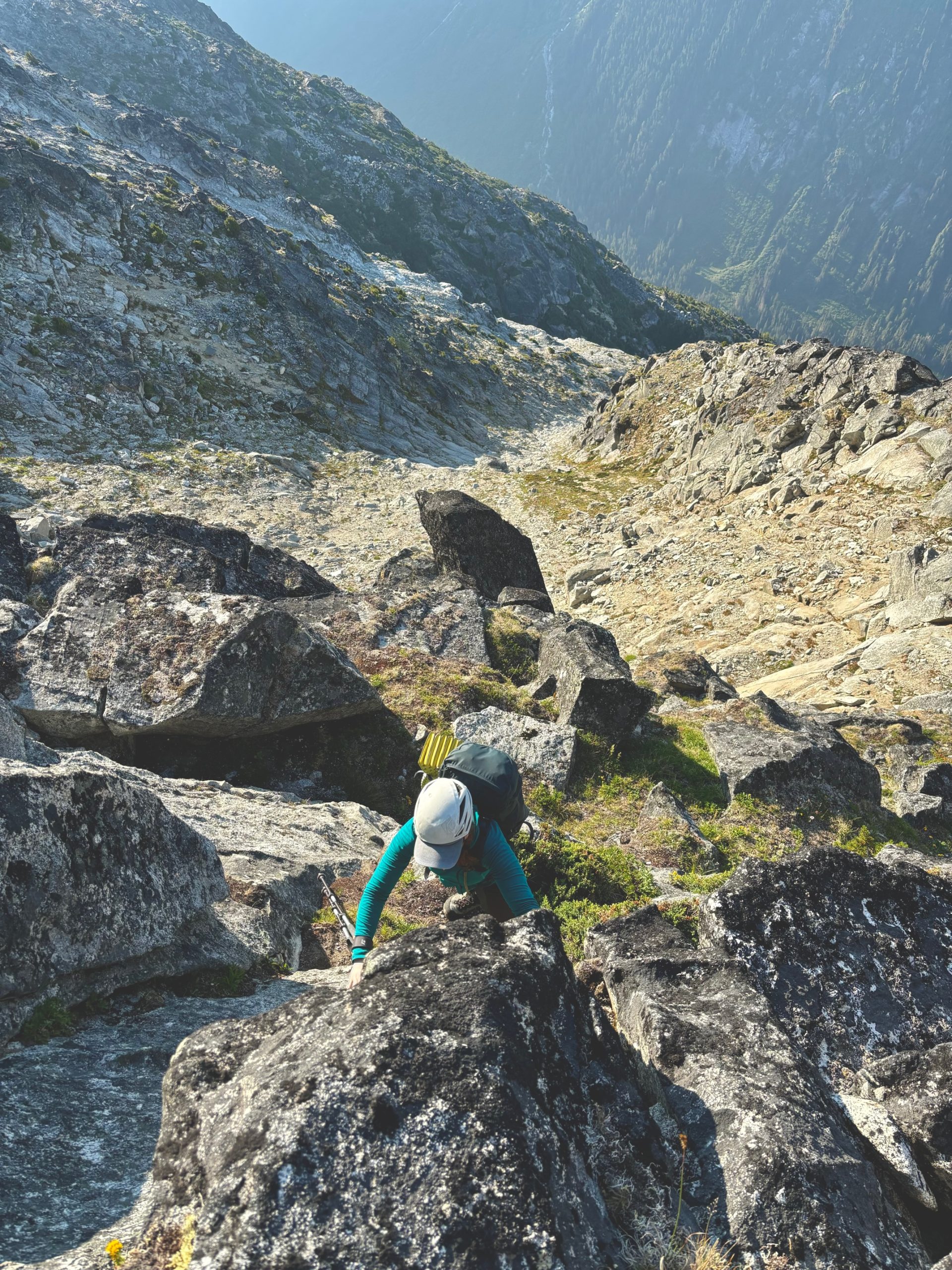
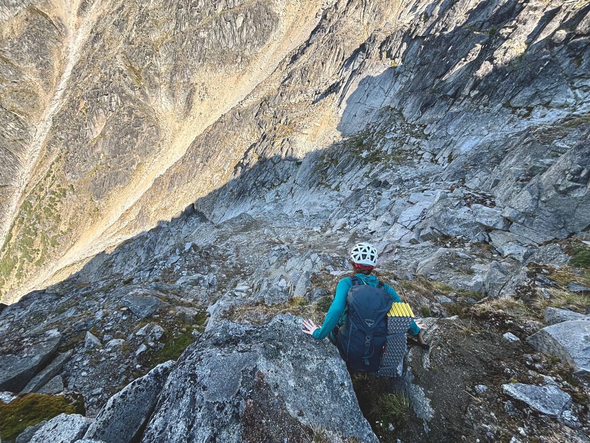
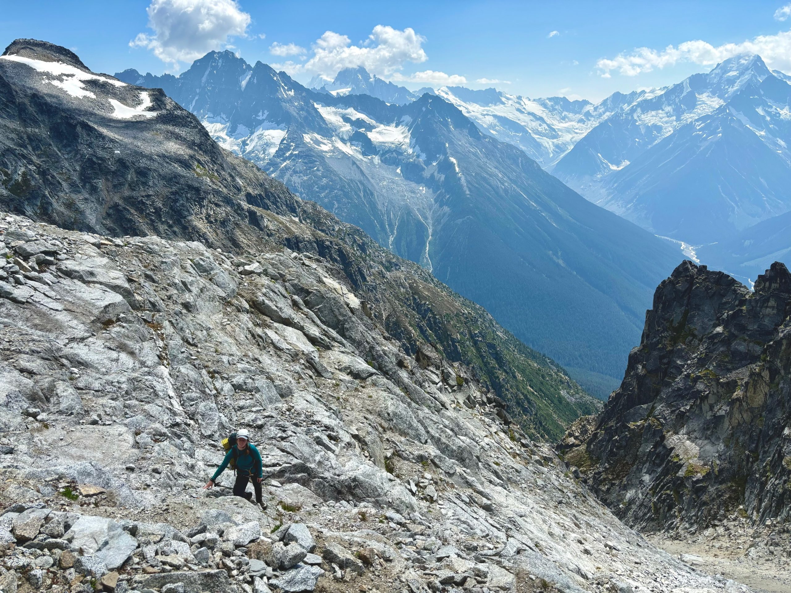
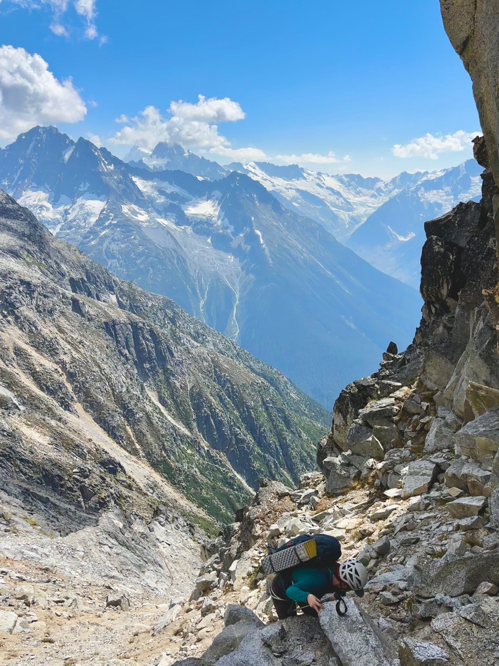
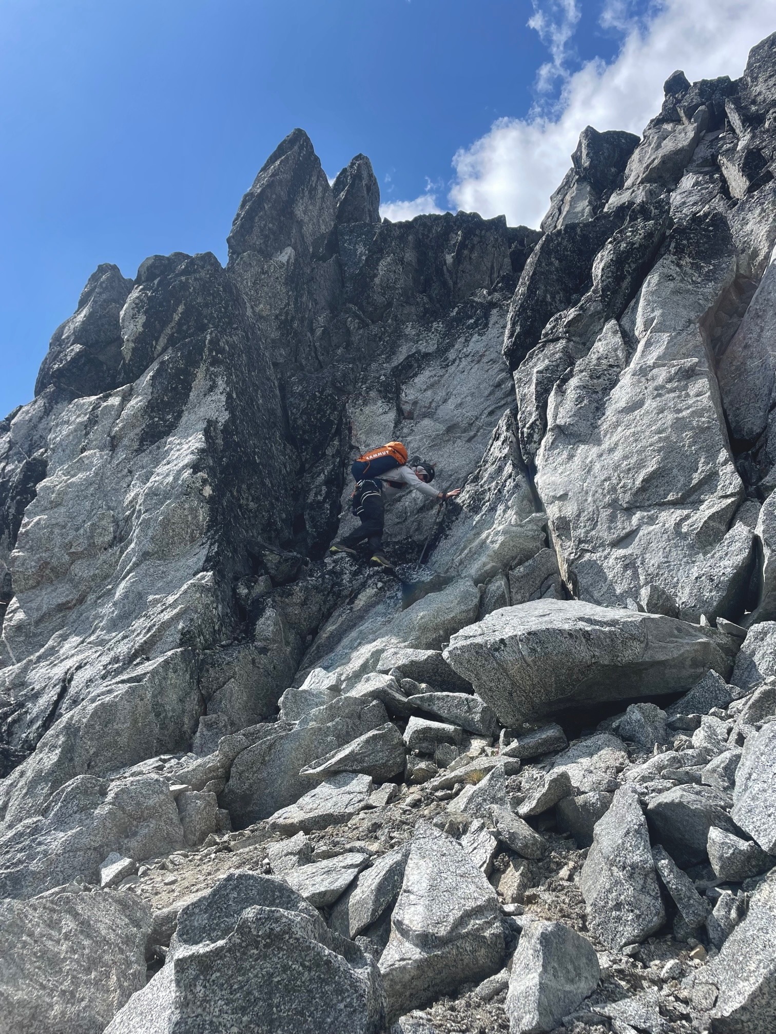
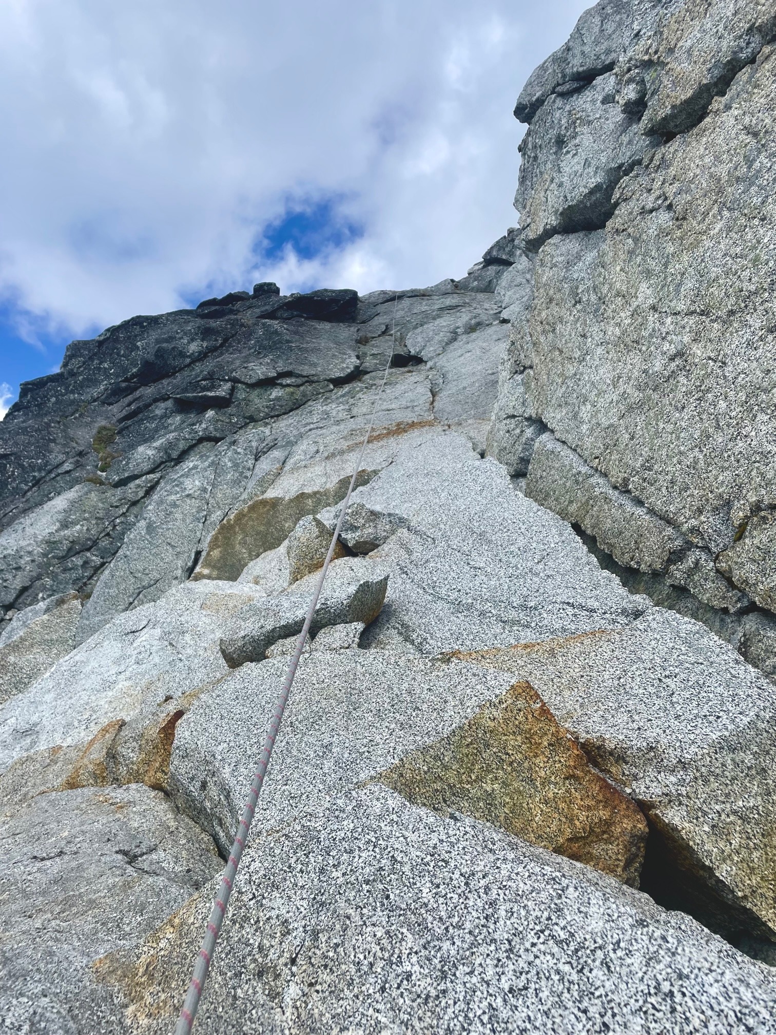
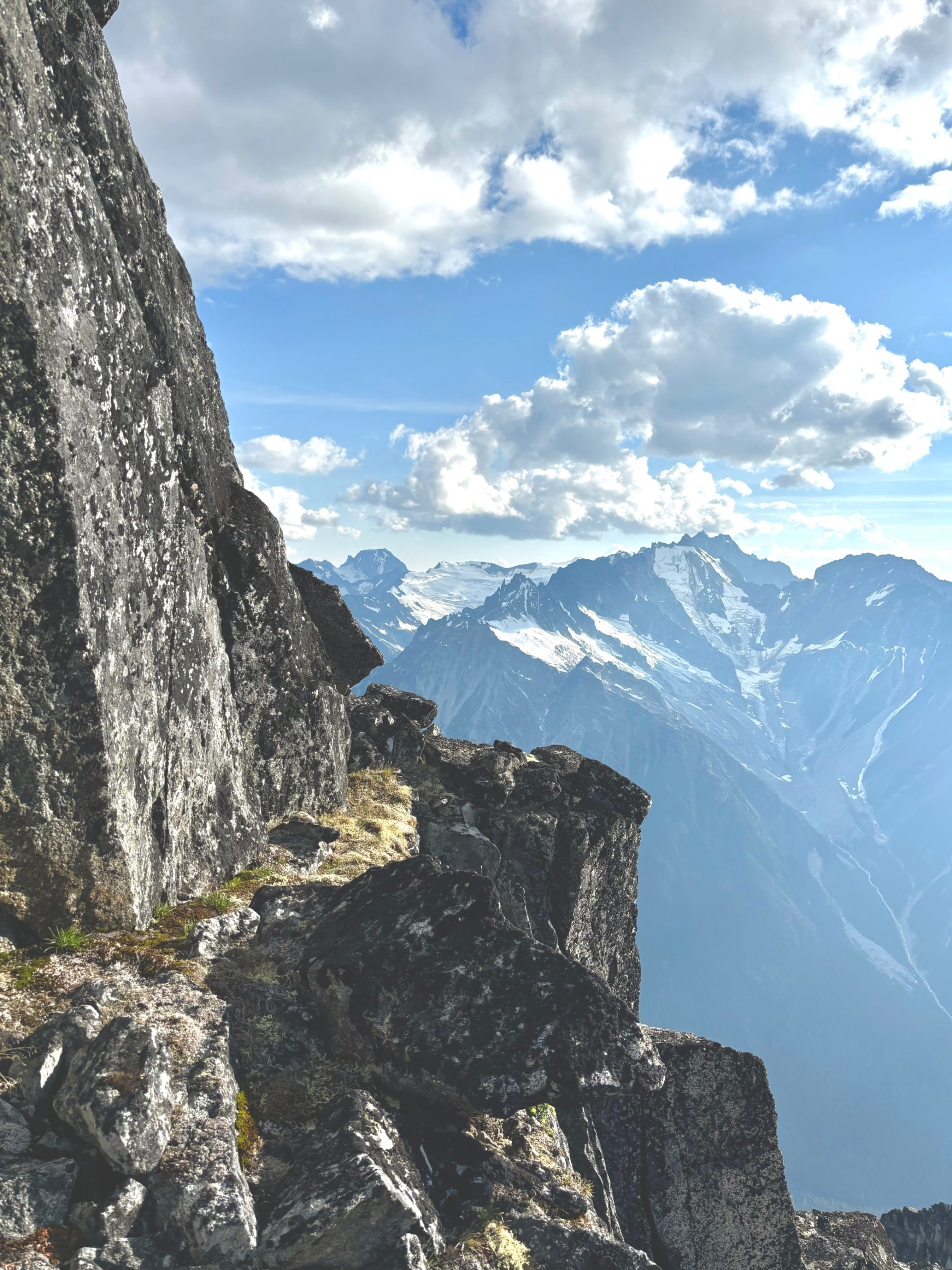
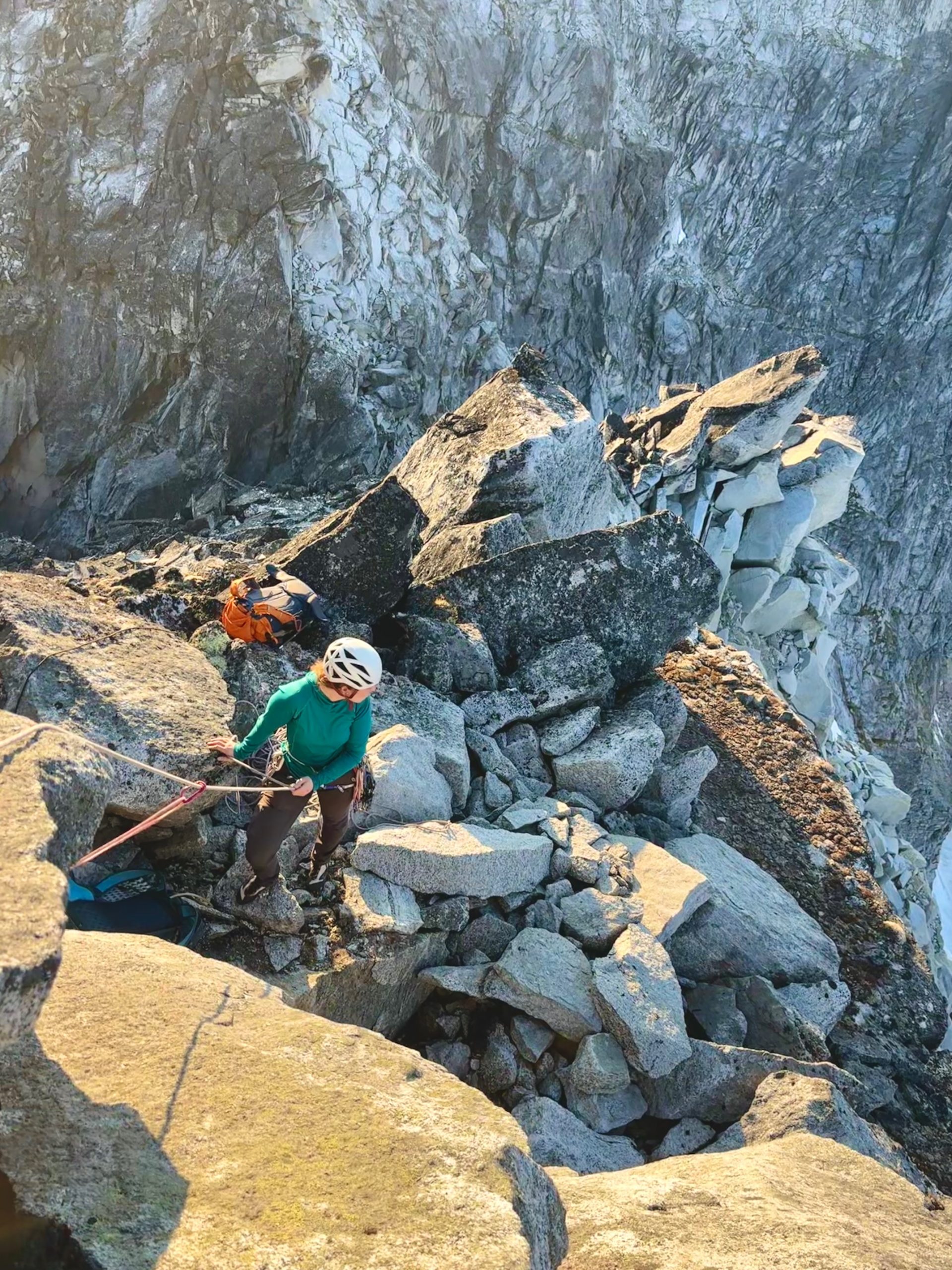
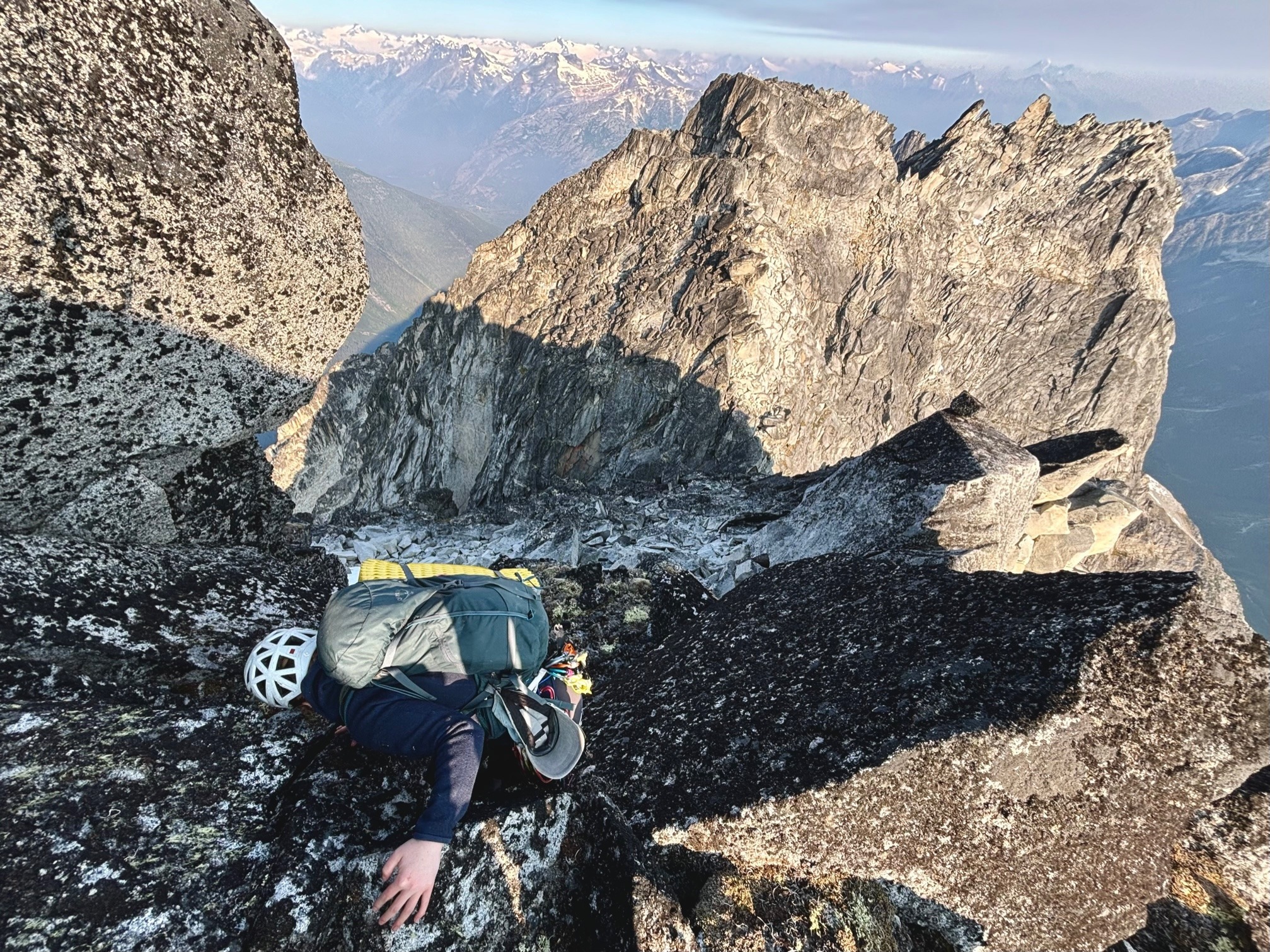
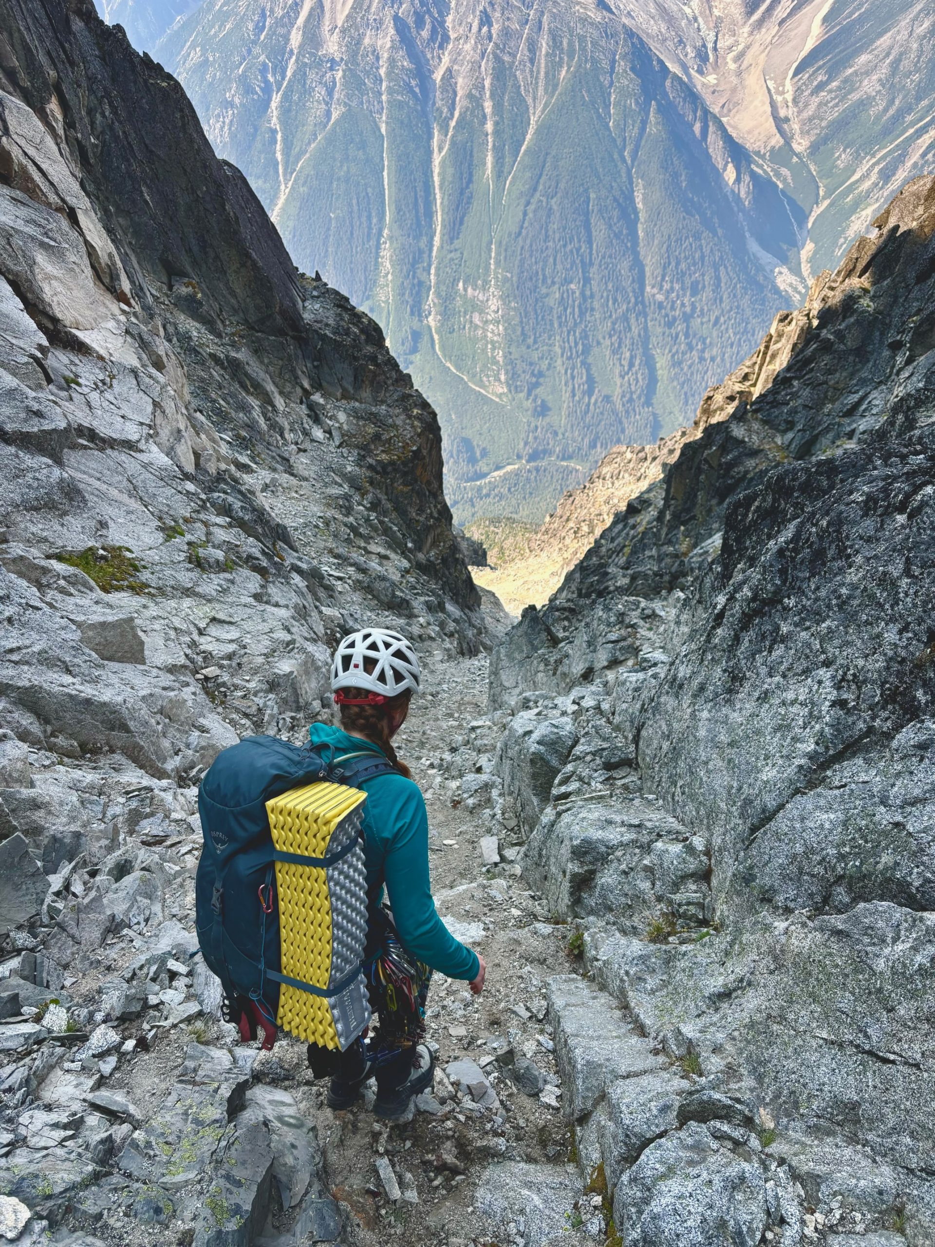
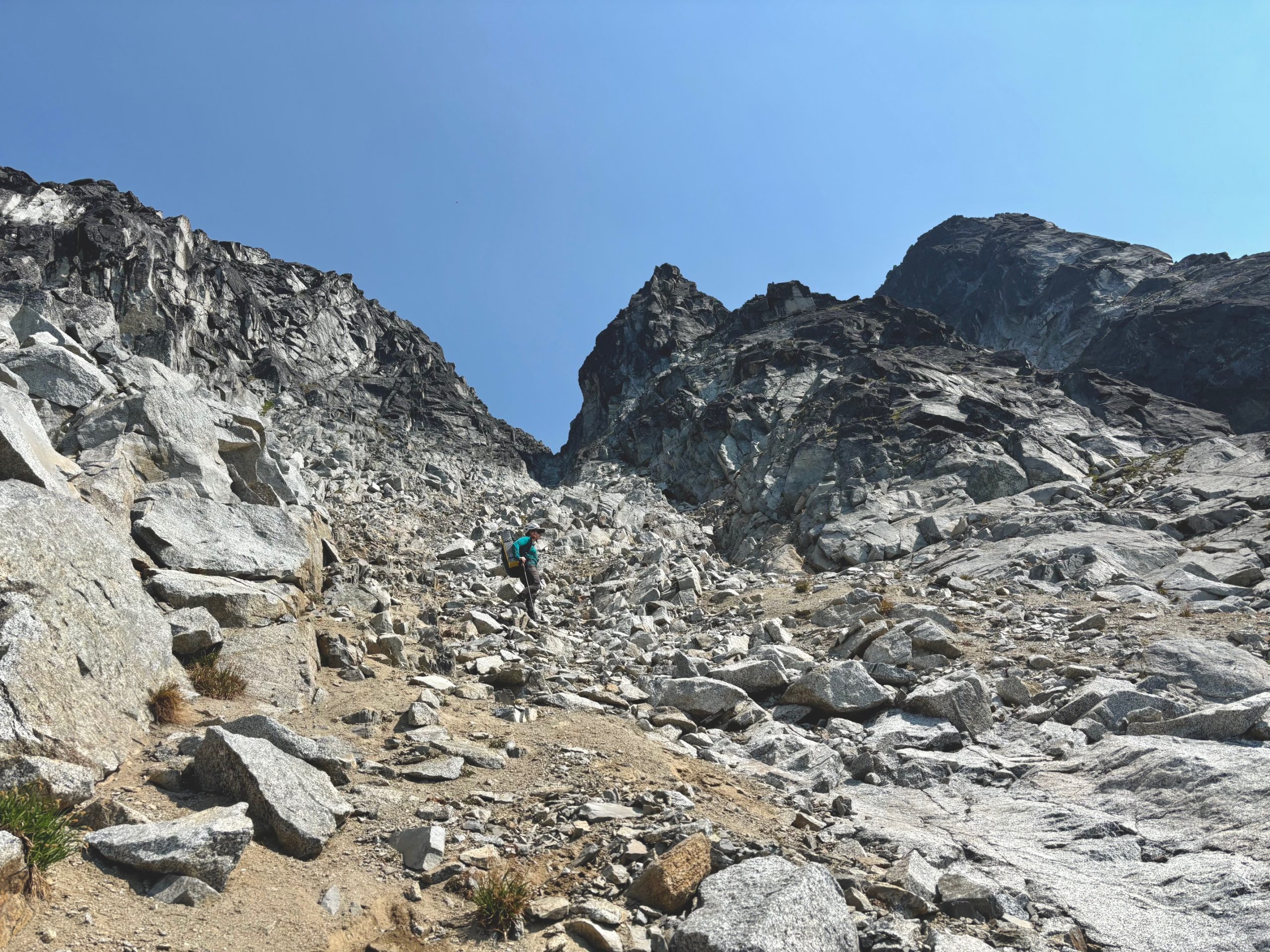
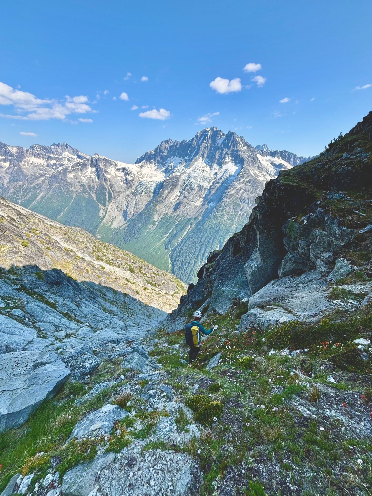
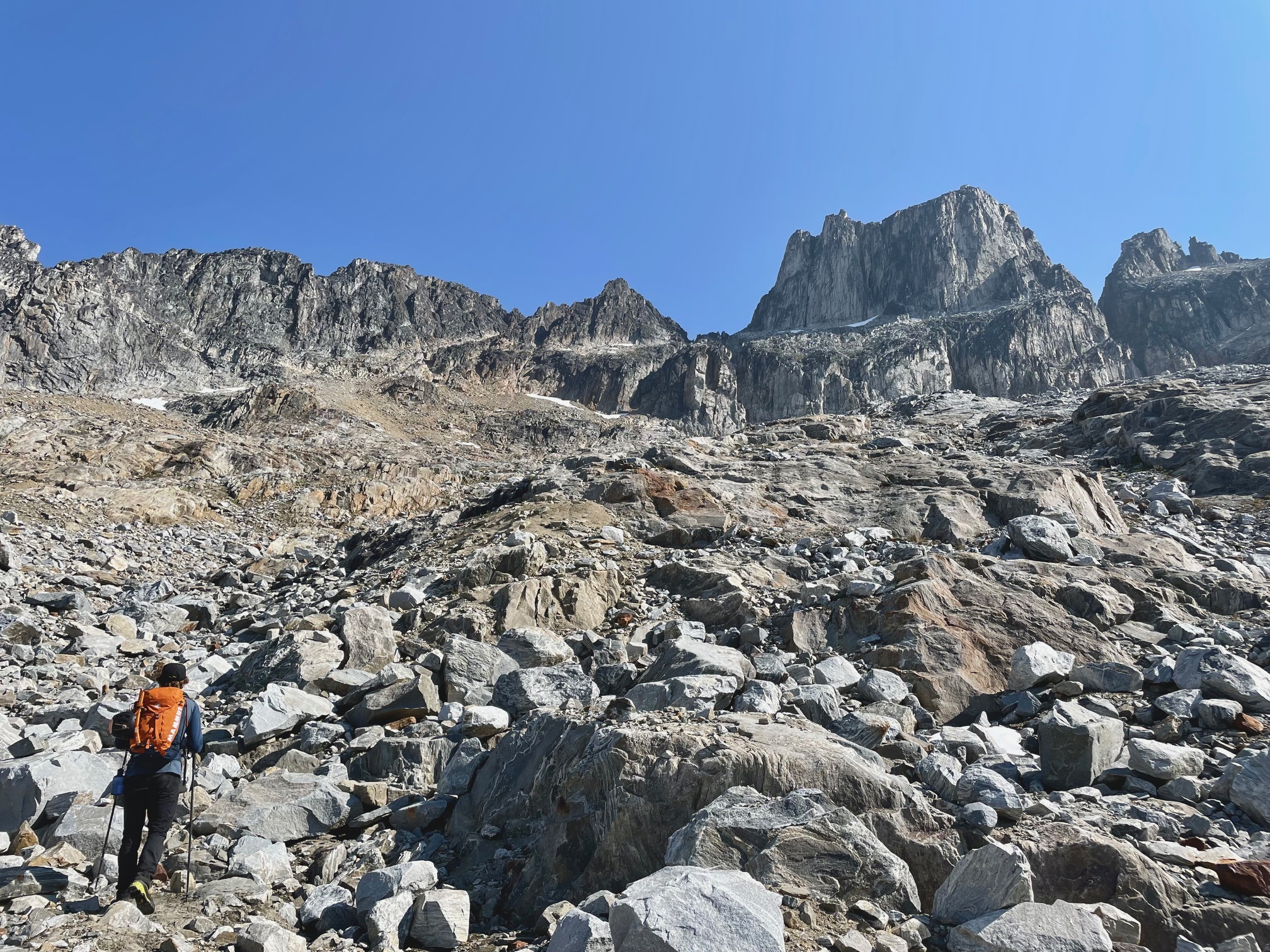
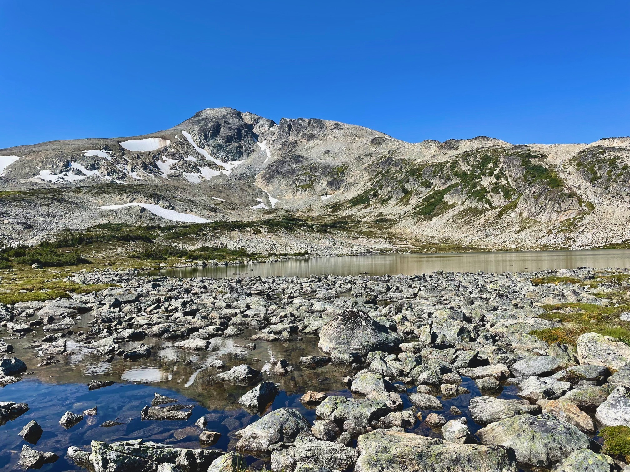
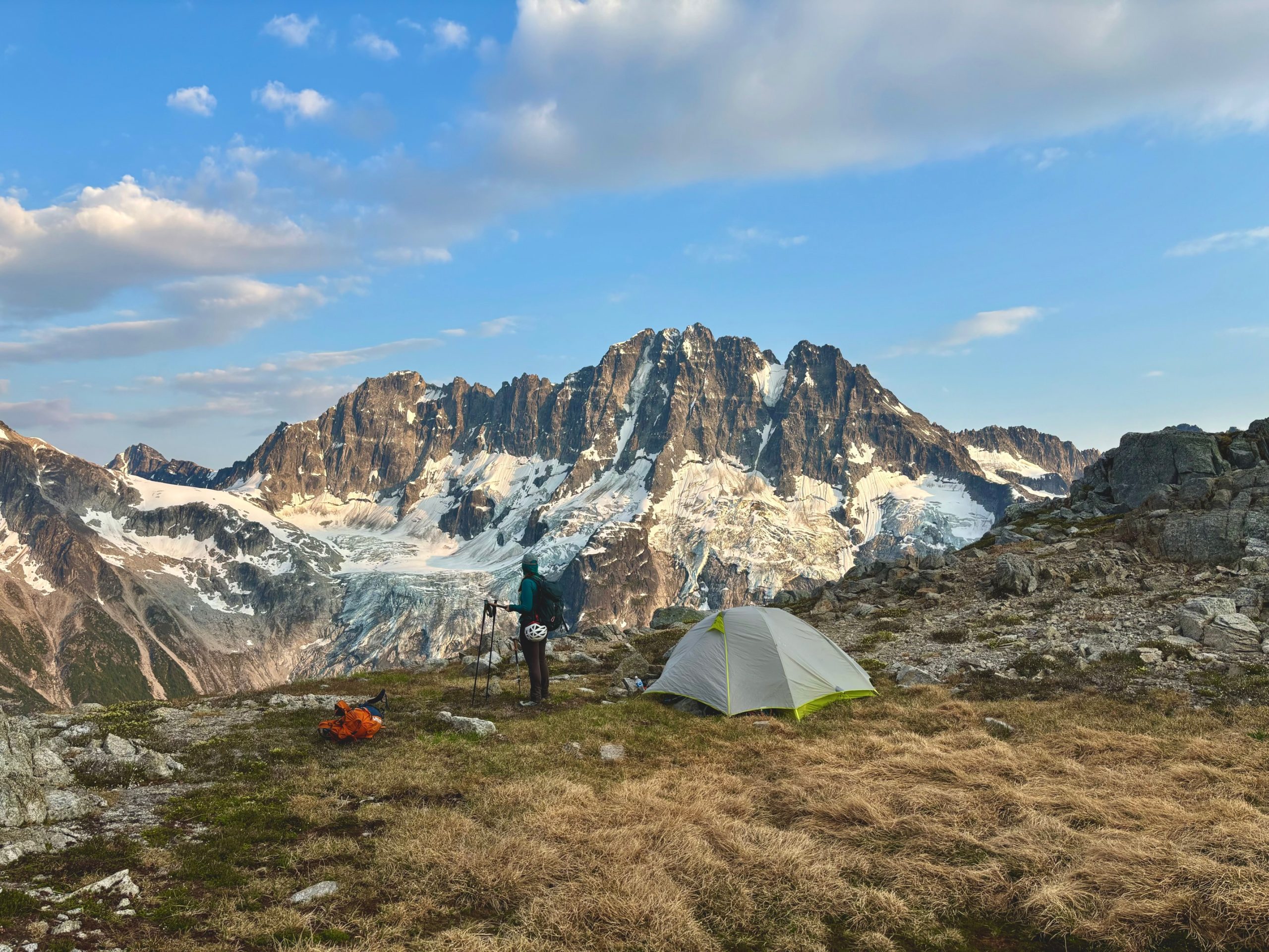
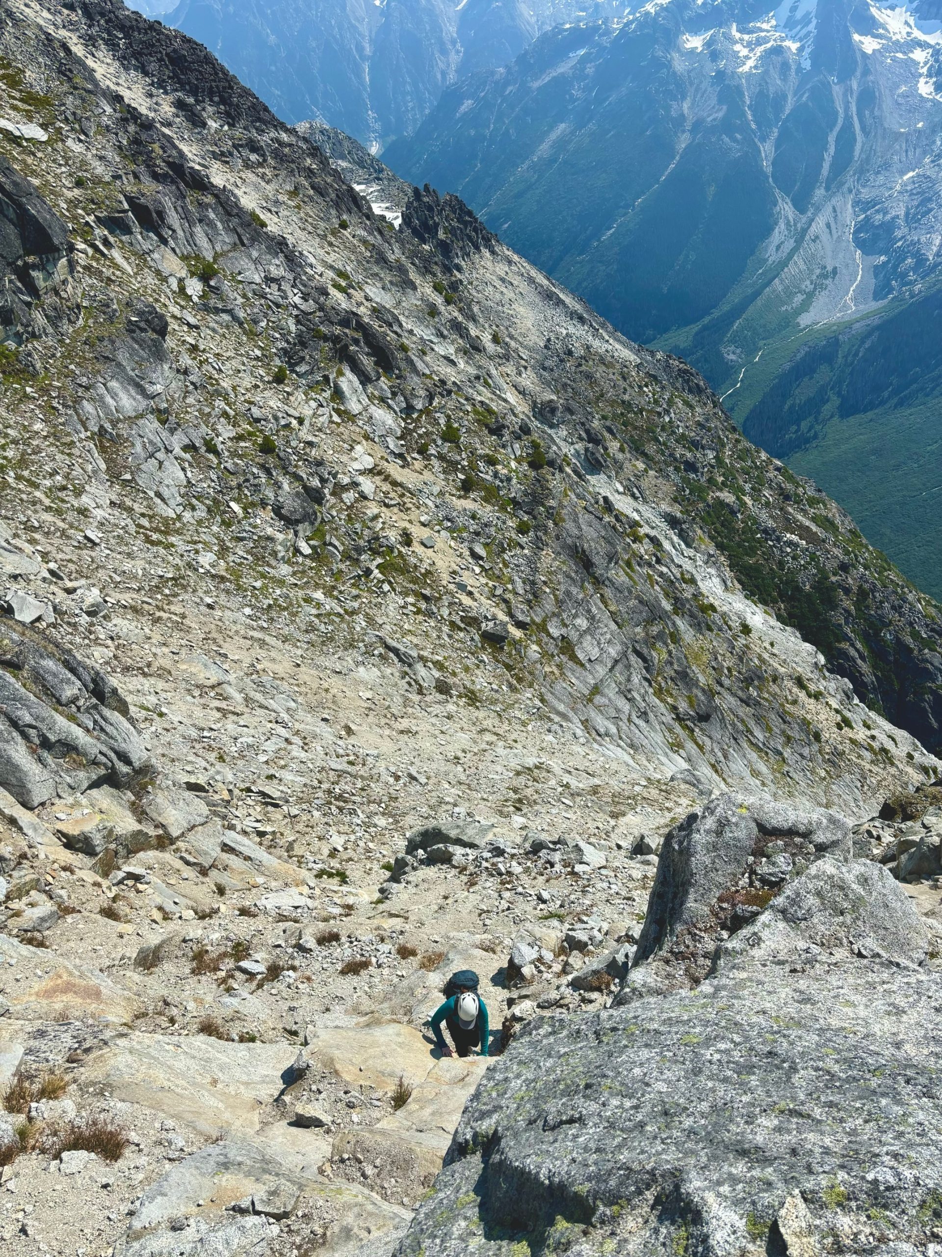
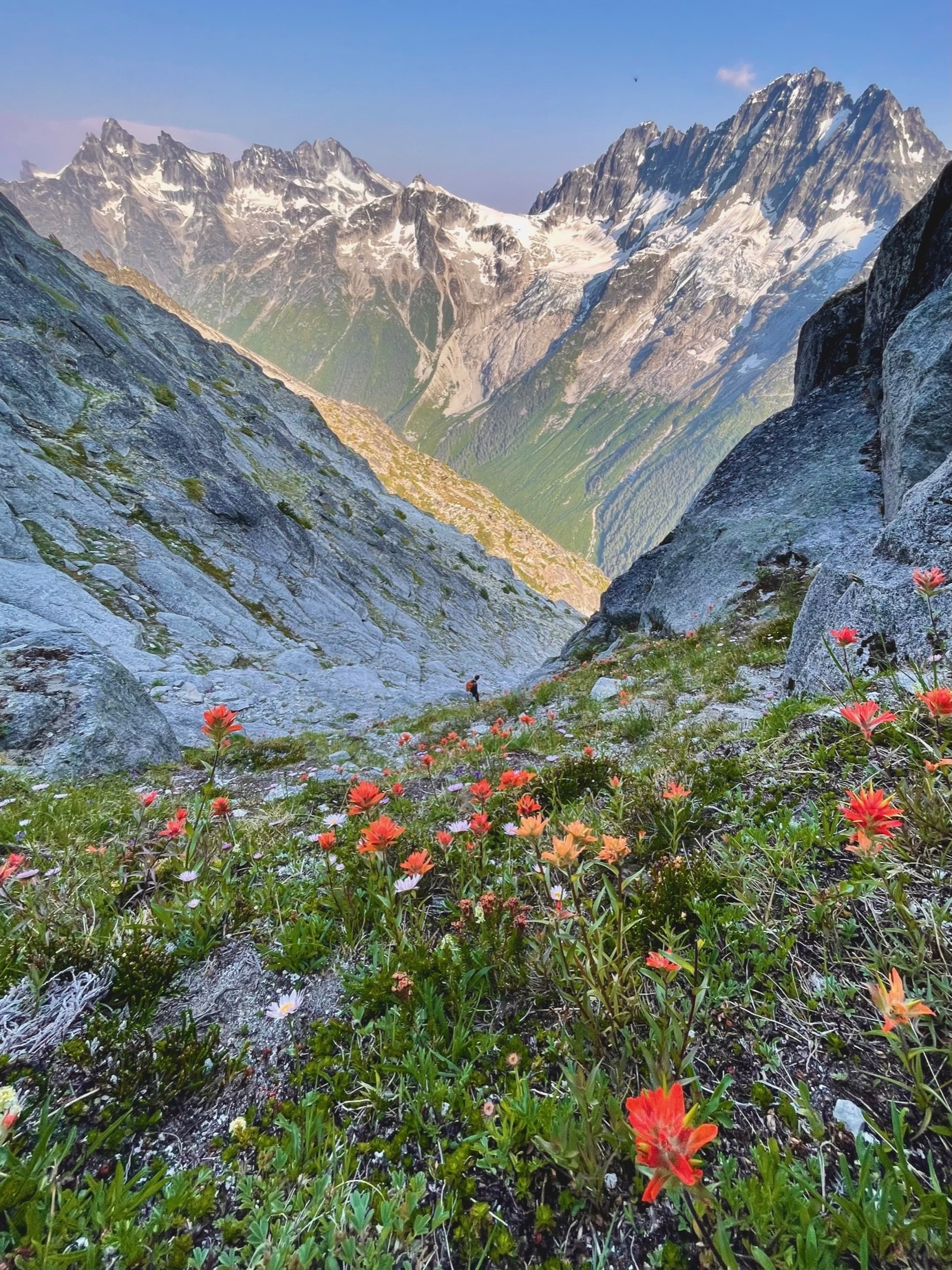
Because the photos describe it pretty well, I’ll go lighter on the route description. What I can say is that the terrain all day required way more focus than I’d wanted to give it. The heather slopes were steep and slippery, the boulder fields were wobbly, and the gullies were sandy, sometimes requiring us to kick steps into hardened sand-concrete, or delicately balance on sand covered slabs. Although the stats to this point were not crazy, the mental energy required was taxing.

When we made it to the top of the gully under #3, we were relieved to find that it connected easily with the ridgeline to the top. We’d been hoping for an alternate way to #1 directly, but since nothing had revealed itself on our way up, we were at least glad to have an option that continued to go. 

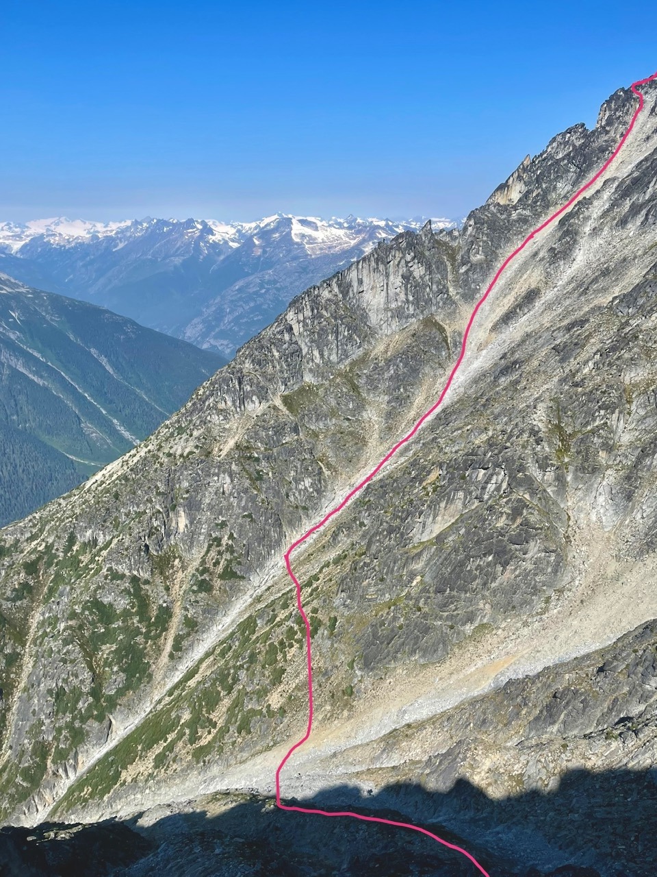
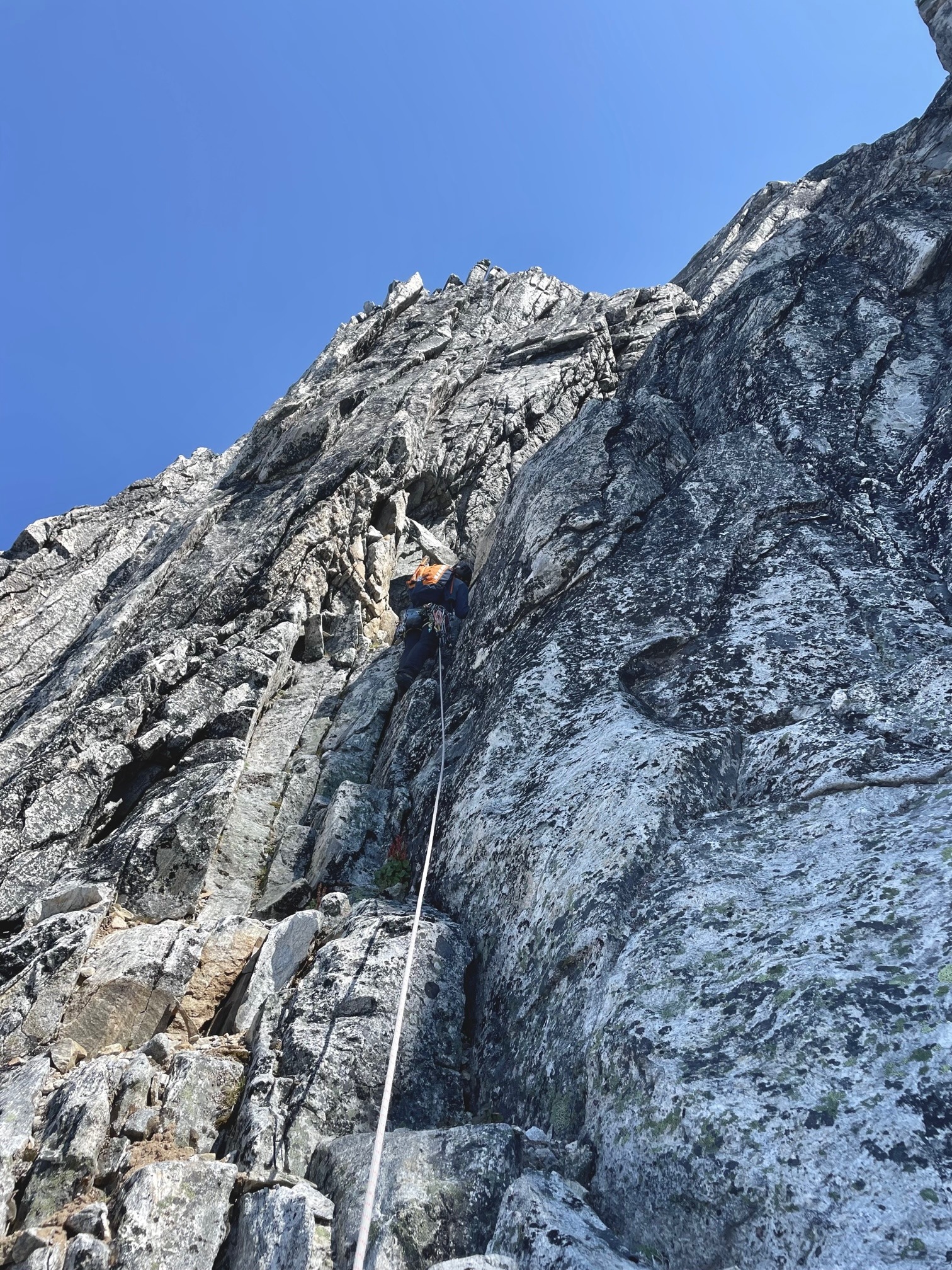
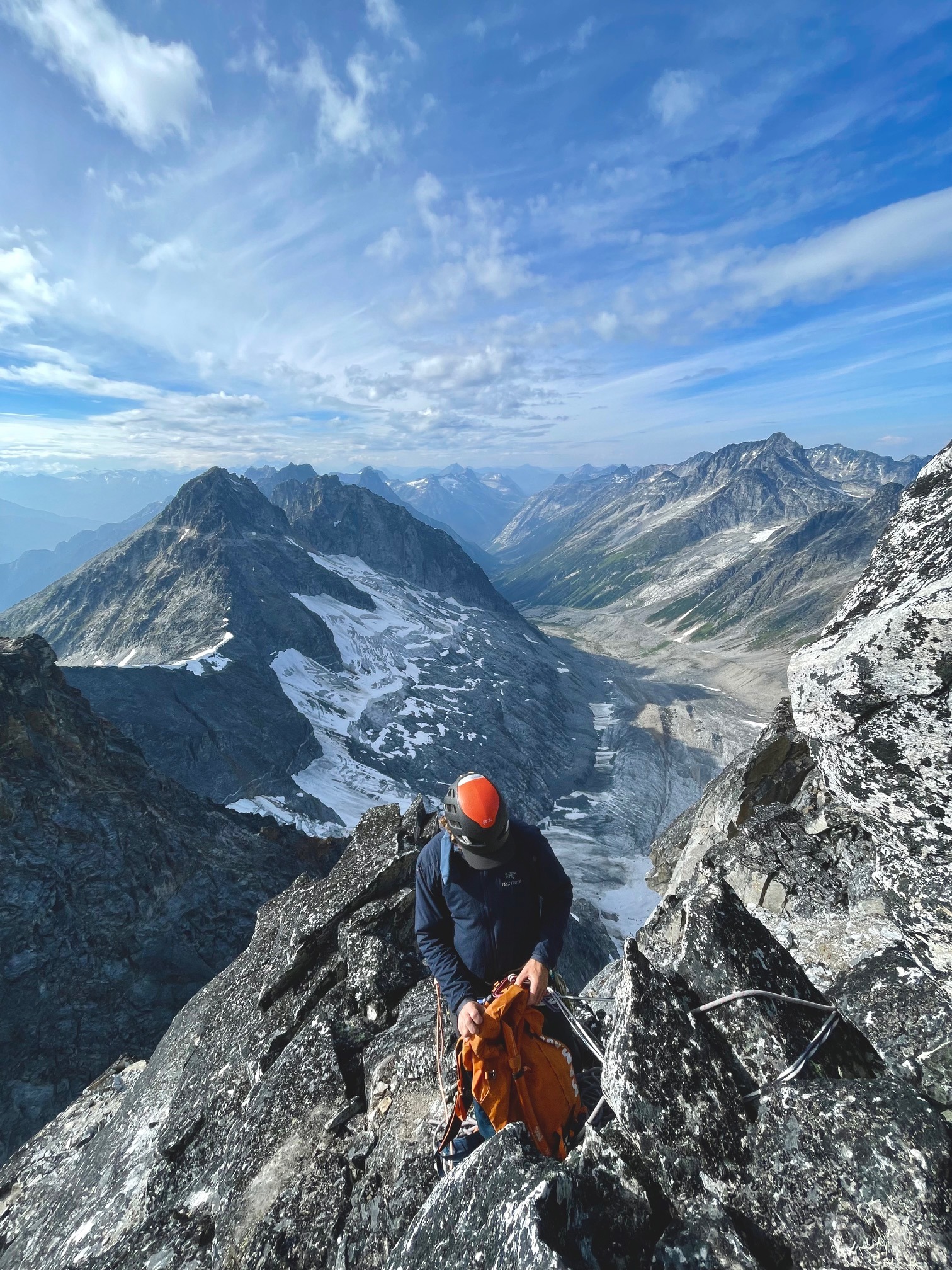
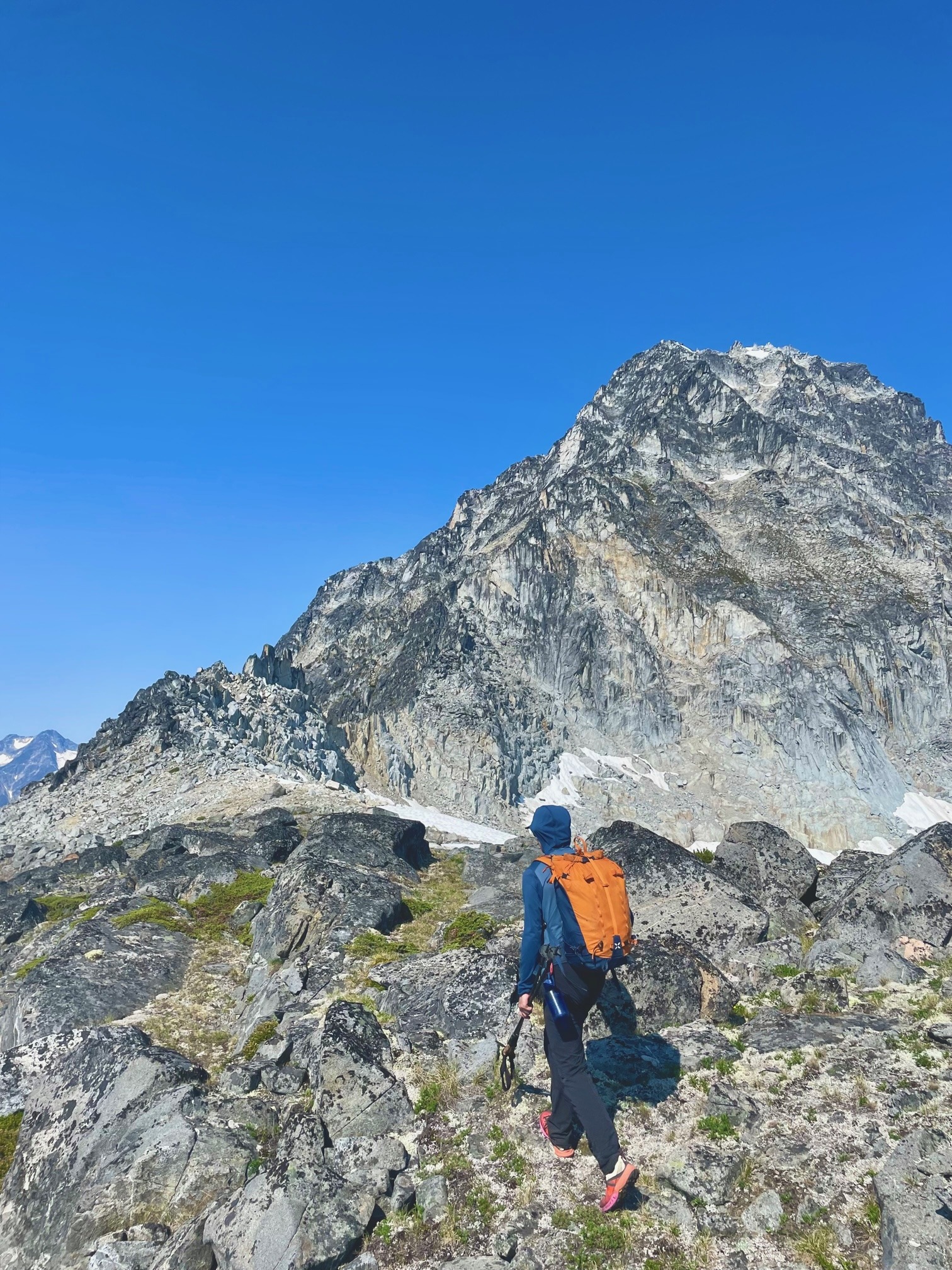
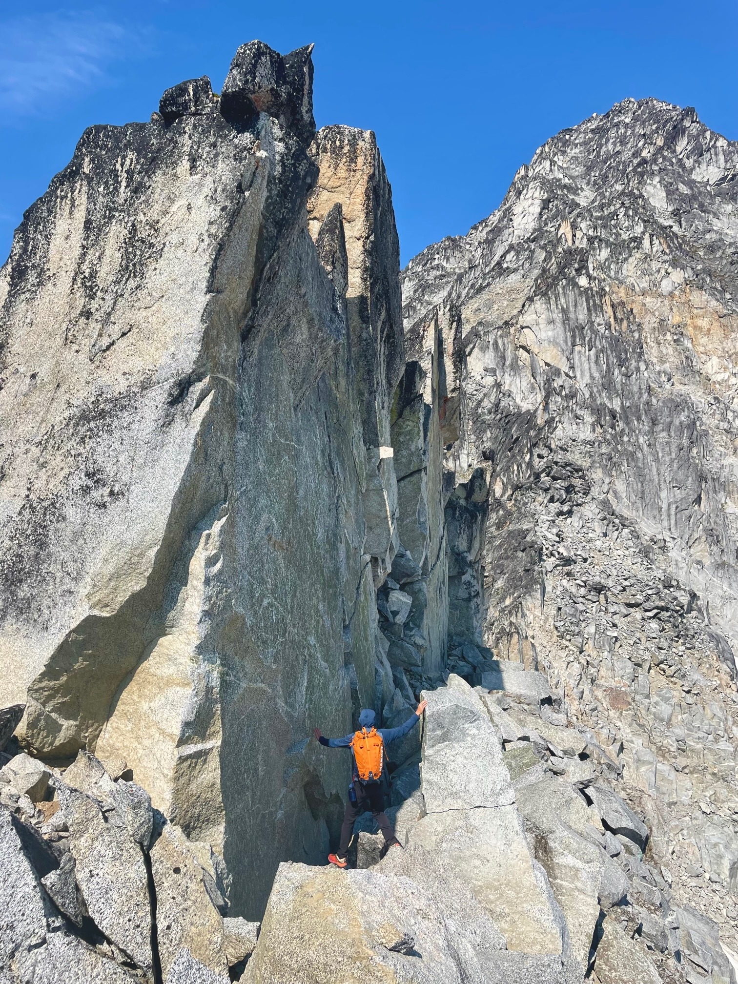
We followed the ridgeline, scrambling as far as we could before reaching a headwall that I didn’t feel comfortable doing in my boots. We pitched the rest of the ridge out as follows:

P1- Was really mostly scrambling after the short head wall, 50m

P2 – Similar, with a few short 4th class moves, 50m

P3 – 5.6, up some really fun and featured dikes, cracks and flakes – some of the most fun climbing we had all day, 60m

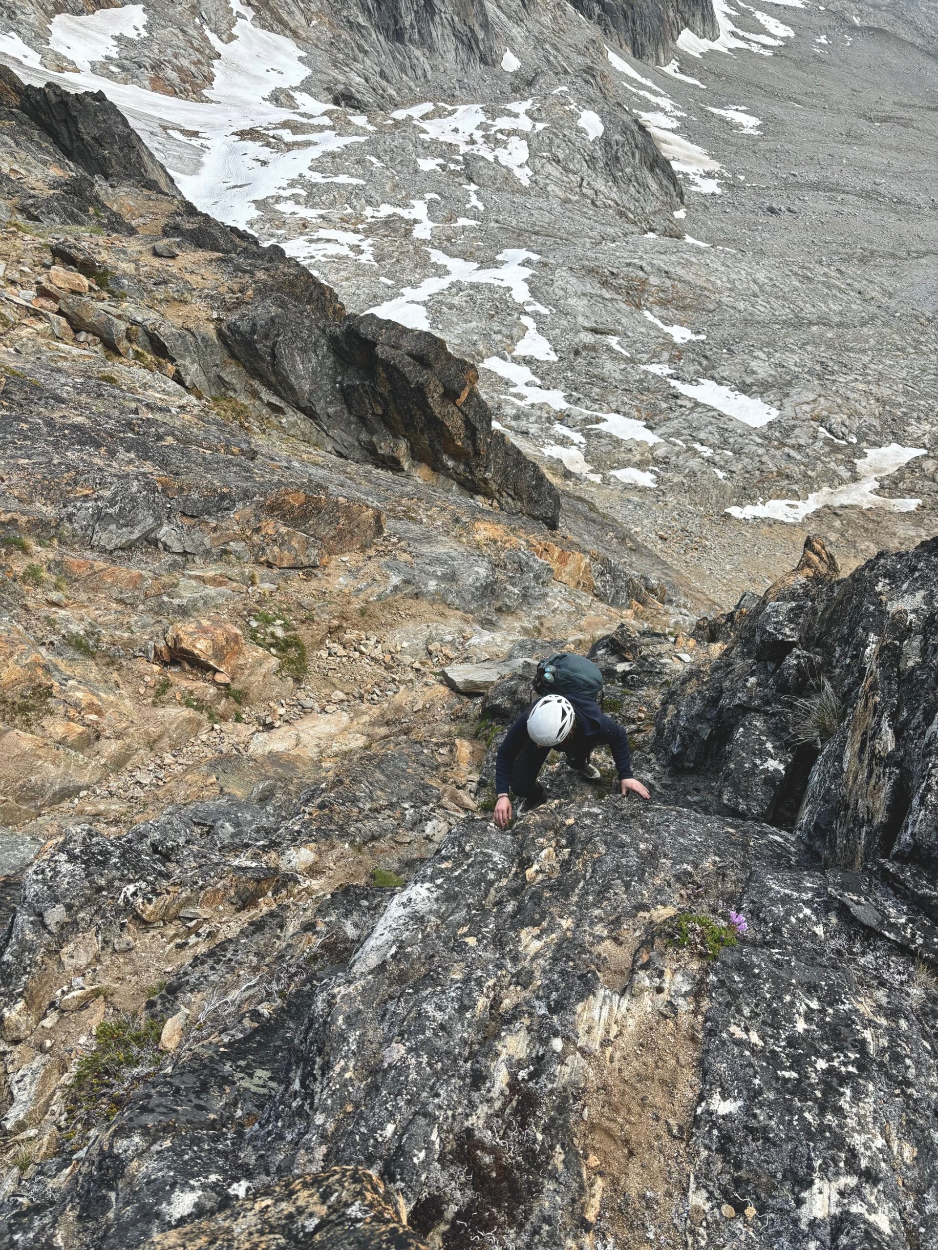
P4 – One final pitch of 4th class in a mega loose chimney, then on to the ridge top back into scramble terrain, 50m

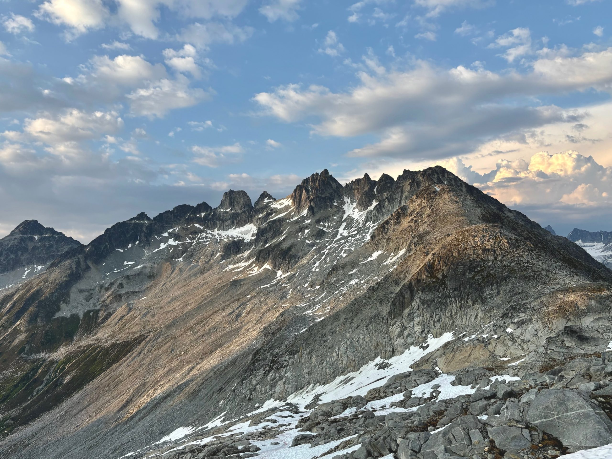
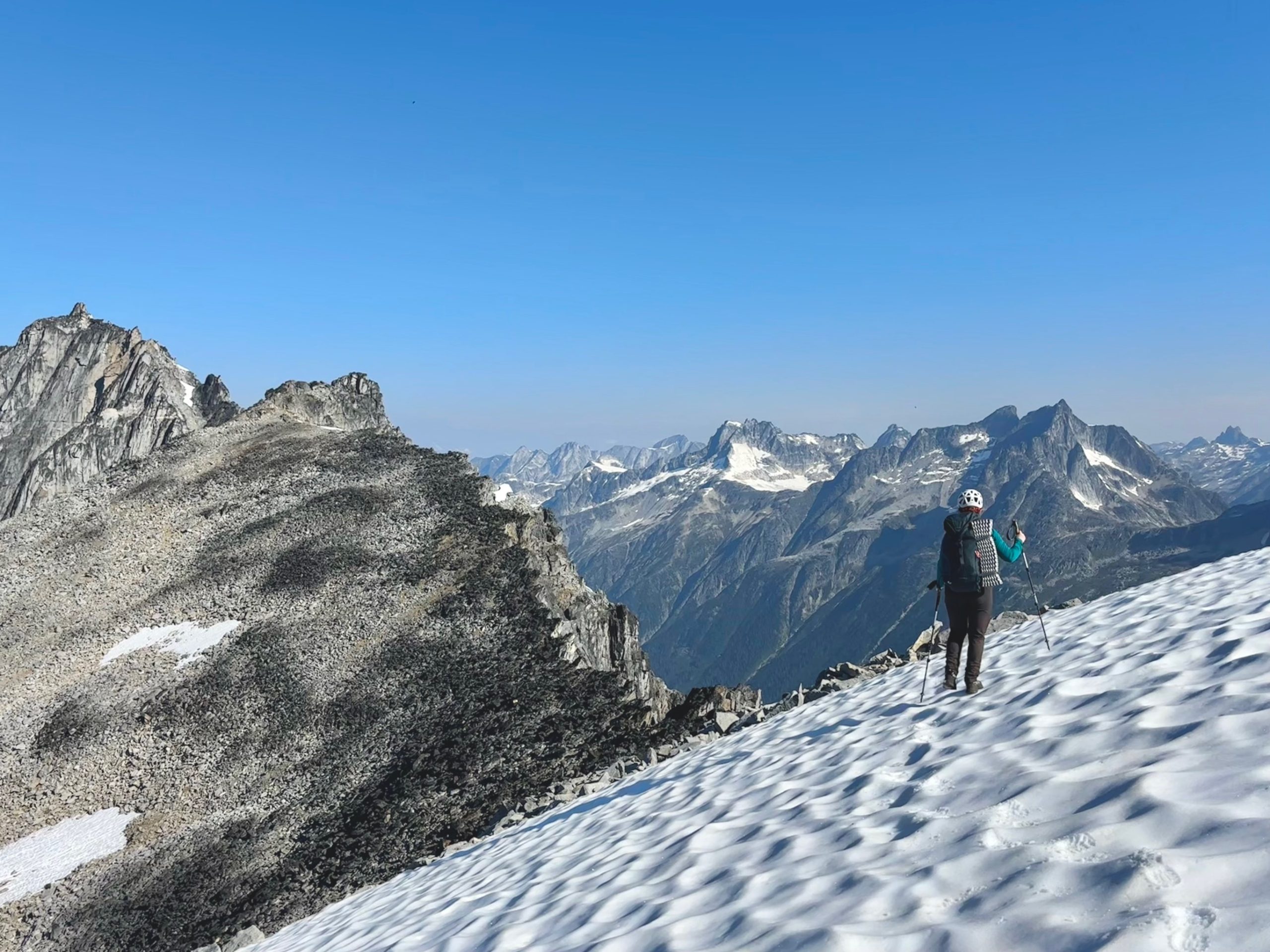
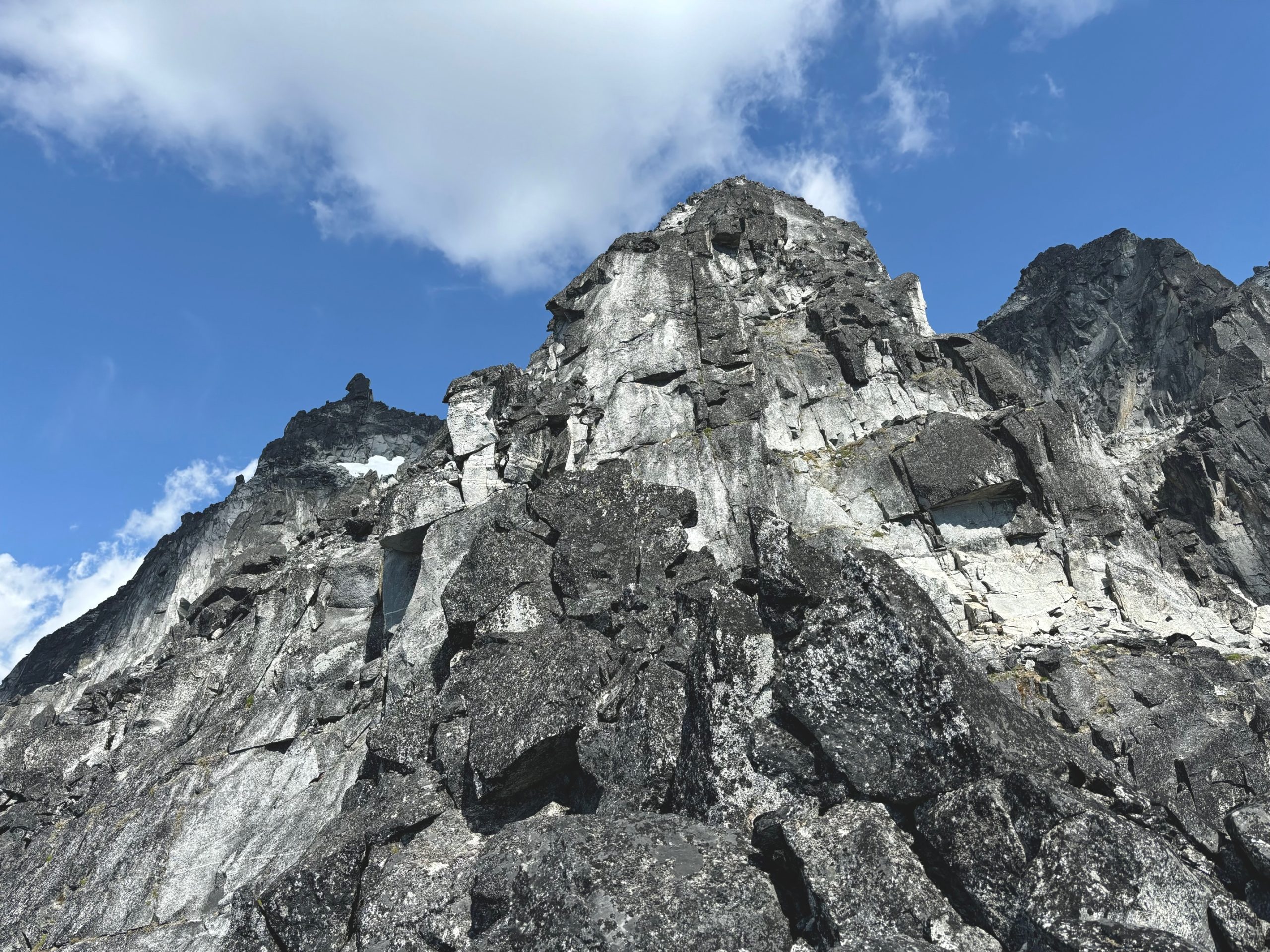
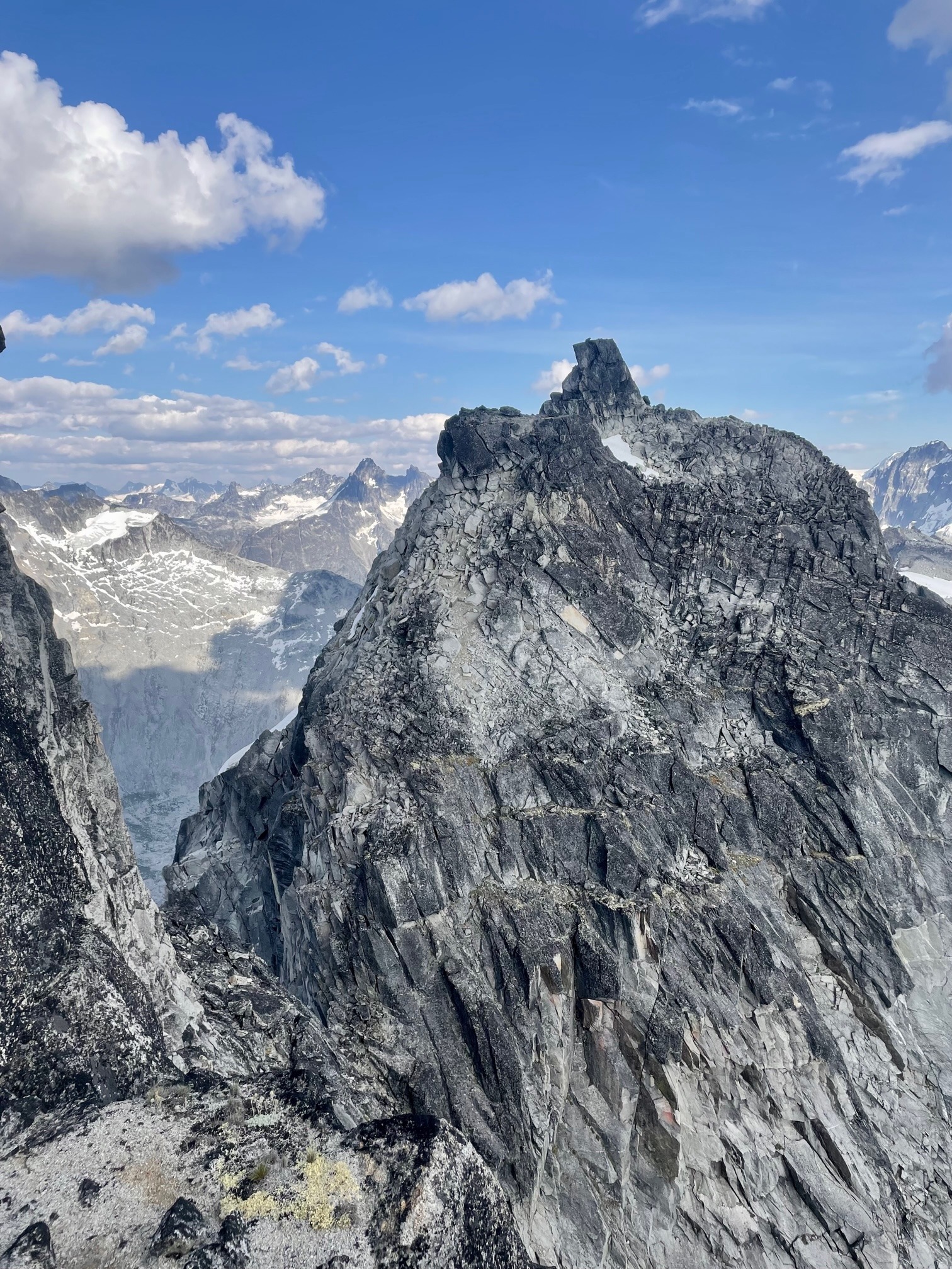
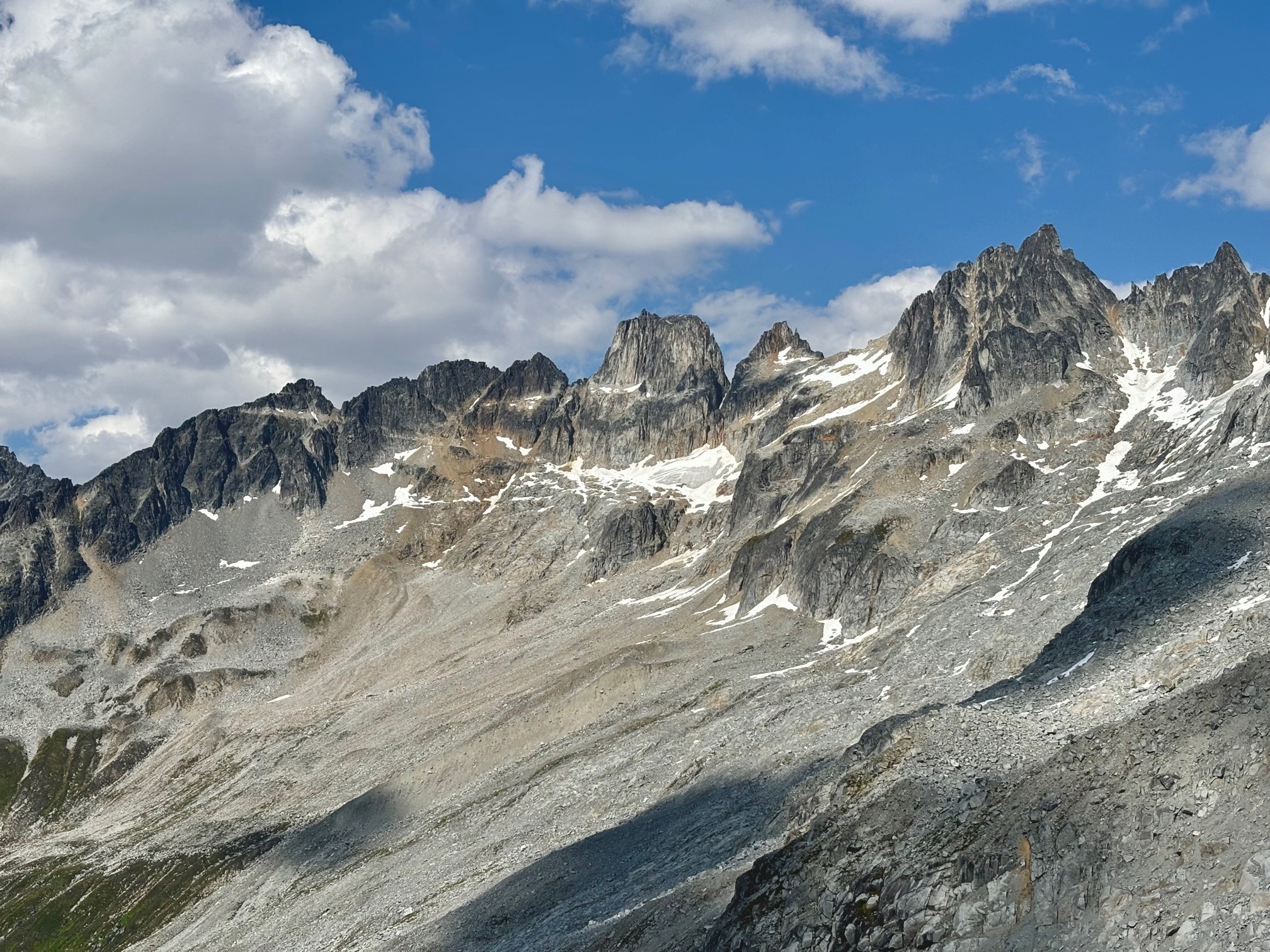
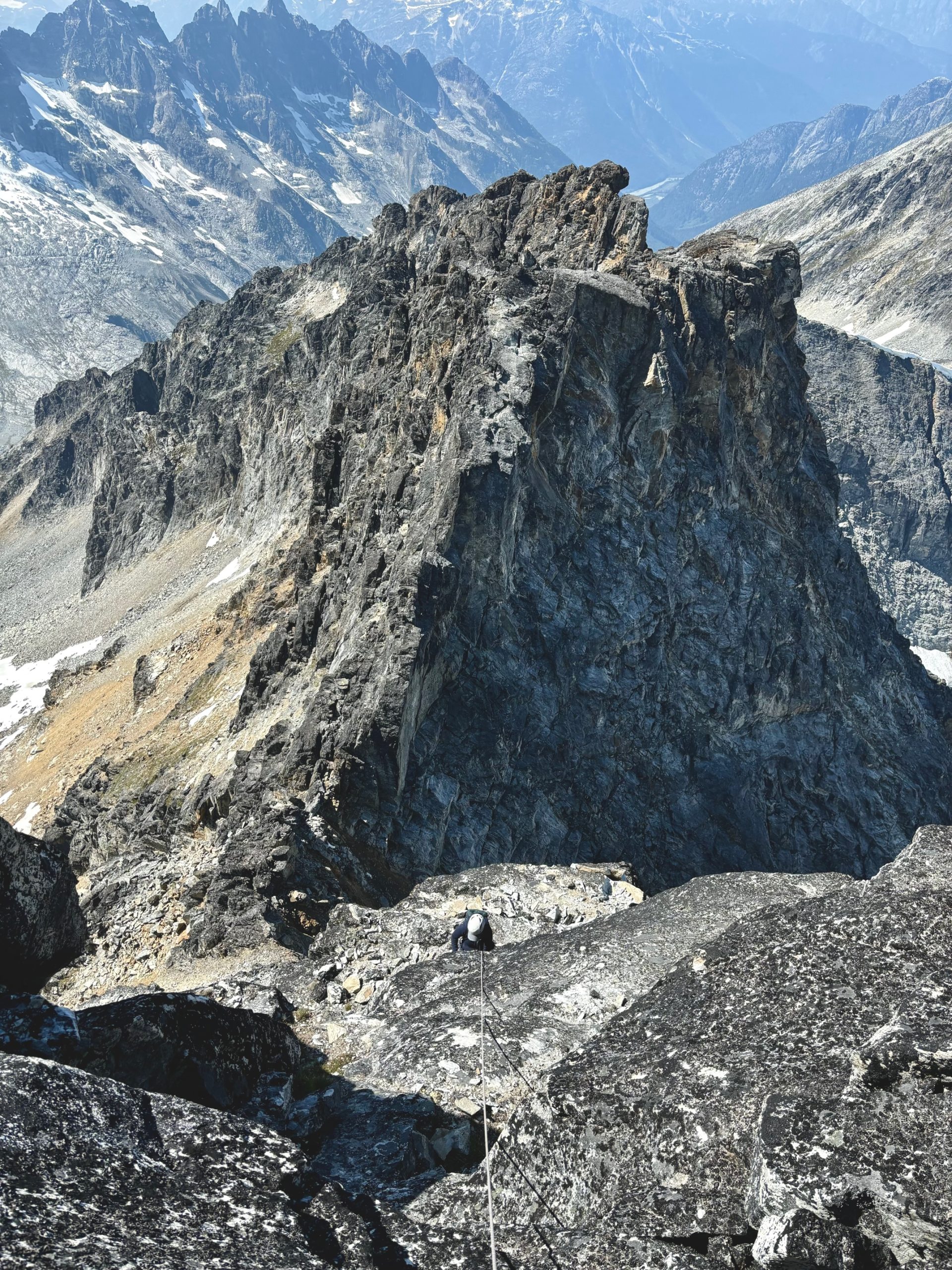
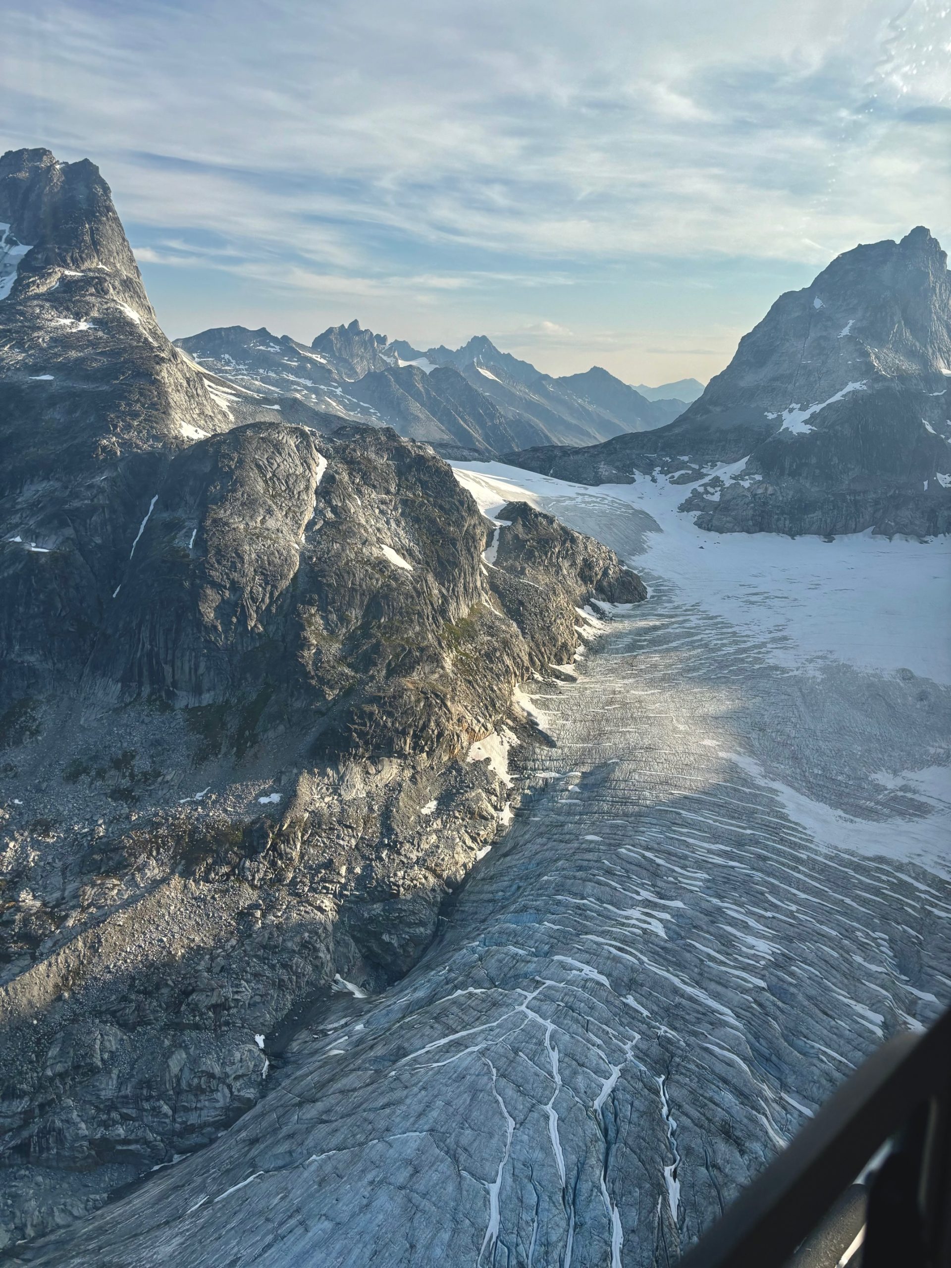
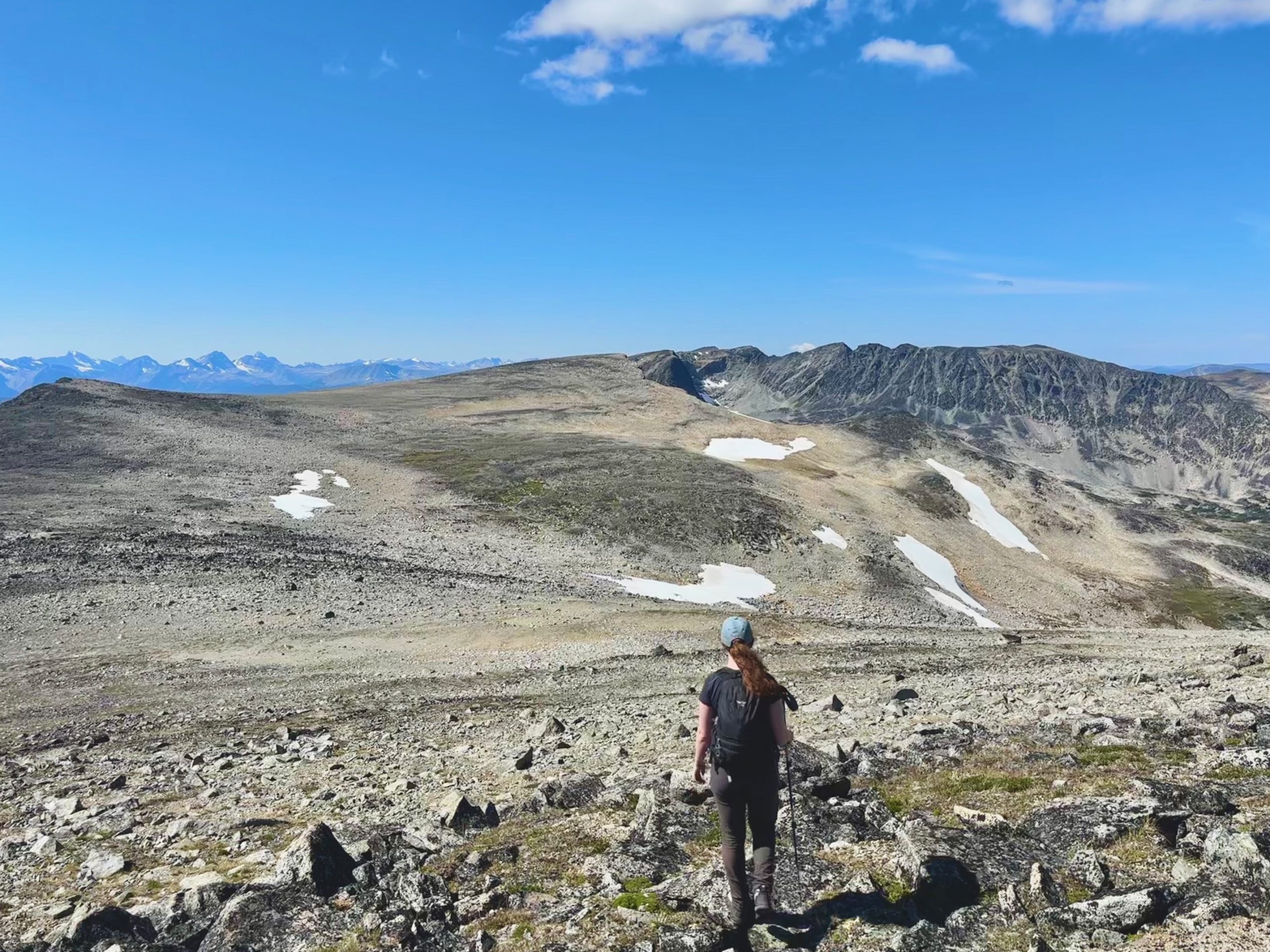
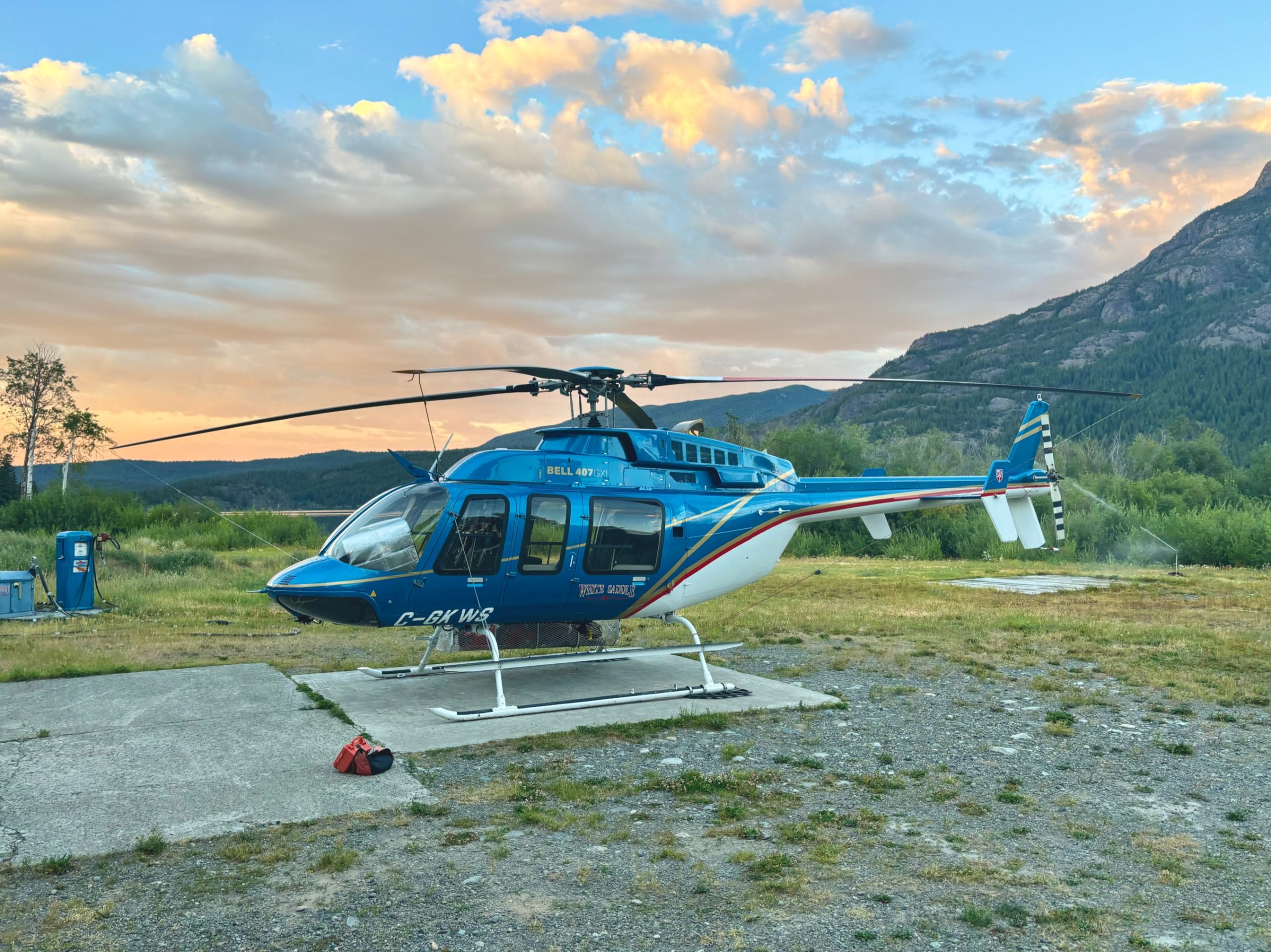
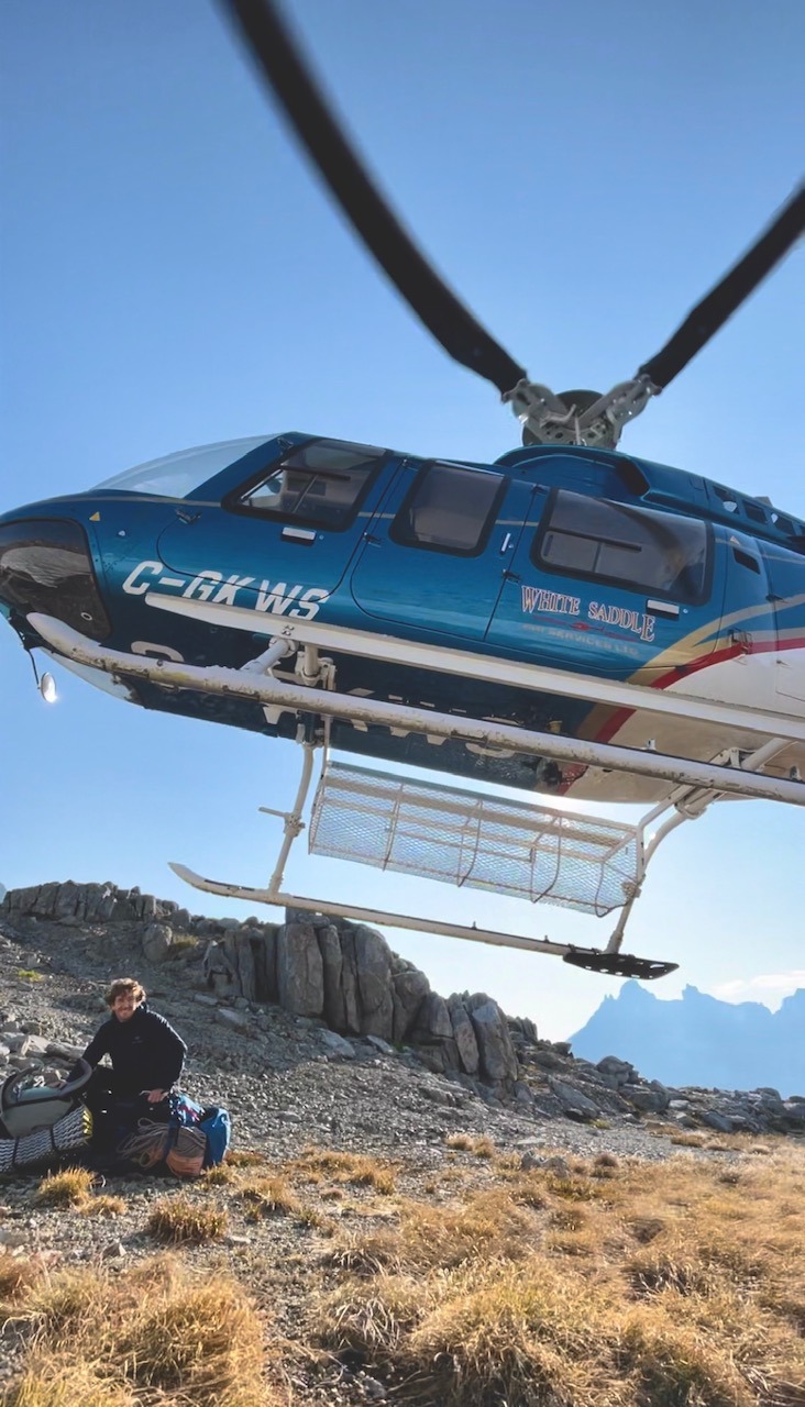
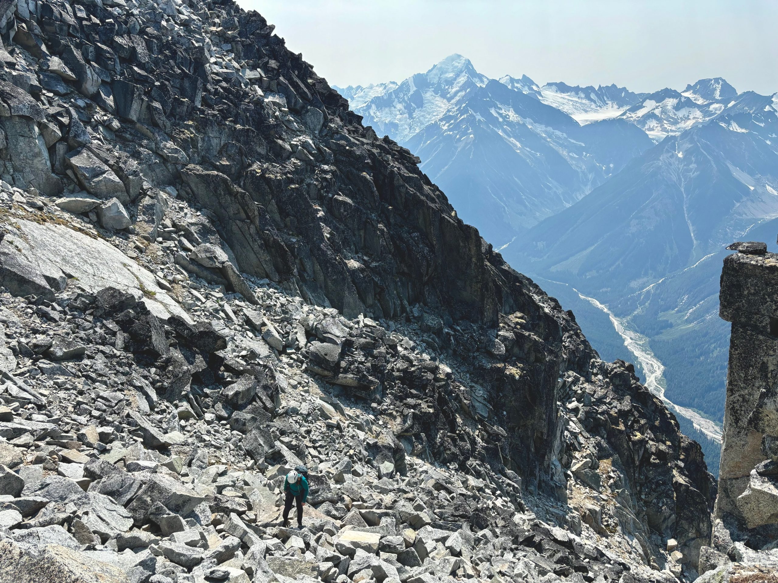
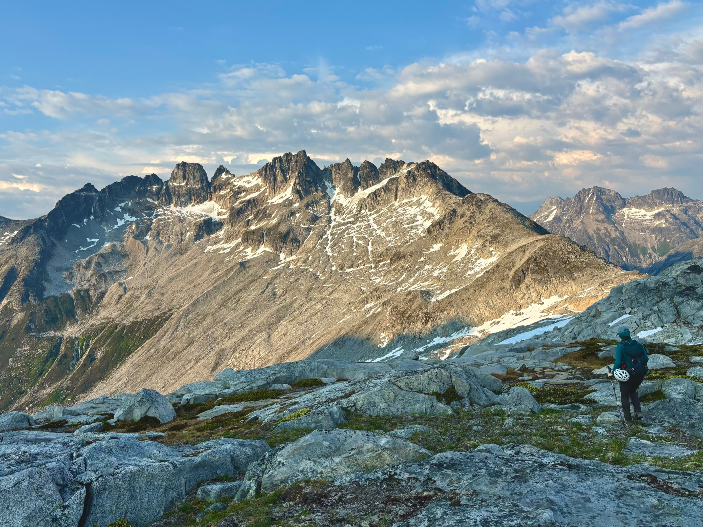
From here, we decided to skip the true top of #3 since we knew that it was just a sub summit of our real goal on #1, and it was already getting late in the day. Our next big concern was navigating the notch between #3 and #2, which we’d identified to be a problem from the Heli photos. 

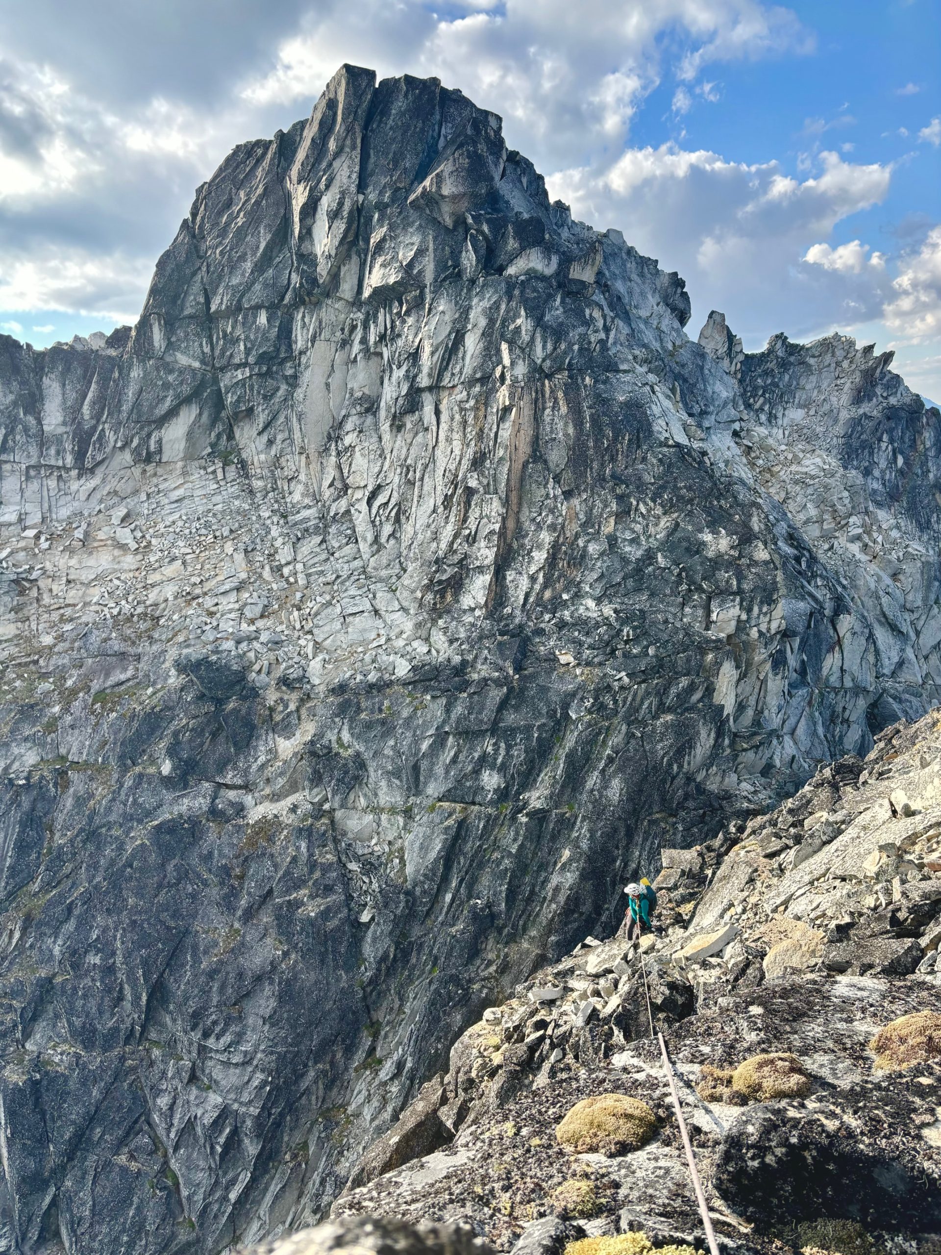
There was a nice bench leading most of the way down #3, which necessitated only a single rappel, but going UP #2 looked terrifying. It looked like piles of vertical, loose blocks, ready to come crashing down on us at any minute. I took one look at it and said to myself that this would be the end of it because I just thought there’s no way it would go. But Francis, ever the man with the vision, insisted that we head to the base of it to look up and see how it is. I was scared, but I was willing to try. It would be a shame to turn around less than 100m from the summit. A few steps ahead of me, he called back:

– I hate to say it… but I think it will go. 

I won’t lie, I cried. I wished that he had a partner that was braver than I am. I was scared of going up there because I was afraid we’d get up and there would be no way back down, with only loose blocks, and no way to rappel. But these are only normal fears up here and he was right. It DID look better up close, and his confidence gave me confidence. I took some deep breaths, swallowed my fear, and silently nodded my head. Okay. We will do it. 

He gave me a gentle and approving squeeze, and told me he was feeling the same way. Despite our shared fear though, he bravely took off on lead. He traversed right on to some heather ledges that were no where near as steep as they looked, and then connected upwards gradually on surprisingly solid cracks. He yelled down that the pitch was actually really fun climbing, and I sighed in relief. We could call this:

P5 – 5.6, traverse right and up from the notch on heather ledges, then scramble on to big blocky terrain to find something to sling for an anchor. 55m

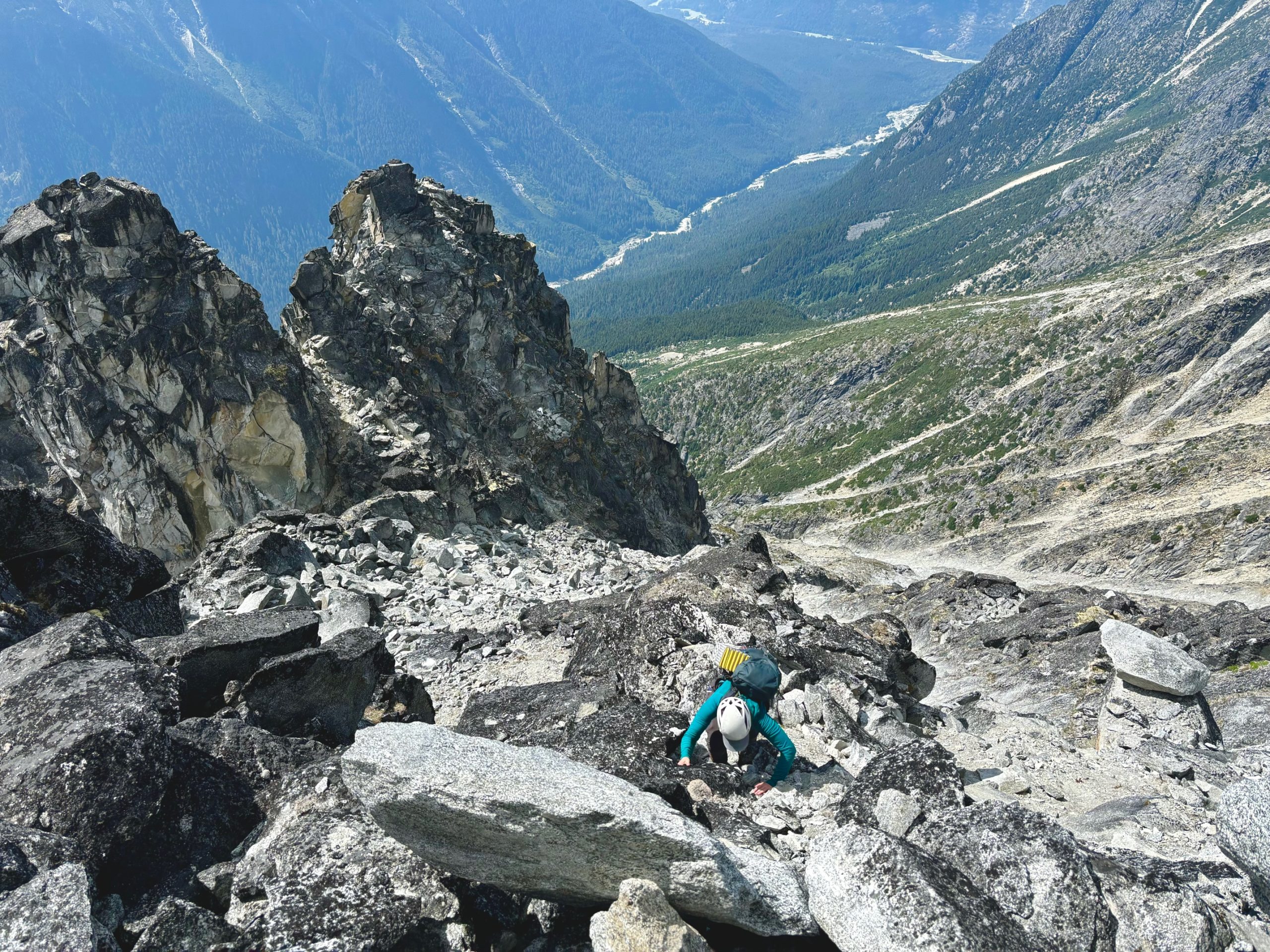
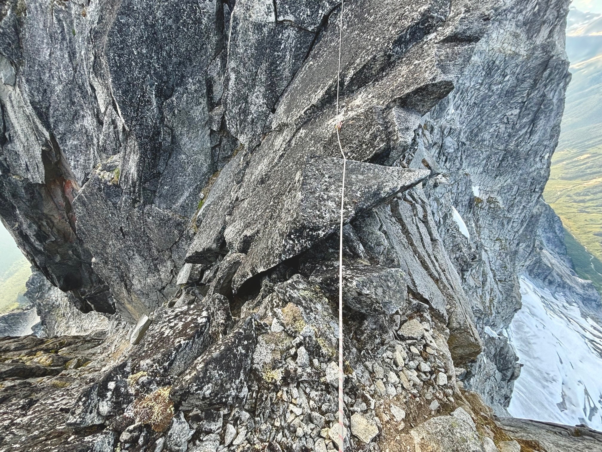
When I joined him at his anchor, I was so happy to see that despite this sub-summit (#2) looking like a blocky pile ready to collapse, the blocks were way larger than human size and were definitely not going anywhere anytime soon. In fact, looking back at #3 where we’d come from, it actually looked just as loose – and we knew that it wasn’t that bad either since we’d just scrambled it. 

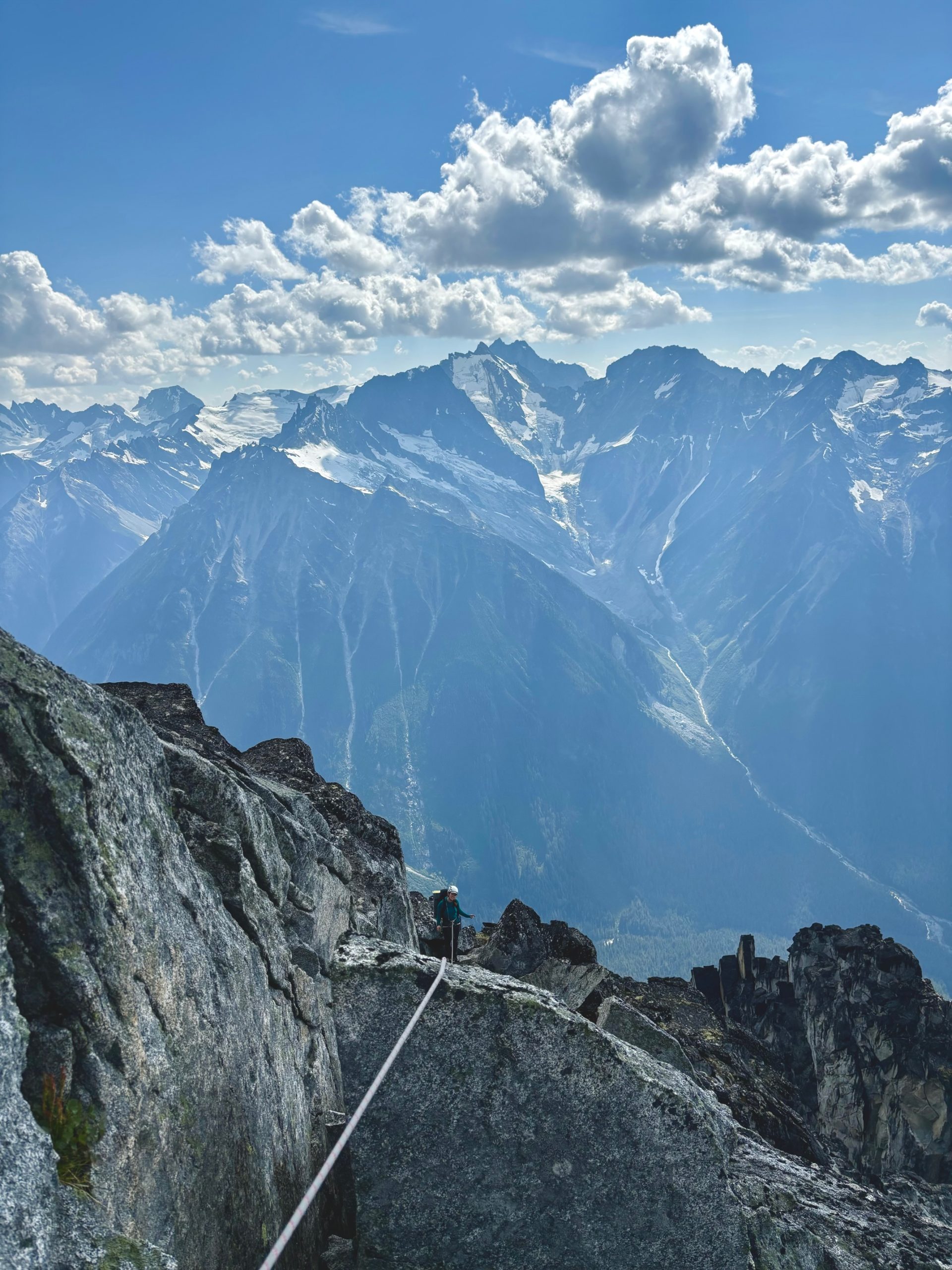
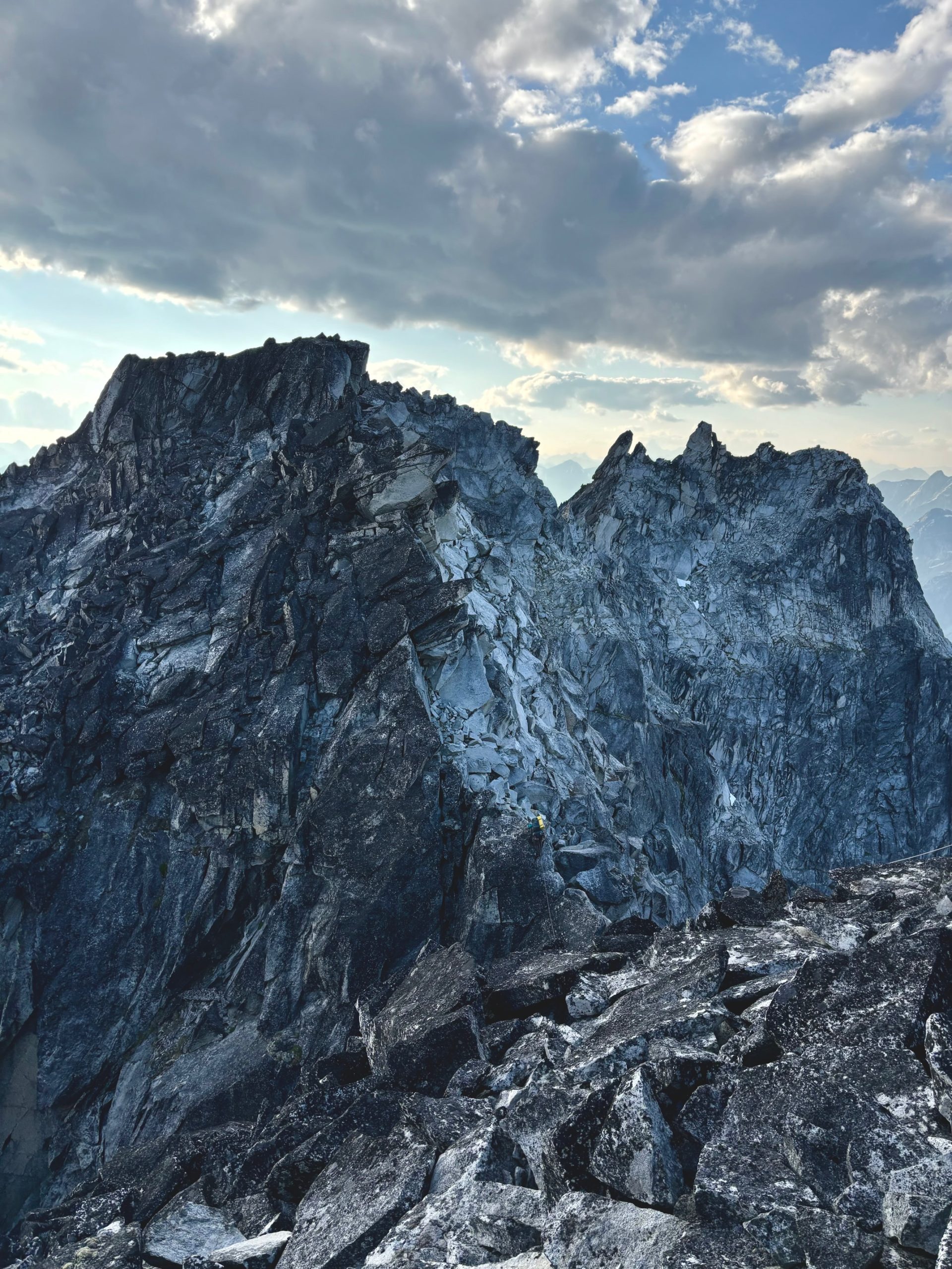
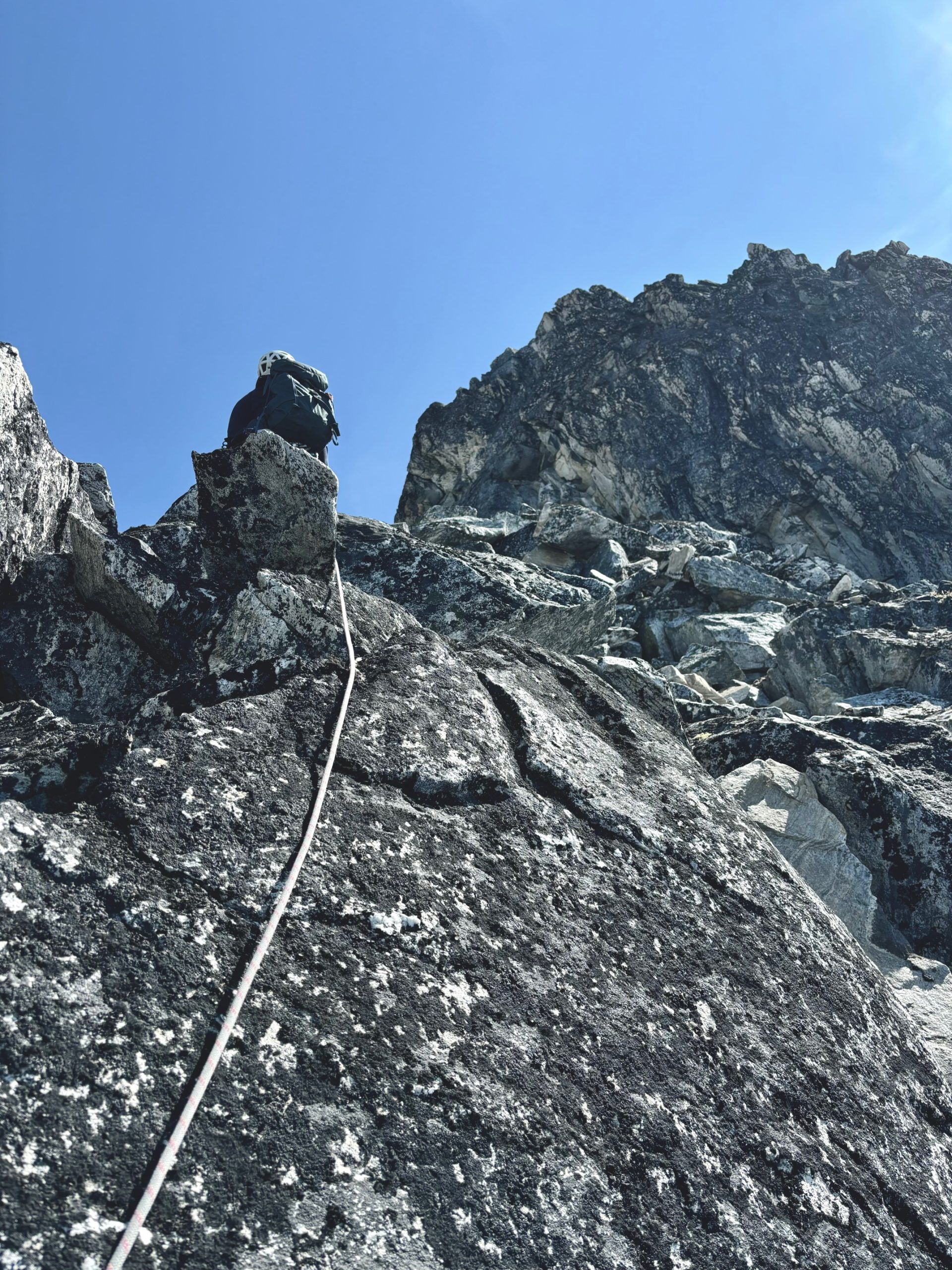
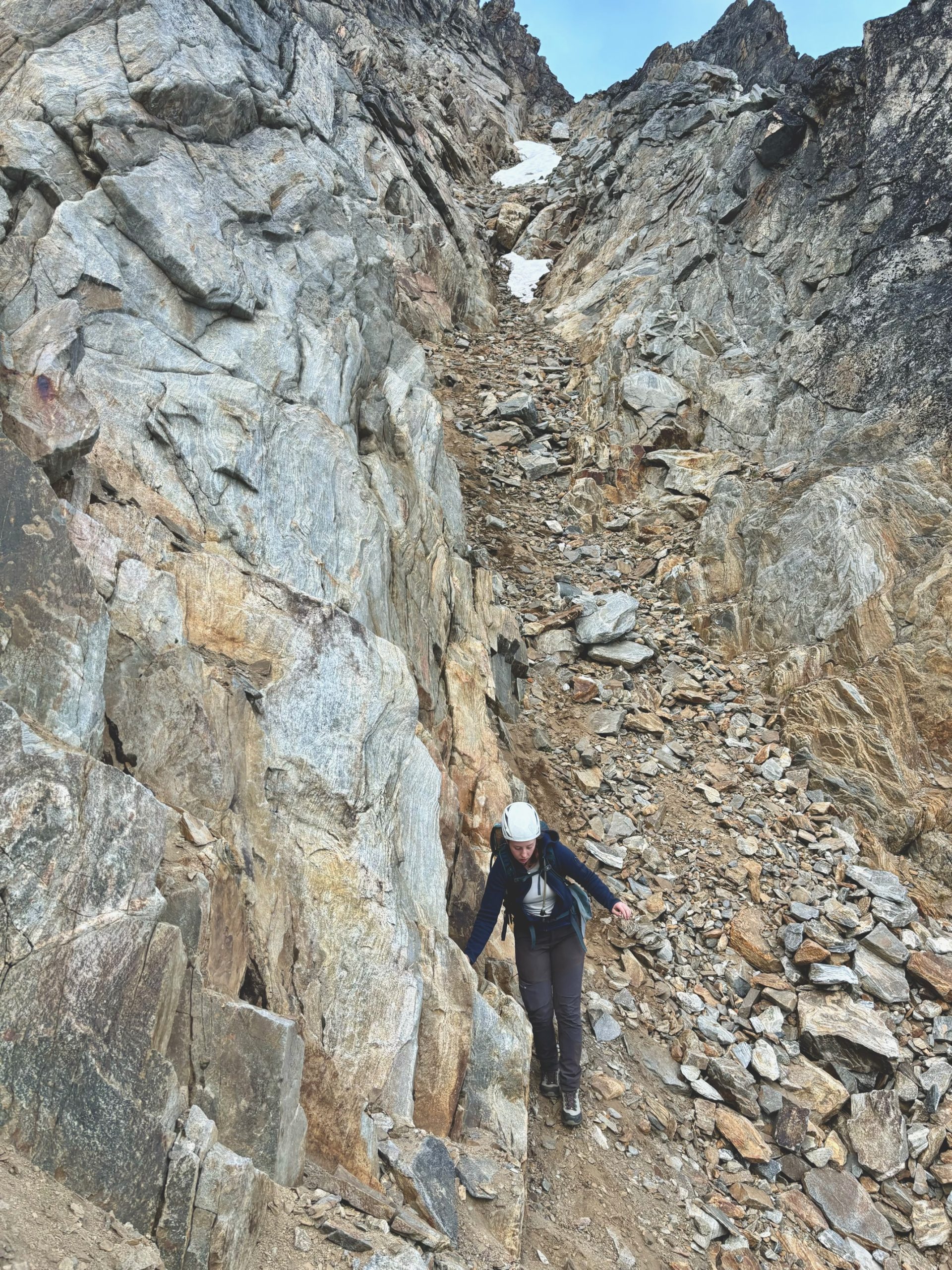
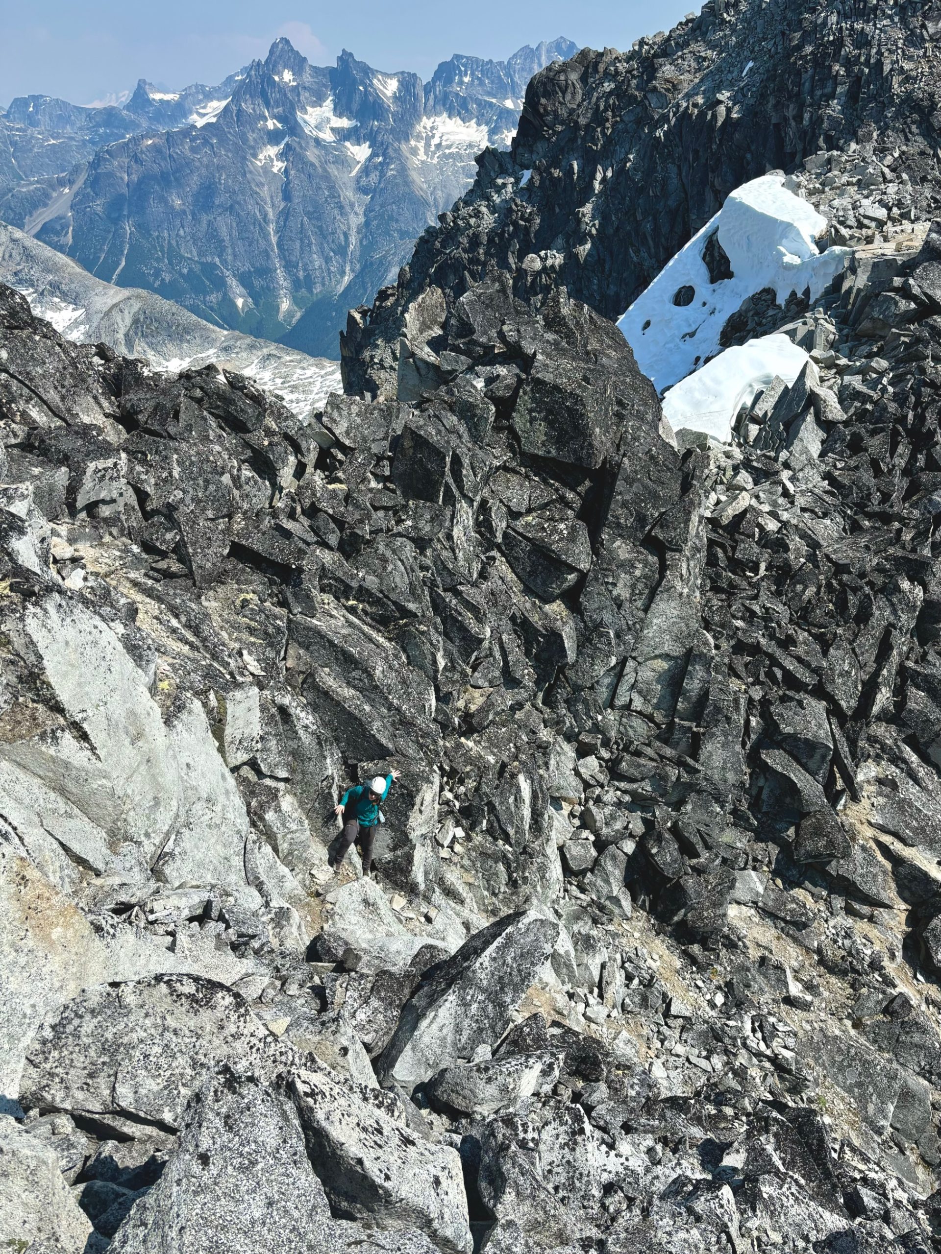
Now, we had one more notch to navigate to peak #1. We thought this one would be a scramble, but we decided to rope up anyways because holy (!!!!) it was exposed! The notch was just a single large knife edge, covered in black lichen. Francis again took off on lead because I was just mentally too tired !

P6 – 3rd class, exposed. Downclimb into the notch on good holds, traverse over the large knife edge, and then back up on to scrambling terrain. 30m or as long as you want to make it. 

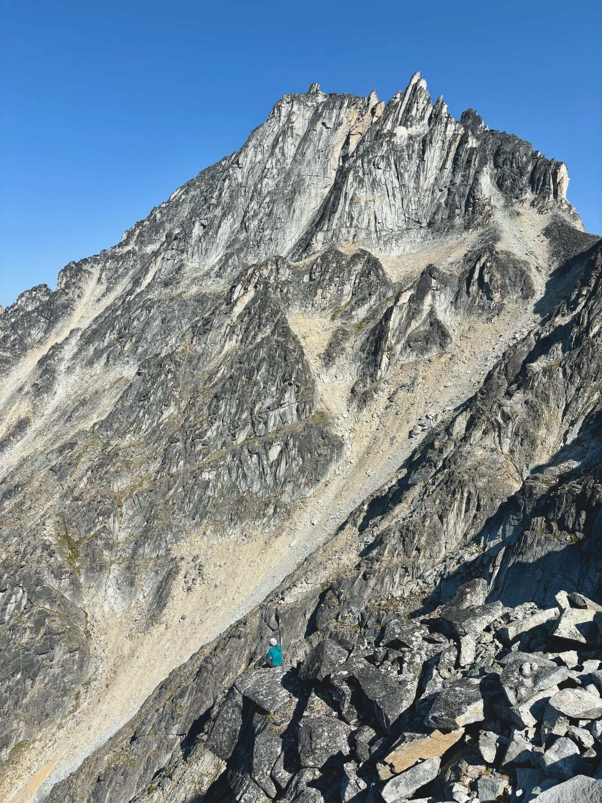
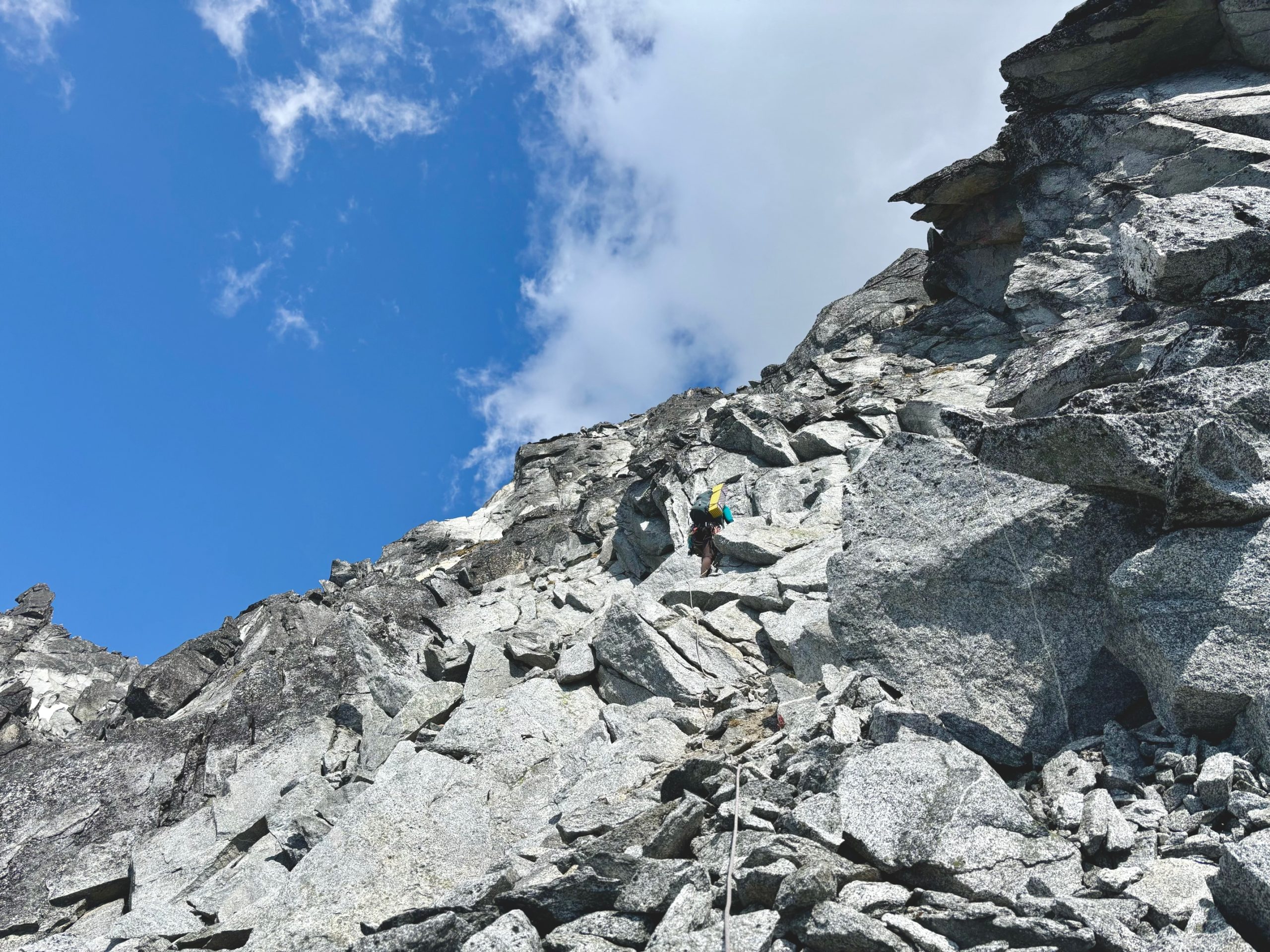
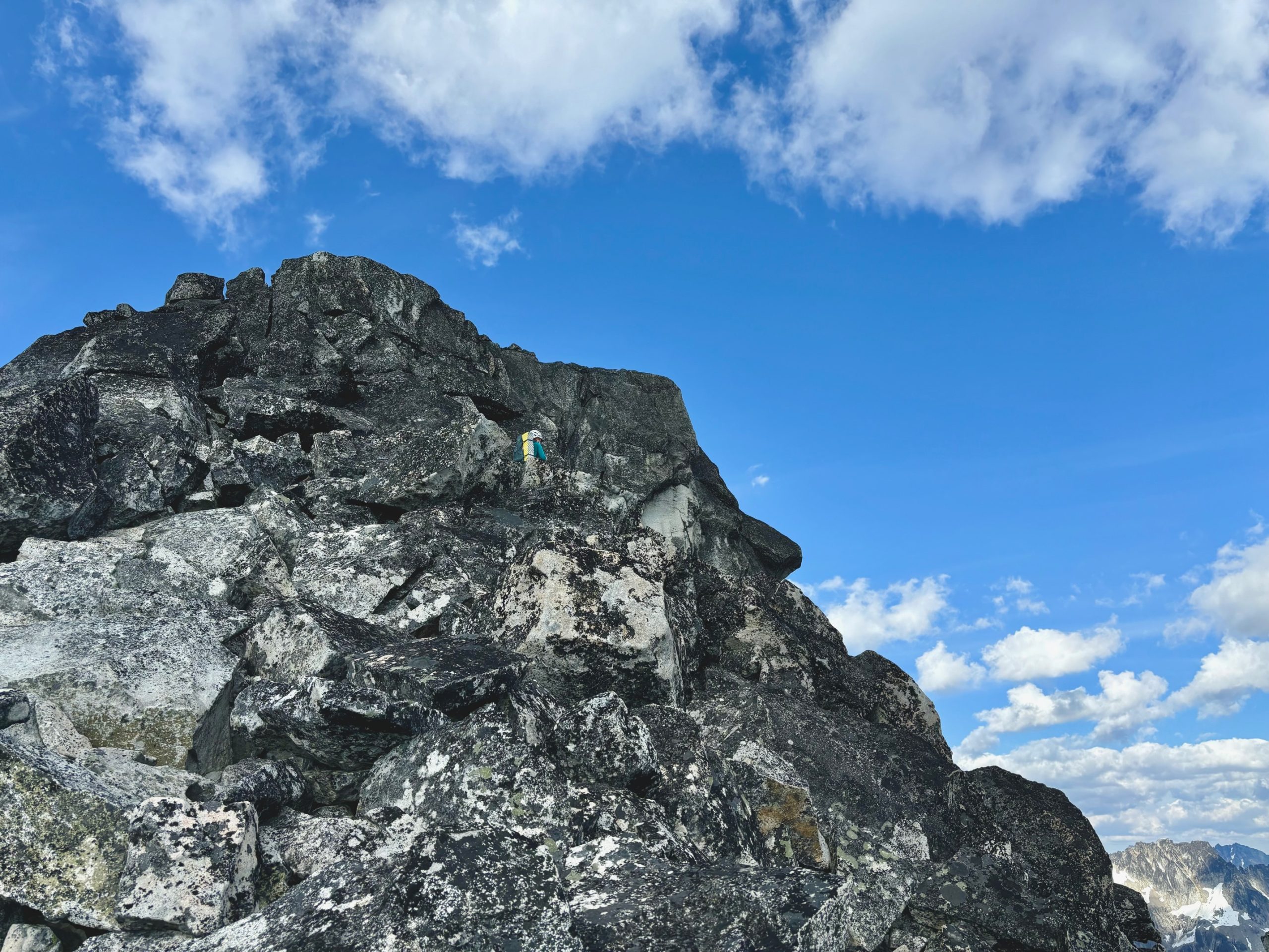
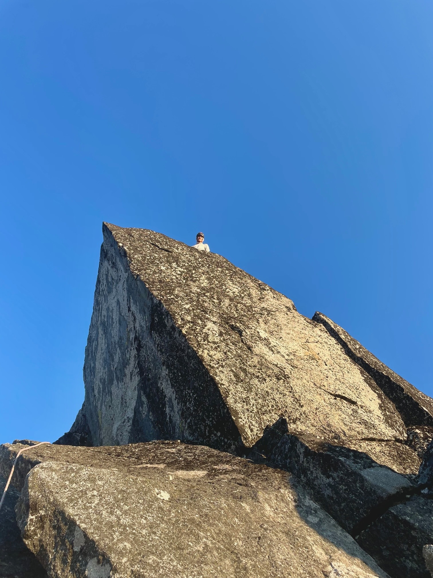
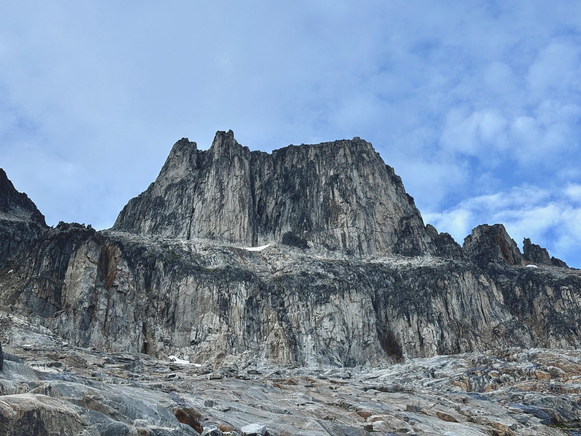
Finally.. we were on #1, but there was still the summit block itself to navigate. We’d hoped it would have a scramble route on at least one side but… of course it didn’t. At this point we should have expected that, lol! Francis really wanted me to have the lead, and despite not feeling like I deserved it after being so afraid, I was too tired to question it and wanted to make him proud. 

P7 – 5.6, scramble up boulders to the base of the summit block. Follow cracks underneath a flake (a few 5.6 moves), up a slab, then to the right inside a chimney. I went straight up because I love chimneys but Francis apparently walked inside the base of the chimney and found a walk-up. The summit has no way to make an anchor so a downclimb is mandatory.

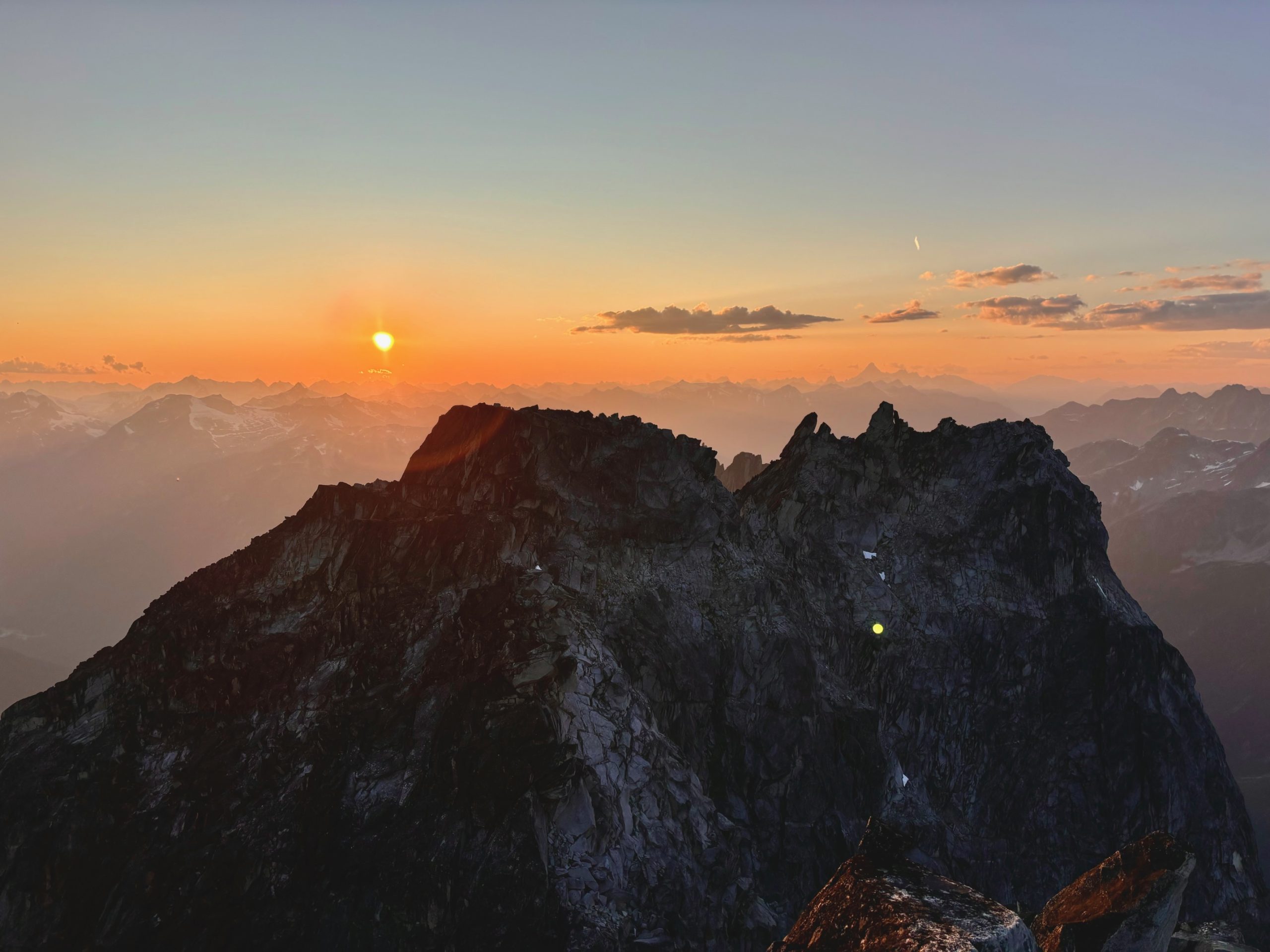
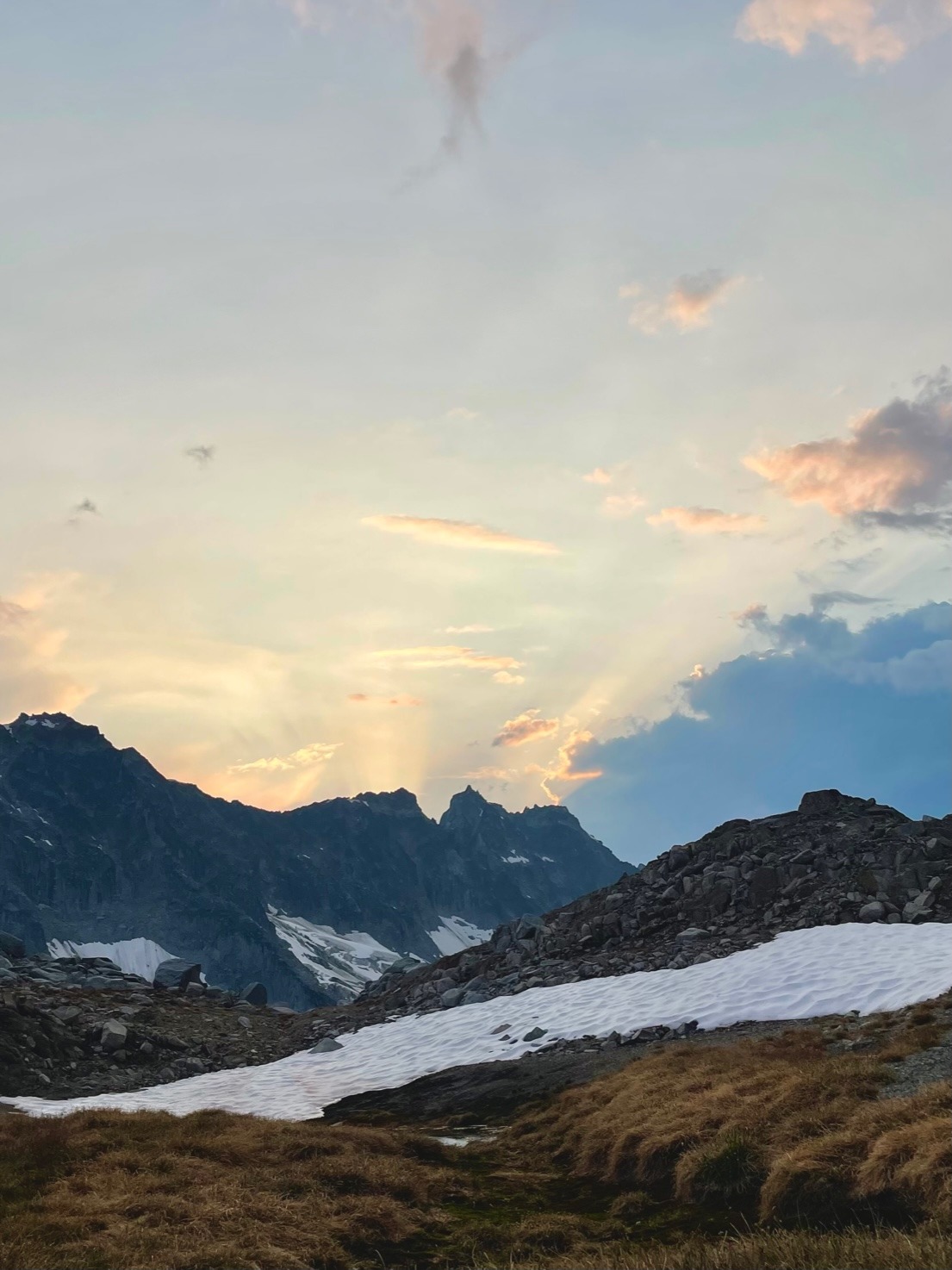
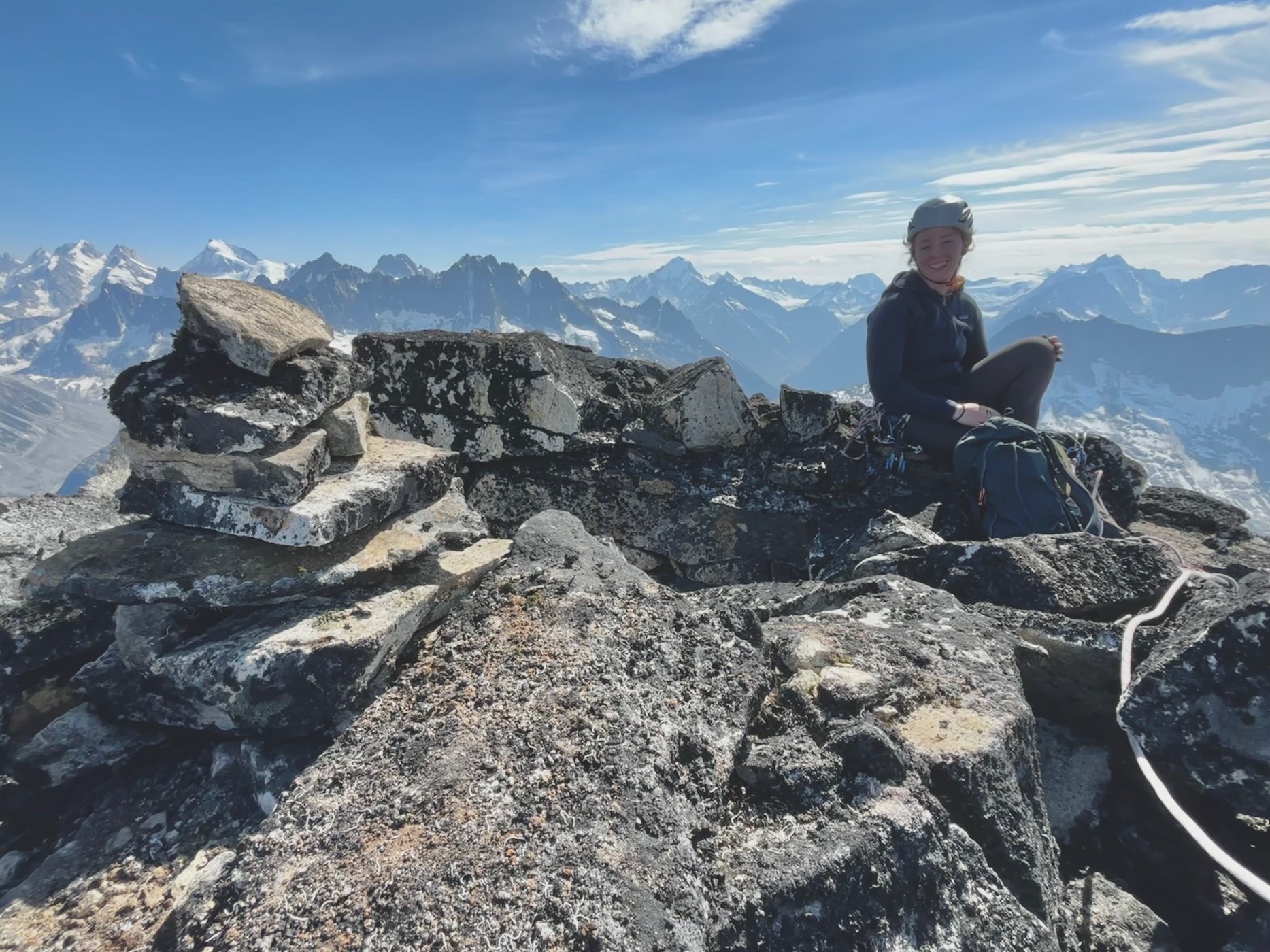
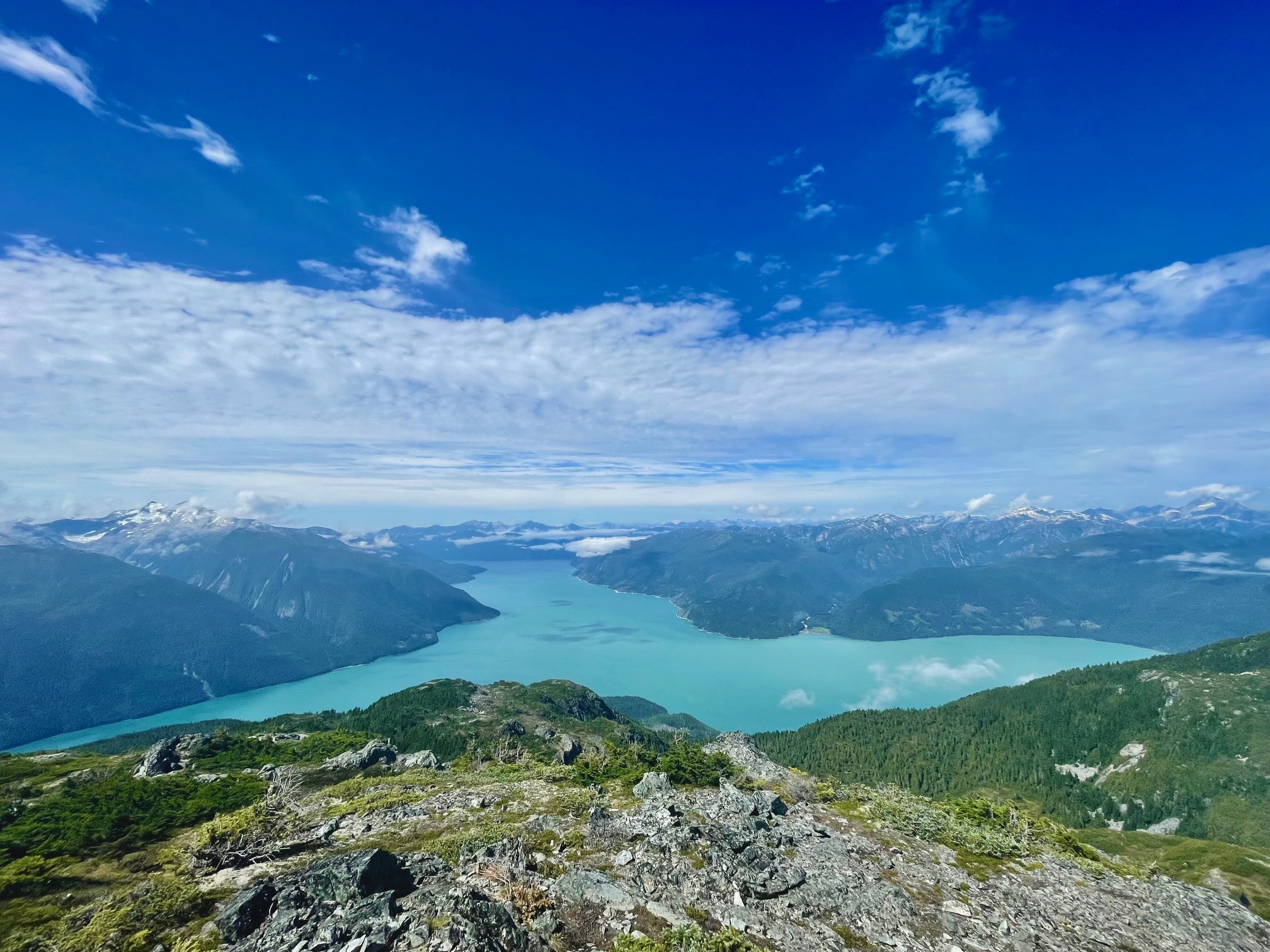
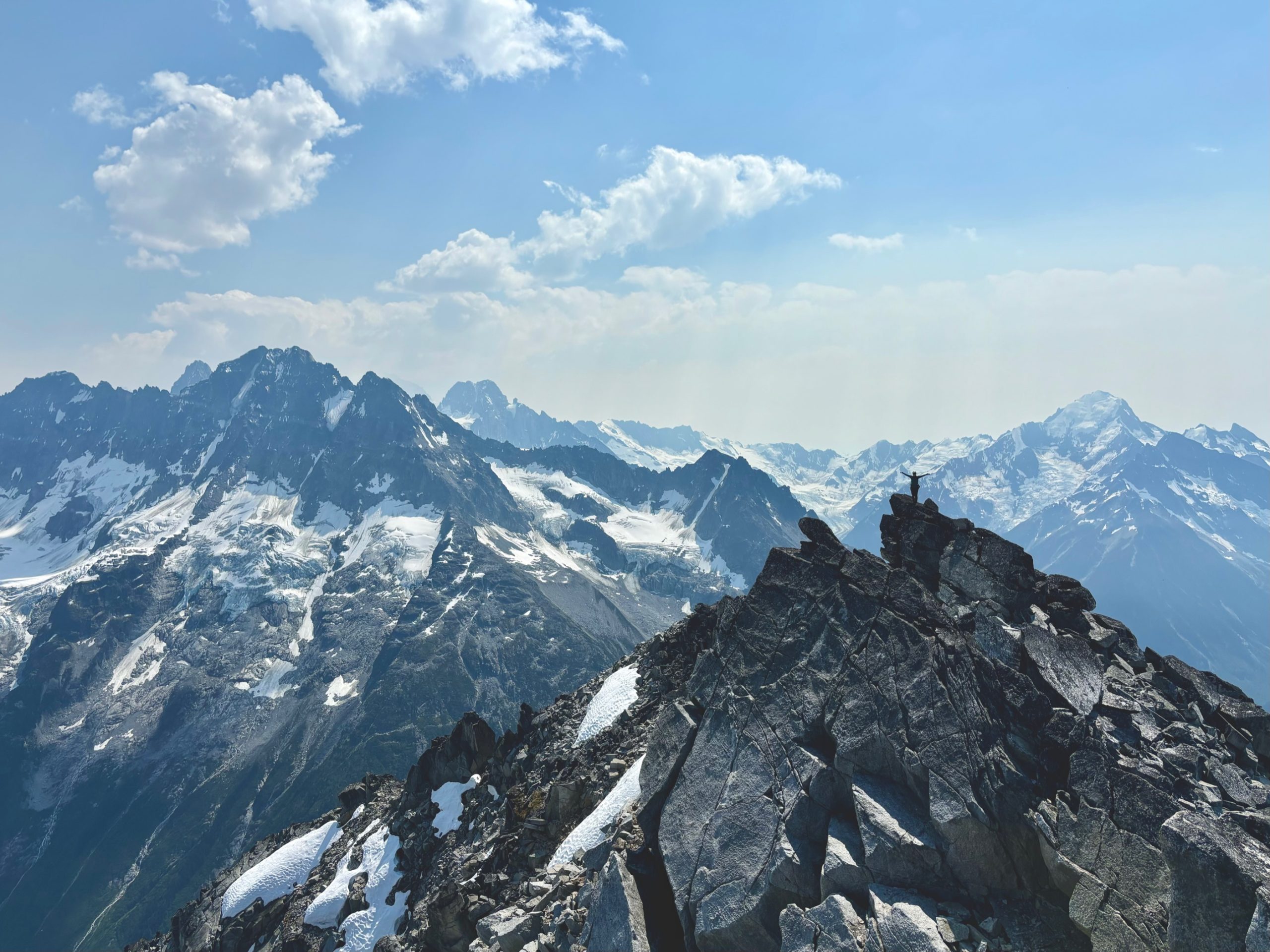
The views up top were… I don’t have words for them actually (in a good way!!) After such an insanely long day and finally standing on the summit, my smile was as big as ever. My fear, now completely dissipated, was replaced by immense joy. 

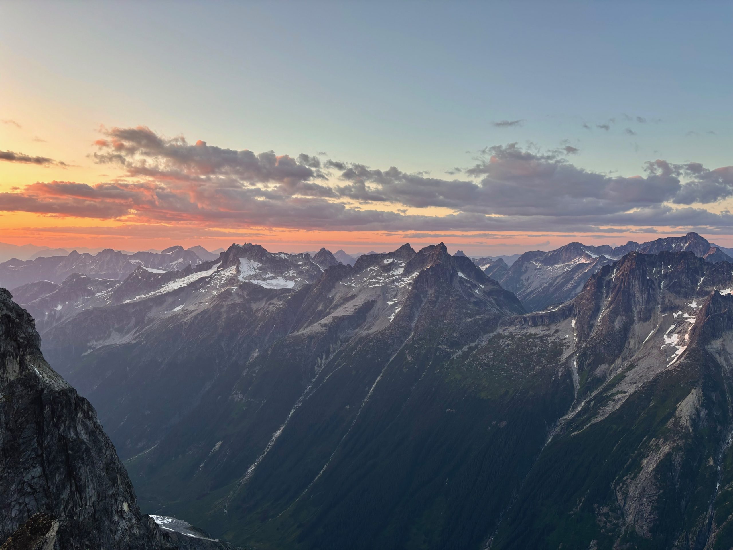
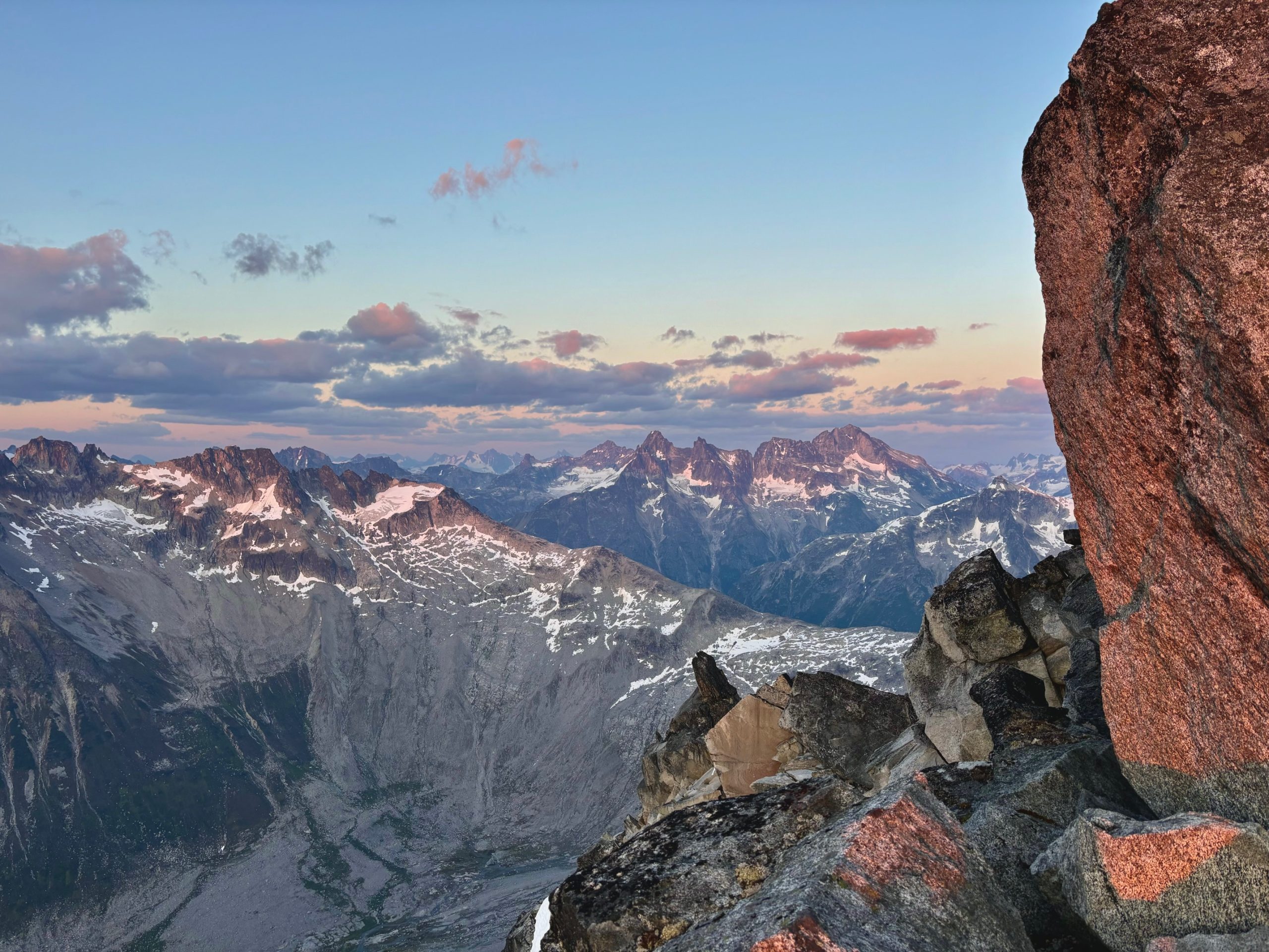
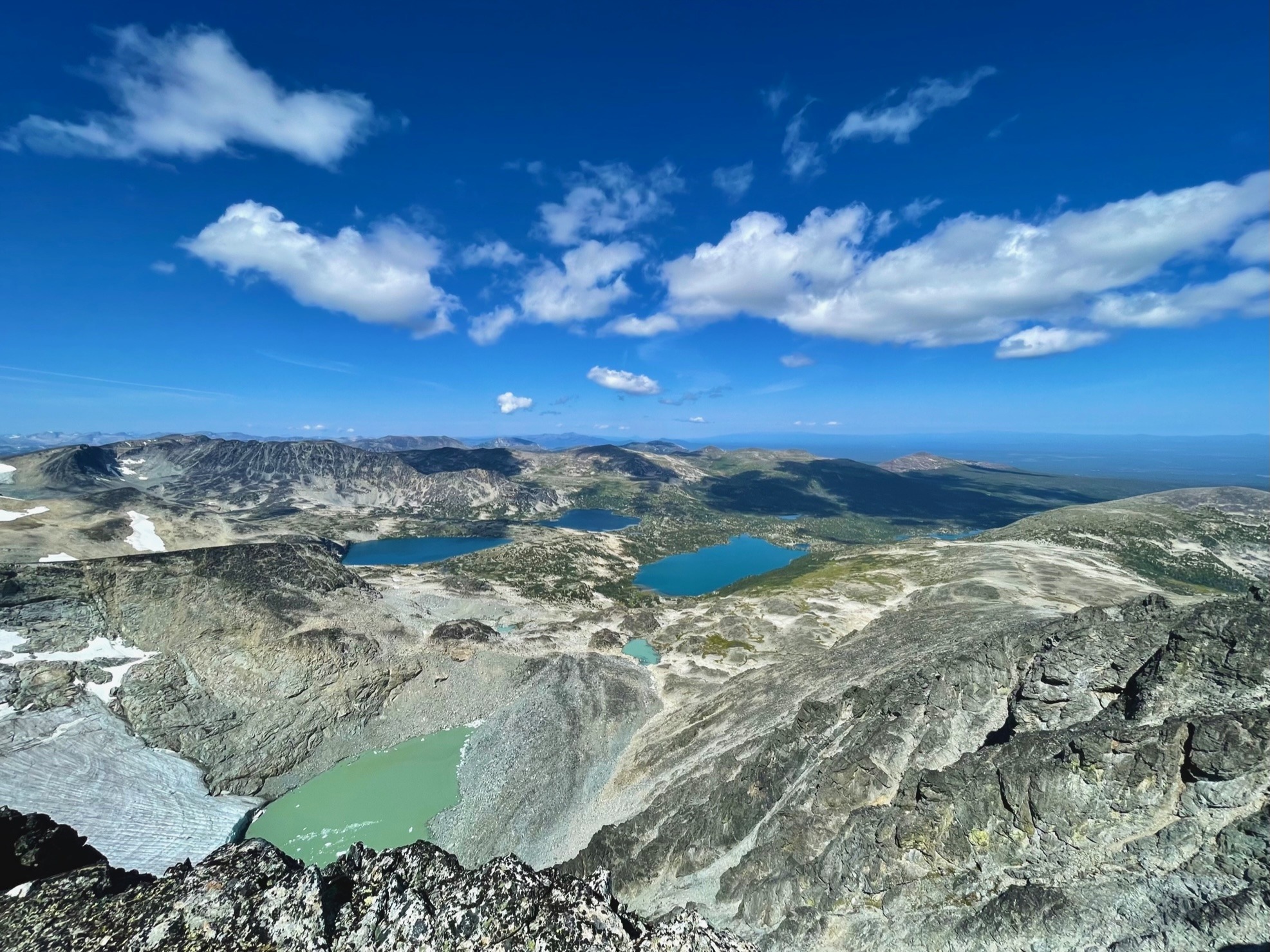
In every single direction was the most beautiful view I’d ever seen, and I tried my best to capture every angle of it quickly in photos so Francis could have his turn on the summit too. The sun was starting to set, and the light on all the sharp peaks and glaciers was incredible. Even better, was the fact that I was standing on by far the tallest thing around, meaning we had well and truly accomplished what we’d set out to do on the trip, which was stand up here. I’m in absolute disbelief too when I think about the fact that we were the first people to ever do so. Mindblowing! 

I quickly downclimbed the chimney and back to a very large ledge where I belayed Francis up and past me to the summit. I heard some whoops and hollers of joy, and then a bunch of rocks being moved around as he build a summit cairn. I didn’t think there were more than 3 rocks up there but I hope he was able to make a cute little stack anyway. 🙂

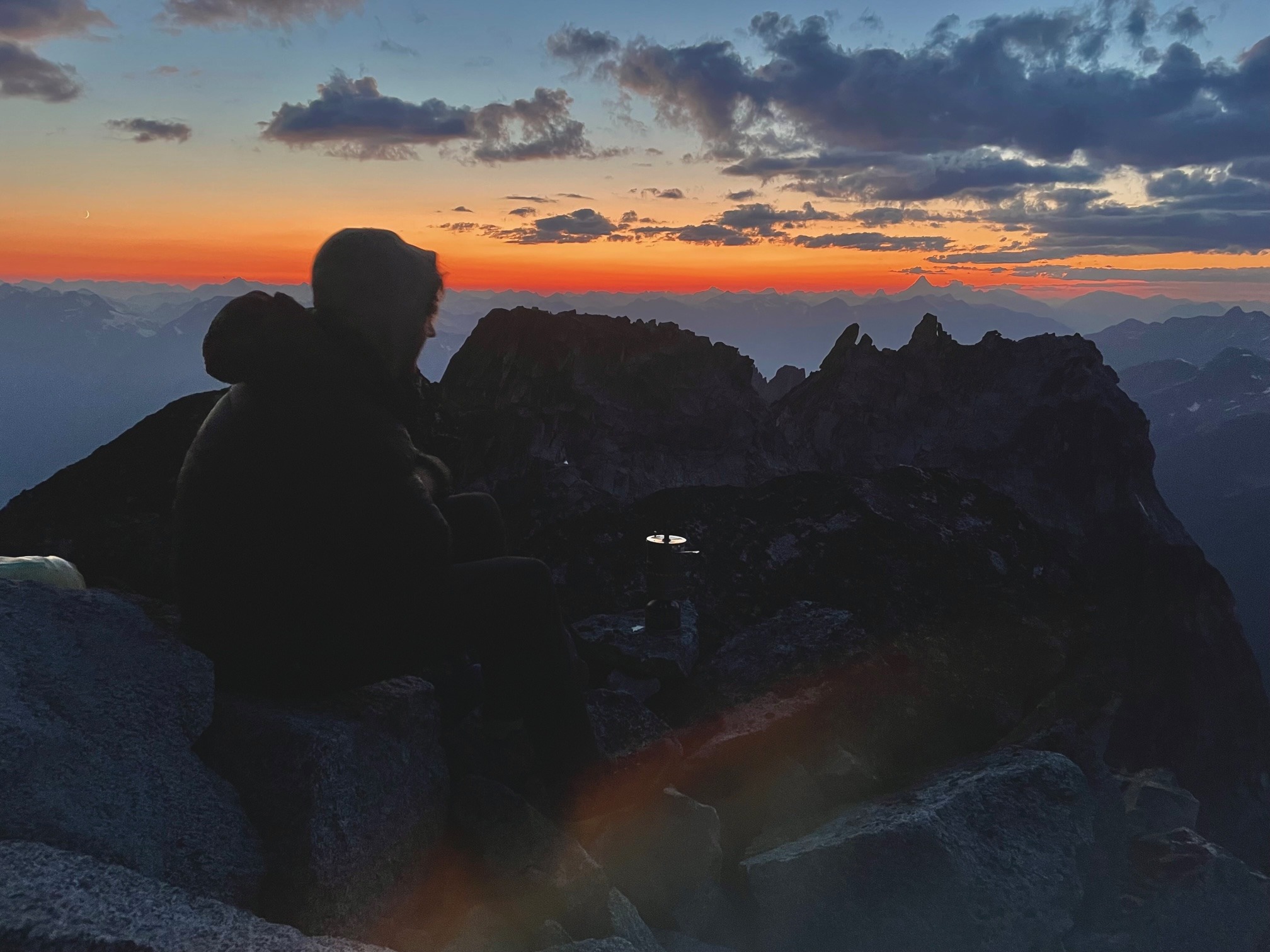
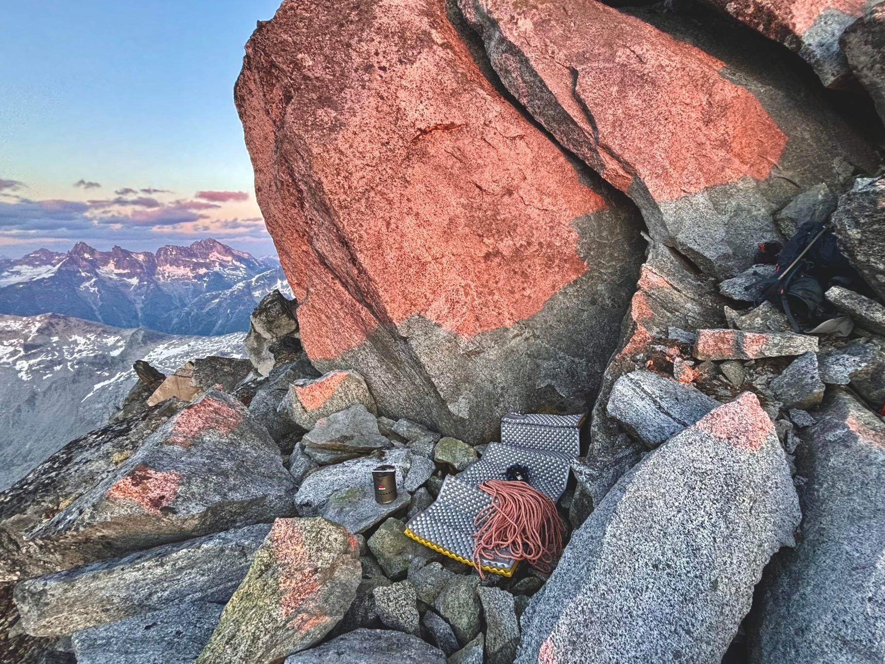
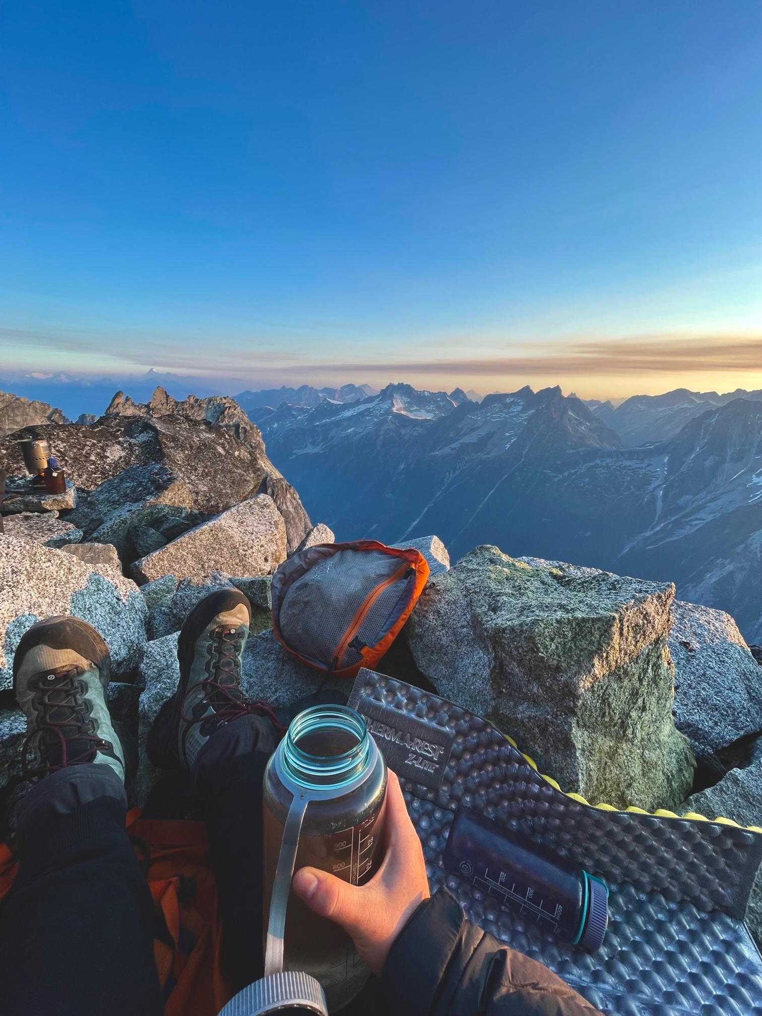
We left a nut so he could skip most of the downclimb, too tired to take on any extra risk for the day, and then joined me on the big ledge I was belaying from. I noted that it would make a pretty great bivvy spot if we moved some rocks around, so we decided to stay there for the night. It had taken us 15 hours to reach the summit, and I was glad that we’d packed a small amount of overnight gear. 

Coming up the main gully now

Some very typical loose terrain

Me making an awkward step in the gully

Francis doing the same

Finally connected with the ridgeline!

Looking up towards the summit of #3

A couple more scrambly steps before the headwall 1/2

A couple more scrambly steps before the headwall 2/2

Looking down on P2

On P1 above the short headwall

Some fun climbing on P3

Coming up the last bit of P3

Setting off on P4 up the short chimney

Me sitting at the top of P4 where we unroped again

Our first look at the rest of the unclimbed peaks on the ridgeline!

Looking over at the summit. I don’t think this photo quite emphasizes how scary it looked in person.

Francis’ lead up from the notch. As you can see, it’s nowhere near as scary up close.

Super chill. These heather ledges are flat! 

Francis looking back at me, #3 behind me. It also looks loose but as we know it also wasn’t.

Francis’ knife edge traverse on P6

Francis now scrambling towards the summit!

Me coming down on to the knife edge from #2

Looking back over the sub-summits of Culbert Crag from the true summit!

More beautiful summit views

Looking south from the summit, Mount Waddington directly ahead in a cloud

A closer view back down at our campsite ridgeline. And from how sharp this ridgeline is I think we made a good call coming up from the other side!

Me belaying Francis up to the summit from our bivy ledge

Little Francis head on the summit tower 🙂

I grabbed some snow from a snow patch just below our ledge, and then we set about making dinner and organizing rocks into something of a flatter platform. Between the flat stones, my light foam pad, the rope, the tagline and the two backpacks, I think we did a pretty bang-up job at creating a make-shift bed! 

The sun set as we did all this, and created the most wildly beautiful reds and oranges in the sky. I was glad to be spending a night up here just to get an amazing sunset in the coast mountains, despite knowing I was in for a long, long, night of shivering. Before bed, Francis wrote a beautiful note to leave in the little summit register we’d brought up with us. We named the summit Culbert Crag, a name that Glenn had picked out to honour his best friend and legendary coastal mountaineer Dick Culbert. 

Because the summit is totally flat, we left the little orange pill bottle on our sleeping ledge just below the summit, tucked away behind the rock that we used as a pillow. We hope that someone else one day will come up and find it! 

We’d sacrificed sleeping bags for weight reasons, but still did our best for warmth before bed. With some extra layers for the night, puffy jackets, bivy sacks, and boiling water in our nalgenes, I fell asleep surprisingly quickly… though it didn’t last long. We spent most of the night tossing and turning, shivering and readjusting whichever way we were curled into each other. We were somewhat sheltered from the wind in our little corner, but being up above 2000m with no sleeping bag is never a warm affair.

The sun setting over the mountains

Francis boiling water for us as the light fades

Sun setting over Nemesis and Gilgamesh group

Getting all my warm cozy layers on!

More pretty sunset colours with the Furies & Diana

Looking past our bivy spot towards the ridgeline where our tent is

Our little bivy site, sheltered in there as much as we could!

Our summit register <3 Francis is much better at wording things nicely than me 🙂

Sun is truly setting now. Monarch was a sight to see on the horizon line!

Moon rise!

My glorified garbage bag bivy sack which is gold lined so you know I’m special trash 🙂

Day 4 – aka: Culbert Crag pt. 2

We were both awake long before sunrise, as the sky turned from beautiful stars and the Milky Way into blue and pink light along the horizon line. I felt desperately ill, probably from cold, lack of sleep, and extended stress over the last 24 hours, and I got up and paced around for what felt like an eternity, trying to get my stomach to settle. 

When the sun finally crested over the farthest mountain, Francis shifted out of his bivy sack too, and we sat together facing directly at the sun. We took our morning really really slow, defrosting ourselves mentally as well as physically. As the day began to warm up, we slowly felt alive again, and Francis kindly made me some more tea to sip on. I felt too nauseous to get any food down, but he was able to stomach a pop tart, which he claims is a great source of calories for the morning!

We eventually packed up all our gear and scrambled back down to the notch between the summit and sub-summit #2. I led a short pitch back over the knife edge notch, and then we scrambled over the top of #2 to find a decent rappel station. We slung a very large boulder that was resting behind another, and felt very certain that they were rooted down enough for us to use them. The full 60m of our rope and the tagline to got us down to the notch between #2 and #3, and we scooted out of the way as much as possible before pulling the ropes due to how loose the rocks were. Thankfully nothing big came down, and the ropes pulled clean without getting stuck. We thanked all our lucky stars. 🙂 

The sun that felt like it took 4 hours to rise….

Monarch mountain still looking so impressive in the morning light!

Sipping tea. warming up.

Francis coiling up the tagline that we slept on

Scrambling down from our bivy ledge

My short lead back to #2

Francis following me back across

Me rapping back down to the #3/#2 notch

Francis joining me

From the base of the notch, we looked down at the gully and decided that we’d rather navigate it than spend the next many hours rappelling our route from yesterday. So, we coiled the ropes and set off very close together, sending down hundreds of rocks in the steep gully. We figured if need be we could rappel some especially bad sections, but in the end we actually managed to scramble the whole thing. This gully would be horrendous to ascend, but I suppose if you were desperate to skip our nice route then maybe it would save some time. 

Linking back with the original gully we came up, we happily boot-skied down the loose rocks and sand, thankful to finally be out of technical terrain. From here out it was steep and kinda terrible, but it was only a matter of retracing our steps.

I had a very enjoyable nap in the sun on a large flat boulder about halfway back to camp, and with renewed energy afterwards, we were able to truck on quite quickly. We reached our tent around dinner time, and it was only then that we finally allowed ourselves to say: we did it!!! It took us 15 hours up, and 10 hours down, making it 25 hours of moving time.

Many mountaineers much wiser than us will tell you that no summit is “done” until you’ve completed the descent- which we’ve both taken to heart over the last couple years. Now back at camp though, it felt so nice to finally celebrate our accomplishment. 

We had a nice high protein dinner of my dehydrated sheppherds pie, and then almost immediately tucked into bed. Reflection and some relaxation could come the following day. 

Starting down the very loose gully

Francis heading down. We mostly tried to stay beside each other rather than ahead or behind… yikes

Finally popping out the bottom of the gully. Lots of butt scooching which Francis gave its own joke grade of “BS(butt-scooch) 2”

Back onto sandy gully. Better, but not by much lol

Coming down more gully…

omw back to camp 🙂

Our last time making the descent of this pretty gully (we were happy about this lol)

A sunset from camp we could never get tired of.

Day 5 – Well deserved rest.

After an amazing, long, and warm sleep, Francis and I had one single goal for our rest day: to get clean! We hiked a short distance to a snow-melt waterfall along the slabs we’d scoped out on our second day, and used the freezing, freshly melting water to clean off with some biodegradable soap. 

We spent the rest of the day reading, wandering around, practicing hammering in pitons, drawing, and snacking. It was very enjoyable, and a well earned rest day.

my bene gesserit inspired bug protection outfit

… the reference. hahaha I bet those ladies never deal with mosquitoes 😉

I was very entertained that this ice block had a finger sized hole hahahaha

Just a small selection of the meals I dehydrated before coming out here. Maybe I should post recipes here on my blog for future trips!!

Best shower views in the west! 😀

Day 6 – 2nd Ascent of Diana Mountain

After a second warm nights sleep, I was feeling ready to tackle something else, and so we got up and set out to do Diana Mountain, a summit on the other side of the valley from Culbert Crag. This summit had (up to now) only seen a single ascent by a party in 1981. Although our approach involved a full day of sidehilling and boulder hopping, we were happy to not be ascending any more steep, sand-filled and loose gullies.

We also got blessed with wildlife, seeing many birds, bear prints in the snow, and way, way too many spiders making webs in the larger boulders. Best of all, we finally caught a brief glimpse of one of the evasive mountain goats!! We’d seen their tracks, fur, and droppings in every place we’d been so far, impressively high into the alpine where even Francis and I were scrambling with our hands and feet. Thankfully no goat had summitted Culbert Crag before us, but we did see their droppings as high as the ridge line where we’d been climbing. Those fluffy little guys are nuts! 

On top of Diana Mountain, we were rewarded with fantastic views over into the next valley. Because Diana is higher than Culbert Crag, we were actually able to get full 360° views, and an especially good look at Mount Waddington. It’s a bummer the bigger BCMC camp didn’t work out this summer, because we probably would have also seen some fellow group members on nearby summits. We could see quite easily towards the Nirvana pass mountains, where their camp would have been. 

Back at our camp in the early evening, it felt like a night for some comfort food, so we whipped out my homemade pesto, which really hit the spot. Another reason to maybe add my recipes here…. comfort food. mmmmm

Pretty sweet view from our hike of Culbert Crag and its surrounding peaks. (Sedna on the left, and to the right all unclimbed)

Setting out in the morning

Bear print! Francis’ foot for scale

Coming up through the boulder field of spiders eeeee

Traversing some heather slopes

Me on the summit of Diana Mountain

Francis opposite me

Looking towards Trident Tower. Hard to tell from the photo, but it was from this angle that we thought we saw a line that might be possible!

The glaciated valley beyond Diana

Septentrion Spire looking SICK. We would have climbed this one if the original BCMC trip had worked out!

Pretty golden light through the valley on our way back to camp

Francis taking a break with me in the meadow

A look up at Trident Tower… very inspiring!!

Beautiful sunset light above Culbert Crag

Day 7 – First Ascent of Trident Tower

On this day that marked a week in the range, we’d floated the idea of flying out since we were pretty tired. But due to some inreach issues and being unable to coordinate with WhiteSaddle, we were left with an extra day. This actually worked out in our favour, because despite being exhausted, we really wanted to scope out what a line might look like on that unclimbed peak beside Diana Mountain that we’d been eyeing up all week.

Out of every peak we’d seen in this range, this one looked the most inspiring to me, since now that we’d seen it from Diana, we could confirm that it was truly vertical on every single side. It’s a rarity in the mountains to find a peak with no scramble route up at least one of the sides, and even more of a rarity to find one so vertical that it looks like it was magically transported from the Bugaboos and placed right here in front of us. 

We left camp already feeling near-zero energy, so we repeated our hike from the previous day practically without speaking a word. In just under two hours of contemplative silence, we found ourselves looking up from the boulder field at steeper terrain. We took a snack break to scope out some potential routes. 

Heading up to the base of the big tower!

Our view from where we took our snack break

We knew from our previous day’s adventure that we could probably find a route up the Northwest side, and we could see from our current vantage point that there was a decent bench below the large face. The way up to it was not straightforward but was also not technically difficult. We scrambled some slabs, a very loose sandy slope, and a short gully system until we were level with the base of the peak. Then, we traversed over until we reached one of two large notches.

The first notch turned out to be more of a crux than the second, and although we did a rappel to get into it, we happily did not need to leave any webbing since we could come back the same way. The second notch was easy, but a loose scramble over boulders. 

Finally, around 1pm we stood looking up at the grand face itself. We’d decided to climb the shoulder since it would be a shorter route to the top and we didn’t have energy for a full day on the rock face. However, a stronger party would likely enjoy wrapping around the Southwest side here to have a look at some of the amazing cracks running to the summit.

Me coming up more loose slopes. Sedna Peak and Culbert Crag behind!

Walking over to the first notch

Waiting patiently while Francis scopes out whether the rappel is worth it. If the route didn’t go there’s no point in both of us going over there!

It goes! I followed him up 🙂

We spotted a chimney and some weaknesses from the shoulder, and decided to head straight up those. It was steep, but the rock looked very featured and for once, very solid. It was a toss up on who led the first pitch, but Francis had the gear and so racked up to take it. We broke down the climb then as follows:

P1 – 5.8, climb up the chimney with fantastic face features until you can move left out of the chimney and up towards a bench. Make a few more moves up a thin crack and licheny slab, and belay at one of the large boulders. 60m

P2 – 5.6, scramble up over large boulders to the base of a headwall. Chose your own line here or do what I did and wrap left over big exposure up some nicely featured rock and cracks. 45m

P3 – 4th, from the very big ledge, scramble down and then up a notch, and follow the ridgeline to the summit. Belay at a large block. 40m

In great disbelief, we’d done the huge mountain in only 3 pitches! The route had felt so much less involved and scary than Culbert Crag, and there was actually some really fun climbing on solid rock. Considering it’s such big terrain, I was a little surprised to have just a type 1 kind of day. It was almost like walking up to a crag up here! It was only mid afternoon, so we took a nice break for snacks and photos. 

For the descent, I decided I’d be fine down-leading the last pitch, so Francis placed lots of gear as he scrambled down it on top-rope. I followed, taking our pieces and delicately making the same moves I’d done on the way up. From the big ledge, we then made a 30m rappel over the headwall, and a full 60m rappel (with tagline) back to the base of the climb. 

I’d call the notch from earlier P4 – but I led it easily back up in hiking boots, placing minimal gear and arriving back at our rap station. We then put the ropes away for the scramble. 

After the descent, we hopped boulders and then climbed back up slabs to our campsite at super speed. The wind was completely still, and the mosquitoes were at an all-time high. I didn’t want to put my fleece on for uphill travel, so I summoned the last of my strength and plowed up the hill like a tank. 😀

The sun was fully set as we arrived back at camp, and we pulled our headlamps out as we got dinner underway. The wind had picked up a ton after sunset, and I crammed the food into my mouth as quickly as possible so I could bundle up in the tent.

When we finally cozied up, we saw that we’d missed a few messages from WhiteSaddle offering to pick us up that night. Timing hadn’t worked out, but we confirmed that we’d be ready for pickup at 7am the following day, as previously scheduled. 

Francis having a look at the route

Here is Francis at the start of our route

Francis cruising up P1

Following up P1

Francis’ view as I took off to P2 towards the headwall

The right side of the headwall which looked tempting but was way more overhanging than it looks at first glance

The big headwall of P2 (lots of options!)

My lead… you can see I ran out of cracks to climb and zig zagged around the corner lol…. making a butt load of rope drag. ugh hahaha

Francis heading up towards the summit on P3

Amazingly vertical! Hell yeah. Such a cool summit ridge!

Me coming up the summit ridge on Trident Tower

Francis waiting for me up top!

On the summit!!

“my cairn and my girl” is what he called this :’)

Francis on da summit!!

Me up top, about to start my down-lead

Ways that most men show their lady they love them: flowers
Francis: over protecting her easy downclimb into a notch, hahahaha. Look at his smile, he knows what he’s done !!! <3
I yelled over “aww you love me so much!” “I do!!” he says. hahahaha

Rappel #1 – trundling a few rocks so they don’t come down on me lol

Francis coming down as well

Re-organizing for rap #2

Rappel #2

Looking down the lower half of the rap at part of our route!

Francis coming back down

Scrambling down, with the climb behind us

Some more downclimbing

Some more scrambling back down

And back into the loose gully

Francis back on the descent

Francis back on the descent

Looking back triumphantly at what we climbed!

I really liked the rock texture in this area. So pretty!

Success!

Day 8-10 – On to new adventures

Mike again casually rolled up in the Heli at 7:40am, whisking us out of our beautiful remote home in the mountains. As we flew out, he pointed out many sites where he’d flown other parties over the years, from climbers, miners, skiers and geologists, to places he’d fought fires in different valleys. We were again in awe at his incredible life, and I could see Francis (ever the lover of helicopters) imagining what it would look like to be out here as a pilot himself. 

I can see us making many more trips here over the years, to different valleys and mountains for sure, but actually living up here (and flying helicopters for Francis) will probably always remain a dream. I don’t see us ever giving up our ice lattes, sushi dinners, seawall bike rides with gelato stops, dinner dates, bouldering gyms, and all of our friends. But man, it sure is a good life out here. 

When we landed back at WhiteSaddle, we took Mike up on his offer to hang out by their dock for awhile and get refreshed with a nice swim. It was warm and sunny, and we were happy to finally jump into fresh water! 

I also asked him where other climbers and adventurers go for a celebratory meal after they come out of the mountains, because I know for a fact that all climbers have good food on their mind when they’re out there. He sent us to a place called the Graham Inn, which is not only the best place in town to get a burger, but also probably the only place to get food in town at all. No matter though, because it was wonderful. The new German owners are delightful, and served us the most fantastic homemade brunch and coffees. It wasn’t burgers, but it was better!! Francis got the bacon and eggs that he’d been craving, and I enjoyed a classic eggs benny. 

A final pano of everything we did on the trip: Sedna pk, Culbert Crag, Diana mtn, and Trident Tower. I think we covered pretty much everything you could do in a day trip from our basecamp!

A pano in the other direction with our campsite

Peacefully waiting for the heli

Some dreamlike views from the heli 1/4

Some dreamlike views from the heli 2/4

Some dreamlike views from the heli 3/4

Some dreamlike views from the heli 4/4

Mike flying in to get us

The dock at Whitesaddle. Beautiful!

If the theme of the first half of our trip was mountains, the second had to be lakes, and man did we ever have a plan to see some lakes. 

In desperate need of some rest though, we drove up to Bella Coola and booked ourselves a nice hotel. Although it wasn’t one of the fancy resorts that are up there, it had a soft bed, and a little kitchenette where we could finally make some fresh food. 

To say we loved Bella Coola is an understatement. It’s a beautiful little ocean town that is a lot like Pemberton, except that it’s also a ferry town, and also has the most incredibly huge and unexplored granite rockfaces of anywhere I’ve ever seen! It was a bit like driving into Squamish for the first time, except instead of 1 Squamish Chief, there’s like 50 of them. The potential for climbing here is nuts! I would say that I can’t understand why it hasn’t been explored, but realistically the 10-11 hour drive from Vancouver is definitely a barrier.

On recommendation from the hosts in our hotel, we spent our rest day doing a very small hike to some gorgeous alpine lakes, and a summit called M Gurr. It had incredible ocean views, an easy walk through some meadows, and a choice of about 20 lakes to swim in. I was exhausted and had a huge bout of brain fog all day until I was finally able to jump in the water. I swam in all my clothes since there was a big guided group there, and plus it was super hot out. This would be a wonderful spot to come camping for the weekend, but we had bigger plans in mind!

M Gurr Lakes and the inlet from the ocean

One of the upper lakes

Francis hiking to the summit past another of the lakes

Me on the summit

Francis on the summit

The ocean!

Swim time!!

Amazing crystal clear water.

😀

Cute furry friends at our hotel !! 1/2

Cute furry friends at our hotel !! 2/2

Day 10-12 – The Land of a Thousand Lakes

During our rest day, we’d made the unfortunate discovery that the rain would be rolling in fast for the rest of our trip. So, rather than take an additional rest day, we decided to go straight for our backpacking trip in an area called the Charlotte Alplands. This area is just East of Wildnerness Mountain, and I discovered it while looking for backups for the Pantheons trip. If you look at satellite imagery for the area, you can quickly see why I wanted to come: it boasts hundreds of tiny gemstone lakes that I absolutely had to see in person. It wouldn’t have made a good backup for the Pantheons since the area has way more lakes than mountains, but when I suggested it for the latter half of the trip, Francis was all ears. 

We drove up a fairly new logging road, which we were worried may be in use since it was a Tuesday, but we passed through with no issues. At the very end of the road there was a big pile of logs, but to our surprise the road actually continued right up into the alpine. Alpine access like that is strange, and although we were grateful to not be bushwhacking, we were curious why they’d built such a highway right into the mountain. Maybe Cat-skiing? Snowmobiles? We’re not entirely sure.

Either way, we made use of our good fortune and hopped over rocks to the top of Mount Nogwon. It was exhausting, but we soon settled into a rhythm once we were on the ridgeline, going up and down all the sub-peaks. Our goal for the day was simply to get as far into the range as possible to camp, then do the rest of the exploring as a day trip before hiking out on the third day. After 10km of ups and downs we were pooped, and found a nice spot to pitch our tent near some running water. The weather on this day was bleak, and although I was still convinced the lakes would be beautiful, the ridgeline (I thought) was nothing to write home about.

Hilariously, up here in the middle of nowhere we actually had cell reception, and with it being the tail end of our trip we happily settled in to watch a movie in the tent. We picked one of my Dad’s favourites: Airplane! An old movie, but we’d been talking about it recently so it was time for a rewatch.

The satellite view I was talking about. Do you see all those lakes?!

Hiking up to the ridgeline from the service road (behind)

Francis on the summit of Nogwon

Pretty dreary views as you can see

The first lake, looking pretty but definitely not spectacular!

Looking down the ridgeline in the direction we’re going

Our campsite with the wild looking black snowpatch

Sun going down at our campsite

Cozying up for movie time !! haha

On our second day, thankfully the weather had drastically improved. We were greeted with a nice warm and sunny tent in the morning, and a fresh set of mosquitoes due to the lack of wind: something we were sadly accustomed to by this point on our trip. 

After a quick breakfast, we headed up the first summit (Peak 2177, sadly unnamed) from our camp. From there it was obvious that the gloomy weather had indeed been putting a damper on the beauty of this place, because now in the sun, the lakes on the other side of the ridgeline glowed. I thought I could see a lot of them from this vantage, but as we hike along throughout the day it seemed there was a new one every time we turned a corner! Every time I crested over a ridge, I’d go: “Whoah, another three!”

We hiked up to an unnamed summit (Peak 2448) which is the most prominent in the area, and from here I was able to count a total of 43 lakes!! Not even including an extra 20 or so small ponds. It was insane! Every lake was a slightly different shade of blue. Some of the bigger ones were deep and dark, while the small ones were shades of fluorescent turquoise. There were a few directly at the base of a glacier which were more grey-green, but the contrast between all of them was incredible. I have truly never seen so many alpine lakes in one spot before. 

We brought our stove & pot so we could make our favourite instant noodles on the summit (Indo Mie!!), and then Francis had a long nap while I set about counting lakes in every direction.

My breakfast: oatmeal had started to taste disgusting by this point so I treat myself like a child and jazz it up to trick myself into eating it

First views of the lakes beyond the summit 🙂

Hopping over soft moss in what we call “hobbit lands!”

Aforementioned hobbit lands

Pretty lake with our main summit behind

Hiking up now. I count at least 7 lakes just in this photo!

We have our friends HT & Yunfei to thank for this one.. 😀 Francis has been especially obsessed since they introduced it to us haha

As many lakes as I could fit into one camera view.. and this isn’t even half of them!

After the summit, we obviously had to go pick a lake to swim in, and made a loop out of our day, hiking off the back of the summit in the other direction towards one of the three larger lakes. Although I knew that big lake = cold swim, this one was such a pretty colour that we just had to go see it up close.

It was indeed beautiful and crystal clear, and there was even a large waterfall pouring into it from one of the small glaciers in the valley. I wondered if I’d reached heaven, but the cold shock of the water brought me straight back to earth. We sat by the water for awhile after our swim, in no rush since there was so much daylight left.

Hiking down from the summit

Getting close to our swimming lake 🙂

Sooo nice wow

That colour is insane. So beautiful!! but so cold…. haha

Here’s a pano for maximum effect!

The hike back to camp was strenuous, and it was nice to crawl back into the tent in the early evening. Every part of us was getting sore, and we were looking forward to getting home again. In the morning we packed out and skipped breakfast, eating our last few pieces of chocolate bar on our hike out. I’m not sure how I did 10k without breakfast, but the thought of getting real food on our way home probably kept me going. 

We stopped for brunch again at our new favourite (Graham Inn) in Tatla Lake, and they were kind enough to serve us brunch again even though it was already 2pm. We then crammed the rest of the long drive into a single day push, making it home to Vancouver in record time just before midnight.

It was a fantastic, life changing, incredible, or however else you want to put it kind of trip, and by equal parts also exhausting. I feel very proud looking back on it now, and happy to take some much needed rest back home. Till next time !!! <3

Another amazing lake we passed on the way back

Overlooking the big lakes now on our hike back to camp (we swam in that far one)

Pretty wildflowers up here too.

Francis hiking through the meadow

Contemplating the beauty of this place as the sun starts to go down

Looking back at the lake near our campsite. Much more pretty now that the sky is blue!

On the hike out (our last day) 🙂

Gear

  • 60m rope & 60m tagline
  • Double rack of cams (though we only brought a single for Culbert Crag, and then brought doubles in .5-1 for Trident Tower)
  • A collection of small nuts and offsets
  • 9 alpine draws, & a 5m cord each for anchors
  • Webbing to leave behind for rappels
  • Snow & ice gear (which we didn’t use, but would have if there was a good route up from the glacier)