Kapella Headwaters Traverse
June 30 – July 12, 2025
After the success of our Pantheons trip in 2024, Francis and I were eager for another big trip in the coast mountains. He is especially excited about first ascents, and so we spent months scouring past Canadian Alpine Journals for areas that were potentially unclimbed. He did most of the research on general areas, and then we would narrow in and try to trace out routes from previous parties based on the vague descriptions in their trip reports. Our plan A for this trip was actually near Prince Rupert, but a horrendous weather forecast had us pushing south to our plan B in the Kitimat ranges.
Despite some weather concerns in this area as well, it looked quite a bit more stable, and our hopes were high since we were so eager to get into the mountains. We optimistically drove up to Nimpo Lake on Saturday, June 28, and car camped at a wonderful lake just south of town. On Sunday morning after brunch we drove in to Tweedsmuir air, only to be told that the clouds were too low in the Dean Channel area for us to fly. These tiny float planes need direct line of sight to land, so apparently the low cloud cover needs to be almost zero.
On Monday, July 30th, we showed up early in hopes that we could fly as soon as the pilot had a free spot, and sure enough he was able to fit us in around 11am. It was bright an sunny in Nimpo Lake, but we still anticipated some clouds in the mountains. Despite the high price tag of the flight, the only way for them to find out if they can land is to fly in. Lucky for us, there were no low clouds in the valley, and the lake was wonderful and sunny as we taxied in to a small beach on the southwest end.
Day 1
Journal (my little spark notes):
• What a push…!
• Bags were too heavy, we were being crushed!
• I couldn’t even stand up onto anything above knee height. Francis had to help me with some weight – equal struggle he said
• Alder was HEAVY leaving the lake, some trunks were nearly a foot thick!
• Glacier was beautiful and.. exciting. Lots of massive holes to the center of the earth. Wild!
• Exited the glacier onto a lovely heather bench where we camped
Immediately after leaving the beach, we crossed a small outflow of the glacial river, and began our trek through bush and rocks into the alpine. Thankfully we’d picked a valley with sparse vegetation; with the lake at 750m, we only had a kilometer or so of bushwhacking to do. The alder was extremely heavy though, with some of it being as thick as tree trunks. With our massive backpacks, it was hard to lift or push it aside, so we did our best to weave along the river bank until we could exit the bush into a boulder field.
Staying high through the boulders, it was only another hour or so until we were standing at the toe of the glacier above us. It looked incredible already from our vantage point, with massive cracks that looked to be crumbling apart every year. The glacier had receded even farther than the satellite images we’d been looking at, so navigating it was a challenge we could only prepare for by standing directly in front of it!
We gained the glacier on the right side of the toe where there were no cracks and mostly a collection of small rocks sitting on top of pure blue ice. With crampons on, we slowly plodded our way up the glacier to the first small roll. As glaciers flow over terrain features like hills and valleys, they either expand or contract, changing the shape of the surface ice. The hill we were approaching had layers upon layers of deep crevasses, due to the convex nature of the slope. We spent hours zig-zagging around the crevasses carefully, stepping only on the solid blue ice and avoiding the patches of soft snow which hung over the deep caverns. I couldn’t physically jump with all the weight on my back, which worked fine on this day because I had no desire to anyway!
Finally at the top of the hill, we reached the rest of the expansive glacier. It was flat through the entire rest of the valley, which stretched for kilometers out of sight as it curved slightly left around a mountain. We would eventually have to walk the entire length of it, but for now we decided it would be a good time to make camp off of the glacier where it would be much warmer.
We ditched most of our food under a large boulder just off the glacier, and began the hike up towards the col of a peak that we would later name “Selachii.” Around sunset, we made our camp on a lovely heather bench, overlooking the lake we came from, and the large glacier below us.
Day 2
• Chill hike up to a peak that we named “Selachii.” In the theme of the existing “Shark’s Teeth,” we decided to find scientific words relating to sharks for this range!
• Nice to have a break from the heavy bags
• Saw 2 goats while we ate lunch! No idea how I spotted them. Beautiful animals
• Totally socked in above 2100m but the clouds cleared for a tiny bit to see into the valley
• Lots of reading time, finished my John Clarke book
• Sun doesn’t go down till like 10 and the sky is bright half the night. Sunrise is at 5am but gets bright around 4am as well. Pretty brutal, not sure we’ll see any sunrises, sunsets or stars on this trip!
In the morning, we packed our small daypacks with a light alpine rack, glacier gear, snacks, and a few layers for the day. It was nice not to be carrying overnight bags and we were able to moved quickly uphill towards our first summit. While we stopped for lunch, we spotted two fluffy mountain goats, also munching as they made their way into the alpine for the summer. It was mostly a beautiful day, although a layer of clouds hovered around 2100m that would just not go away.
The summit was very easy in the end, being at most easy class 2 & 3 with a tiny bit of steeper snow. We built a nice big cairn while the clouds cleared intermittently for us, but we missed out on any real views of the rest of our traverse. Doing a second nearby summit had been a consideration, but as we hiked back down, the first bit of bad weather began to roll in and we decided to do the summit on the following day. It was wonderful to tuck into a warm sleeping bag and start reading on my new Kobo.
Day 3
• Woke up to patches of rain so had a slow start to the morning
• Got moving during a break in the rain but it continued periodically throughout the hike
• Glacier is absolutely gorgeous, and easy walking since we already passed the tension point (all flat now)
• Funky snow moraines on the glacier!
• The whole day seemed like it would be shorter but the glacier just went on and on and on 😂
• Dumped packs on the col at the end of the glacier and quickly built a rock wall before crashing into bed. By this point it was stormy – rain and wind pelting us as we worked
We woke early with the sunrise, but quickly realized we’d be tucking back into bed as the rain drizzled down on the tent. We wanted to keep moving since there was still so much terrain to cover on the trip, but we were also hesitant to get our gear wet so early on. Late morning, during a small patch of sun, we made the call. We hustled out of the tent, shoving gear into our bags before the rain could get us again, and took off down the hill to collect our food cache.
We’d initially wanted to climb some peaks on the west side of the glacier, but steep cliffs, waterfalls, and icefalls made us decide that any further daytrips would best be done from the col at the end of the glacier. If we had time and energy, we could traverse up and over Kapella to three more unclimbed summits to our west, or climb the one on the east side of the col.
The hike up the long glacier was beautiful but never ending, as it was mostly flat and so large that at times it felt like we weren’t moving at all, despite making slow progress along it. Our packs were still unbelievably heavy, so we conceded that it was better to be moving 1km per hour than to not be moving at all. Every day of eating food and burning fuel would lighten our load, so we just had to take it one day at a time.
It took us the whole afternoon to hike to the col at the end of the glacier, and despite some short patches of actual sun, the rain moved in heavily again as we made camp. We ate hot dinners while shivering in the storm, made a rock wall for the wind, and then dove into the tent for warmth.
Day 4
• Discovered a gnarly blood blister on my heel
• Hiked to another short summit with no cairn !
• Why are the packs not lighter yet?? Why??
• Feet & joints hurt a lot, so much heavy walking
• Made it to the base of Encke. Looks more chill from here but still steep. Steep snow shall be interesting with packs..
• Annie’s with the whole milk powder is baller
• Tried to burn some paper garbage like tea bag sachets but it wouldn’t light LOL
• Sun finally came out!! Most beautiful magical cotton candy sunset ever
The rain had thankfully stopped as we woke, but the clouds still hovered around camp as we got ready for another day hike. Kapella was looking completely socked in, so we decided it was probably best to go hike the unclimbed peak to our east.
We again packed a variety of gear and ended up needing none of it for the short hike. It was a mix of easy snow and solid rocky scrambling, with overall no challenges. We built another large cairn, and this time were rewarded with quite a bit more in the way of views. I placed a large pointy rock at the top of this cairn, which I hope will be there if another party comes to explore this area, though I’m sure it’s more likely to get struck down by lightning. We decided on the name “Hammerhead” for this peak.
Back at camp, we looked up at Kapella which seemed to have its very own weather system, and made the call to continue our progress along the traverse rather than try to summit it and the unclimbed peaks behind. It looked absolutely epic though, and we were pretty bummed to be skipping it despite knowing that more challenges laid ahead.
We packed up camp and hiked along the half circle shaped ridgeline until we made it to a camp directly opposite of where we’d come from. The sun came out as we walked, and we spotted some ice worms in the snow which was a first for us! This campsite was one of our favourites, and we enjoyed the most wonderful cotton candy sunset and clear skies. It was the first real view of the distant mountains that we’d had on the trip!
From this point onwards, we were now linked up with a traverse that was completed in 2005 – which was encouraging since we now had a small amount of info for each summit. They were the first and only people to have climbed the range north of Encke peak, so we would be the second party, except for a few offshoot peaks which we’d confirmed still remained unclimbed.
Day 5
• The hike over Encke was totally fine in the end
• Was nervous about the steep snow on the way up, and the glacier on the way down – but both were actually chill with nice soft snow
• Roped up for the descent of Encke but no knots so we could do a running belay on steep bits if needed
• Some big maws off to skiers left, but we didn’t even find any sagging down the right side. No issues.
• On that note – this would have made an absolute perfect and long ski run 🥺
• Crux of the day was actually the hike up to the ridge below cornice pk!
• Way steeper than it looked, so much front pointing!! Scary stuff with heavy heavy pack – would have been so easy with day packs!
• Actually crawled upwards on Heather at one point near the top cuz it was so steep and slippery
• Pretty much my whole body is sore
• Ridgeline had fuck all for campsites :/ so many big rocks and uneven ground with bedrock underneath meaning we couldn’t even move rocks to make it flat
• Eventually found a small muddy flat spot beside a snow patch.
• Ate dinner by headlamp in a snow and rain storm, and didn’t make it into the tent till almost 11:30pm 🙁
Our fifth day in the range began with a fresh dose of optimism. It was sunny with blue skies all around us, and I even boiled some soapy water to have a small “shower.” It was wonderful to get clean again, and I felt pretty re-energized as we started our hike for the day.
The hike up to Encke involved a bit of steeper snow, which was made a little difficult by the heavy bag (again).. I took my time making careful steps, not wanting to attempt a self arrest with such a big load. Thankfully the snow was soft from the sun, and the steps were fairly easy as long as I was careful.
The summit of Encke was absolutely stunning, with views in all directions of the peaks that we’d be climbing. We even managed to get our first eyes on what we called “the crux of the trip” which was a very large notch in the ridgeline beyond Shark’s Teeth Peaks that apparently would involve a rappel and an “airy balcony traverse” according to the 2005 party.
From Encke, we travelled down the glacier which proved to be much easier than we’d thought. We avoided a few large crevasses on our left, but otherwise were able to boot-ski quite quickly down the soft snow.
The previous party had made camp here in the col, but we decided to push on and try to gain a bit more ground since we had some daylight left. The hill in front of us looked easy enough, and we figured we could weave our way among snow patches to gain the ridgeline. Many times in mountaineering, things look much steeper and scarier from afar, so our assumption was that this hill would be fairly mellow.
We were quickly proved wrong, and the snow steepened to an uncomfortable angle that required delicate front-pointing. The snow was now cooling down for the evening, and with some clouds rolling in, the snow surface also became hard and crusty. Each step was a challenge with the packs, and required a ton of focus mentally. By the time we reached the top of the ridgeline, we were practically crawling up the steep heather with our ice axes still out.
We briefly got our first view of the Dean Channel which was particularly exciting to me, but then the weather moved in, and it moved in quick. As we scoured the rocky ridgeline for a campsite, we were disappointed to find absolutely nothing workable. As the rain started for the night, we were desperate to set up camp, so we eventually managed to shovel out some rocks and snow to make a flat spot on a patch of mud. It was a depressing spot to stop, especially knowing we’d likely have a rest day ahead of us – but Francis put in a ton of work with flat rocks for stepping stones to make the campsite more cozy while I worked on getting us a hot dinner ready.
It was nearly 11:30pm when we finally crawled into bed. I was so emotionally drained that I quickly didn’t care about the muddy campsite or the rain and snow pouring down outside, and went right to sleep.
Day 6
• Hung out in the tent. The day was miserable. Hard to get anything to stay dry.
• Wasn’t the best campsite for a rest day.. rather muddy and not very cozy.
• Lots of kobo time. We feel like old people together in the tent. I’m reading “The Windup Girl” which is good, but sort of slow. Francis is reading some history book about spies in the US.
We awoke to a heavy storm, and finally our promised rest day which my legs were rather happy about. It was cold and wet out though, so we made our cooking and bathroom trips outside the tent very short. I fashioned a shoelace clothesline inside the tent to hang our gear, and we spent the day mostly reading and chatting.
Day 7
• So many conflicting forecasts, totally unsure which one to trust, but decided to get going anyhow to at least make minor progress
• Mostly whiteout conditions, and quite a bit of funky navigation landed us at the campsite
• The summit above camp had 3 cool rock spires. If we could rename it, we’d call it shrine peak, or temple, or something like that. Super unique!
• I came up with a couple slogans which highly entertained me and Francis – “why now, dark cloud?” (For when the weather rolls in at inopportune times) And “wack with pack”, a joke to do with our -50% scrambling/climbing skill deduction while wearing heavy packs. I could write little children’s books with these titles!
• Francis thinks “a learning lesson” isn’t a thing, and it’s just “a lesson”.. we will wait to see if Google agrees with me 😂
• Another cotton candy cloud sunset, which unfortunately we now know means rain is coming in again
In the morning the rain had stopped, and unwilling to waste another amazing whiteout day (sarcasm..), we packed everything up and kept moving down the ridgeline. Again, the logic was that some progress is better than no progress.
We hiked up on a wide low angle ridge towards two summits before Shark’s Teeth that we simply called #1 and #2 – since the 2005 party had not named them. Due to the whiteout, we tried our best to stay on rock instead of traversing the glacier, but just before #1 peak, the ridge steepened into a bit of 3rd and low 4th class scrambling. We continued along the top of it until we found a section of 4th or maybe low 5th class knife edge. This would have been rather easy if we had day packs, but again with our large bags we were forced to find an alternate path.
We backtracked a little down the west side of the ridgeline, and had a long snack break while we waited for small breaks in the clouds and some visibility to see if there was a bypass we could to take. We weren’t sure how far the knife edge went, and didn’t want to get sucked into terrain on the backside of the mountain if we couldn’t get back over to the glacier where we needed to go.
With very few breaks in the clouds, we eventually decided to go scope it out on foot, so we dumped our packs and traversed some steep snow under the ridgeline towards the glacier. Around the corner, it was immediately clear that we could connect back to the glacier before #1 summit, so we headed back to our backpacks feeling relieved and brought them over to a small flat col.
The clouds seemed to be hovering around 2000m, and we had this feeling that if we lost a bit of elevation on the glacier, we might re-gain some visibility, as well as find a slightly warmer and less stormy campsite on the ridgeline below summit #2. Thankfully our assumption was correct, and as we roped up and carefully navigated the glacier, the clouds began to clear up in the valley below us. We finally gained some views of Cornice peak, which we’d skipped due to lack of visibility and no time to wait out the storm.
As we traversed the big bowl of the glacier underneath summit #1, the sun began to come out as well, finally rewarding us with a break from the storm. We climbed up a little scree couloir to the ridgeline, and began another uninspiring hunt for a decent campsite.
The sun then unexpectedly came out in full force, and we decided we could search for a better campsite on our way to the summit of #2 peak! We walked up the easy ridgeline with no packs and just a bottle of water, and I had so much energy that Francis was actually breathing hard following me, I felt wonderful!
No better campsites were discovered on our way, but the summit was fantastic. The clouds surrounded us again as we scrambled up the tallest of the three spires, and we marveled at the exposure below us on every side. The false summit had a set of bolts and a bunch of sandbags which was rather strange, we have no guesses as to what those are for. This summit is more “officially” called Peak 7400, though if it was up to us we would have called it “Temple” or “Shrine” or something like that in relation to its cool summit towers.
On the way back down the ridgeline, we could see over towards Shark’s Teeth Peak, and realized we wouldn’t need to carry our bags over Peak 7400 (#2 summit), we’d just have to traverse the glacier to its base. With that knowledge, we set up our camp almost right where we’d left our packs, slightly behind a little rocky bump to shelter us from some of the wind. As the sun set, we spent a few hours making the camp as comfy as possible with small pebbles, dirt, and a rock shelter. We knew by this point that a beautiful sunset likely meant that another storm was on the way.
Day 8
• The heavy rain started in the middle of the night, ruining my chances at sleep, and also our ability to move camp during the day
• Hiked over to the glacier to see if we could navigate it, but the whiteout on the snow was too dense for our comfort
• Spent the day reading, and building a rock wall so big I joked it looked like a Mayan ruin.. but with the wind storm that followed, we wished we’d built a hovel!
• I finished “the windup girl” and started “a lesson in chemistry” which I’m enjoying much more
• Wind gusts up to 50km/h blew through in the night that followed, with heavy rain
• Two straps on the tent ripped, and we went out in our underwear to strap our tent down with slings from our climbing gear
• Worst sleep ever, but thankful to have my Francis here with me.
Sure enough, as the sun set that night, the storm began. I woke in the morning with very little rest, and turned over to see Francis looking about as rested as I felt. We briefly debated trying to navigate the glacier towards Shark’s Teeth in the storm after the success of the previous day, but the whiteout was complete, and we worried about what we’d do in a wind storm if we didn’t make it over the top to the other side. Our inReach told us that the worst of the storm had still yet to come.
We instead spent the day reading, and reinforcing our rock shelter into something of a small coliseum. We sort of gave up on trying to leave the tent for cooking and did most of our boiling water in the tent’s fly sheet, with the vents wide open. Air circulation was not an issue with the wind howling all around us, and we were happy to stay warm as much as possible.
When the sun set that night, the storm really reached its peak. Even with our massive wall, and all four guylines stretched out between large rocks, three of the tent corner straps ripped. It seemed the tent strings were no match for 50km/h wind gusts, so we braved the storm in our underwear to rig them up with climbing slings for added security. I had zero desire to soak through more clothes, and by this point everything was wet, even my rain gear.
Despite our efforts, the shaking tent was no less anxiety inducing, and we talked through a worst-case scenario of the tent ripping apart in the wind. Our loose plan would be to pack everything up and hike down to the forest, spending 3 days bushwhacking to the Dean Channel with no tent for a float plane pickup. It would be terrible, and the only thing we had left to do was to put it out of our minds completely.
As such, we pressed the little face holes of our sleeping bags together and played a game where we alternated saying mountain names in each letter of the alphabet until someone gave up and we moved to the next letter.
– Alpha
– Appian
– nice. ummm…. Aconcagua
– Ashlu
– ooooh good one….Assiniboine
– Albert Edward
– Adamant
– maybe later this summer!…. Amicus
– Arrowsmith
– oh yeah.. I wanna do that one! hmm… Asperity
…….. etc…
This entertained us until around 3am when exhaustion finally overcame our anxiety and we fell into a restless sleep. I remember closing my eyes and thinking about how lucky I am to have found my soulmate.. Someone I can giggle with into the middle of the night during the worst storm we’ve experienced. Despite the cold, I felt so warm inside.
Day 9
• Woke up to more rain
• Finished “Lessons in Chemistry” and started “the Henna Artist”
• Maybe 4 books wasn’t enough for this trip!?
• Built up the wall a little more, but otherwise didn’t leave the tent till the sun came out (ish) around 5pm
• With all our electronics almost dead, we played scattergories out loud for awhile, and entertained ourselves with more terrible “would you rathers”
• Wishing I could shower today, I am so itchy LOL
This day was just more of the same, although without sun for the solar panel, we had very little charge left on our phones for mobile games or satelite messages. We read books, played silly games out loud, and went for small walks during breaks in the storm.
Day 10
• Woke up to sun (finally!) and got some charges into devices
• Also woke up with a tummy ache..
• Steep snow on the way up to Sharks Teeth was a challenge with my crampons and my stomach hurt so bad
• Summit was a fun scramble but pretty loose rock
• Navigated down the glacier fairly easily despite earlier concerns
• Enjoyed a lunch in the heather meadows and wished we could have camped here instead of the ridge
• Climbed a steep snow & rock couloir which was thankfully much softer snow
• Camped on the col just below the following peak as the rain started to come in
As the sun rose, we opened our eyes to our first clear day since day 5! (Can you believe it?!) The clouds hovered low in the valley, and we finally enjoyed some sun on our faces during breakfast. After two full rest days I would have thought I’d have energy, but I randomly felt extremely nauseous. I knew that this day would be a hard one for me, regardless of how much terrain we covered. Bummer!
We got moving early, and made the trek across the glacier to the base of Shark’s Teeth. Due to its aspect, the snow leading to the summit was steep and hard packed, not yet softened by the sun. My lightweight crampons struggled not to bend under my feet, and it was some effort and delicate stepping to keep myself rooted to the snow. Francis helpfully kicked the best steps he could through the steepest section for me, and then I plodded slowly up toward the final snow slope.
My stomach hurt more and more each minute, and the weight of the pack tight around my waist was not helping. Francis hurried ahead, and came back to carry my pack for the last 50m or so. I’m normally quite stubborn with wanting to carry my share of weight for the trip, but on this day I gratefully accepted the help.
We quickly scrambled up to the tallest of the Shark’s Teeth on loose 3rd class rock. There was no view of the glacier from the summit, so Francis also scrambled to the second tallest sub-peak to see if he could get a better view. Neither of the Shark’s Teeth yielded any route-finding insights, so we had no choice but to rope up and begin our glacier descent.
The upper part of the glacier was steeper, but we easily avoided any problematic terrain by staying skier’s right near the edge of the snow. Lower down, we wove through some sagging snow and open crevasses delicately, carefully assessing each step. The glacier at the bottom turned into a vertical icefall, and we cut a hard right towards more rocky terrain.
Our guess would be that twenty years ago the last party may have been able to walk the entire way down the glacier, but we had some steep, slippery and kitty-litter covered slabs to navigate down to the heathery meadows.
Thankfully, this was our final challenging glacier on the trip, and we took a long lunch break before continuing up the ridge. It was sad to leave the nice heather meadows and what would have been a warmer campsite, but we needed to keep making progress on the traverse – it was already day 10/14!
We booted up a steep snow couloir which turned into a bit of rocky scrambling at the top, and then we were home free on the open ridgeline. We gave up on the idea of doing the “crux” when the rain again came rolling in, so we scouted out another campsite among the rocks. This campsite was alright, and thankfully mostly wind sheltered and dry.
Day 11
• Finally reached the crux! And on another sunny day no less!
• Crux was much shorter and easier than expected. We had it so hyped up in our heads that we had several alternate options. Glad we did this one though
• Made one rappel then climbed a loose (low angle) gully
• The “exciting balcony traverse” was not that crazy in the end – we timed it with just the right amount of snow
• Dumped packs on “Peak 7200” and pushed down a different ridgeline with day packs to climb 2 more unclimbed summits
• Named these ones “Spiracle” and “Elasmo”
• Rain started AGAIN when we got back to our packs, and we made an absolutely miserable descent to our worst campsite so far on the trip – inside a wind scoop.
We woke up to a clear day and more low clouds in the valley. We were thankful for any amount of sun on our faces by this point in the trip, and especially for sun on the day that we knew would be technically the hardest one.
It was not a far walk up “Peak 6600” from our camp, so we quickly summitted it and found the “trip crux” beyond. It makes sense why we could see this notch from across the valley, it’s pretty massive, and a really strange feature to exist right in the middle of an otherwise broad ridgeline.
The webbing from the 2005 party still clung in pieces to a large boulder, and we decided this was as good a place as any to make our rappel. We trundled a few large rocks around it, then wrapped a new length of webbing around the spot. We brought the old bits of cord with us half for trash and half as a cool keepsake from our trip.
Francis wanted to take the lead on this one as he was super fired up about the climbing, so I sent him down first on rappel to have a look at the gully. He reported back that it was an easy scramble, and then he met me at the top of it where there was a small ledge to stand and start our belay.
The “balcony traverse” described in the 2005 trip report was surrounded by just the right amount of snow, which meant it wasn’t airy for us at all as we walked inside the big snow chunk. He made one 5.4 move made difficult (of course) with his big pack on, and then was basically free to scramble again up to the ridgeline. I followed up shortly after, cleaning the small amount of gear he’d placed to protect a fall.
I definitely took a deep breath after this part was over. It was our assumption that the rest of the trip would be easy ridgelines, so now we were supposedly done with all the glaciers and technical cruxes. We ate a nice long lunch break, enjoying every minute of the sunny day.
After an easy hike up to “Peak 7200,” it was only 1pm so we decided to ditch our packs and go make some more first ascents! There is a branch of the ridgeline heading west from this summit that we’d confirmed was not climbed, so we set off with our day packs on a little discovery mission.
We roped up very shortly for the glacier, but it was mostly rocky and snowy scrambling to the summit of both peaks. We named the first one “Spiracle,” and the second “Elasmo.” The latter had a really fun little boulder problem for its peak, and from the top, we enjoyed some stunning views of the Kapella river and the wonderfully green valley around it. With less rainy days, we would have also liked to check out two more peaks west of Elasmo, one of which we would have called the Shark’s Fin for its sheer dark grey face… so it goes with the coast mountains though, I’m not sure anyone enjoys two full weeks of nice weather out here.
As we made our way back to Peak 7200, the rain AGAIN started behind us from the west. We could see the massive storm building through the valley, and we only barely made it back to our packs with enough time to throw our day gear into the big bags with rain covers.
And so began the endless storm that spanned the rest of the trip…
We booked it down to the col below Peak 7200 in howling winds, desperate for a reprieve from what we assumed would be the worst of the storm on the summit. Boot skiing was difficult since the snow was already hardening, so at one point Francis just gave up and slid at full speed on his butt down the rest of the slope!
We searched in vain for a decent campsite, but the wind almost seemed to be howling more on the snowy col! We decided to camp inside a wind scoop, which was definitely an improvement over being in the storm directly, but was still miserably cold. Francis’ air mattress was no longer functioning, and mine was deflating slowly throughout the night, so a campsite on top of snow was definitely less than ideal.
When we made the dinners, Francis’ dehydrated meal pack (Happy Yak) had gone bad, and he went to bed hungry, cold and lying on the rope instead of an air mattress. The wind howled from every direction around us, and we couldn’t get any of the fly sheet straps to stay in place, with only ice axes to hold them down. It was a rather awful night..
Day 12
I stopped my little journal on this day… I was too tired, hands too cold to type, and my phone hovered at around 10% battery – just enough to send out our satellite messages.
When we woke in the morning, our only desire was to get the hell out of here. It was only 6km to the warm heather meadows that we knew existed above Kimsquit lake, and all we wanted was to get there so we could relax and warm up before our flight out.
We got going early, and hiked up towards a peak that we later named “Hindsight,” in part due to it sharing a col with “Foresight Peak,” but also an apt name for a summit that in hindsight we should never have climbed. Due to lack of visibility, we had no idea that this peak would be a difficult scramble. We also didn’t know until after the trip that the 2005 party had bypassed it completely, making it an accidental first ascent.
As the grade kicked up towards the top, it didn’t stop, and we soon found ourselves climbing steep, loose and dangerous lichen-covered rocks with a 60° snow slope on one side and a cliff on the other. The winds were absolutely relentless, and the forecast was pretty accurate in its prediction of 45+km/h winds and rain. It was so unbelievably miserable that I hardly have the words to describe how we made it up and over that summit. It took us more than three hours to hike two kilometers.
The next summit along the ridgeline also looked like broad and easy terrain on both the topo maps and the satellite, but we again found steepening lichen slabs, and a knife edge which we bypassed at different times in different ways. Sometimes there was rock to scramble, and other times we kicked steps into the steep snow around it. We had absolutely no visibility, high winds and rain all day, and it was truly hard to know if this terrain would keep going or ease up.
By the time we made it over the second summit (Tipso Peak), it was past dinner time. We’d been barely staying at a pace that kept us warm, but our clothes were totally soaked through head to toe. My boots somehow squelched both under and on top of my foot with every step, and every time my feet broke the crusty snow surface and sank to knee deep I wanted to collapse and sit down. We’d gone the entire day with a single snack break because there was nowhere sheltered to stop. Basically.. it was just survival walking. lol.
There was only one summit left, but after these first two we were so anxious about what kind of terrain we’d find, and we worried that we may get stranded in the storm through the night. We had genuine concerns that if we stopped after it get dark, we might both suffer from at least some bit of hypothermia. Neither of us had any desire to stop where we were, but we felt like we had no choice, so we stayed warm(ish) while digging a snow wall for the tent, and then immediately dove in to peel the wet clothes off of us.
I hung up the shoelaces with biners again in the tent in hopes that some of our clothes would air out, but instead they quickly became cold and crunchy. Even our sleeping bags were mildly wet, and we shivered ourselves to sleep.
Day 13
An unlucky number, but a lucky day for this trip in many ways.
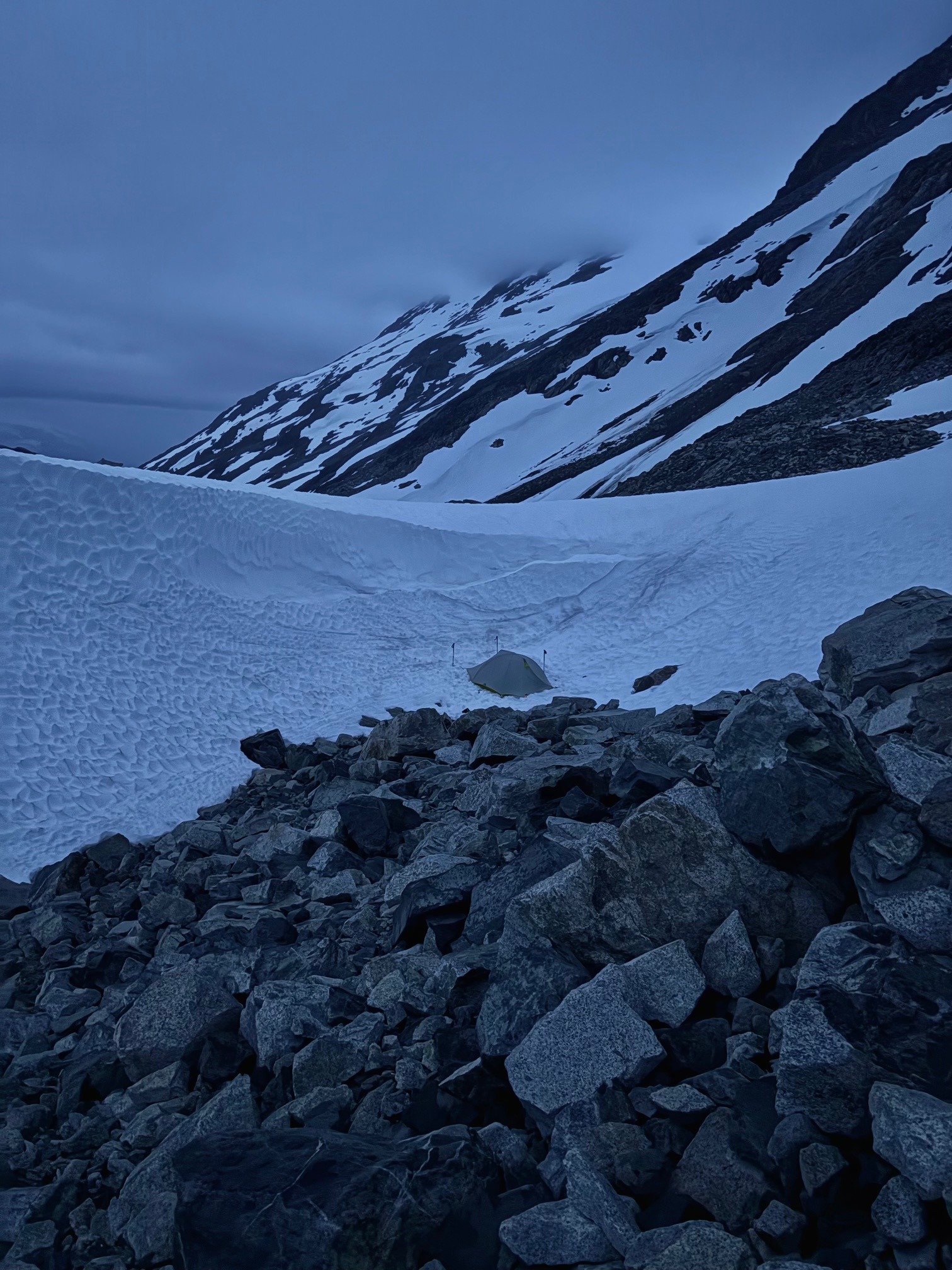
When we woke up, it was still cold but the rain had stopped. We talked through a few options for the day, a main one being that if we could find our way down to a bench below the summit, we may be able to bypass it and more wet lichen scrambling. Our hope now was to make it straight to the float plane pickup, with not another minute spent in this freezing wet hell. We made a bit of a risky decision in wearing our sleeping clothes (our last set that was still dry) rather than trying to put on the frozen wet ones. If we didn’t make it today, we would need to build a fire to stay warm.
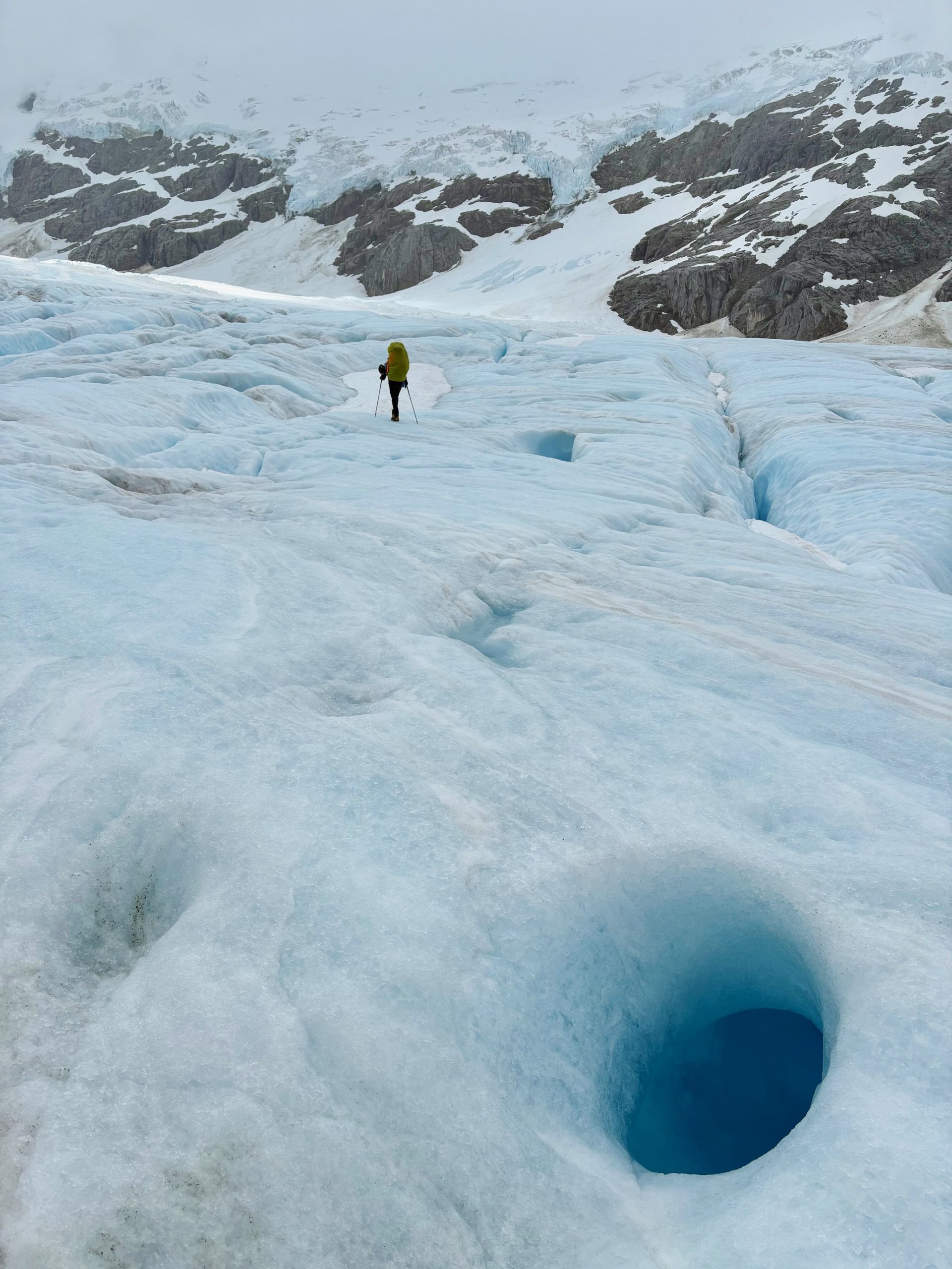
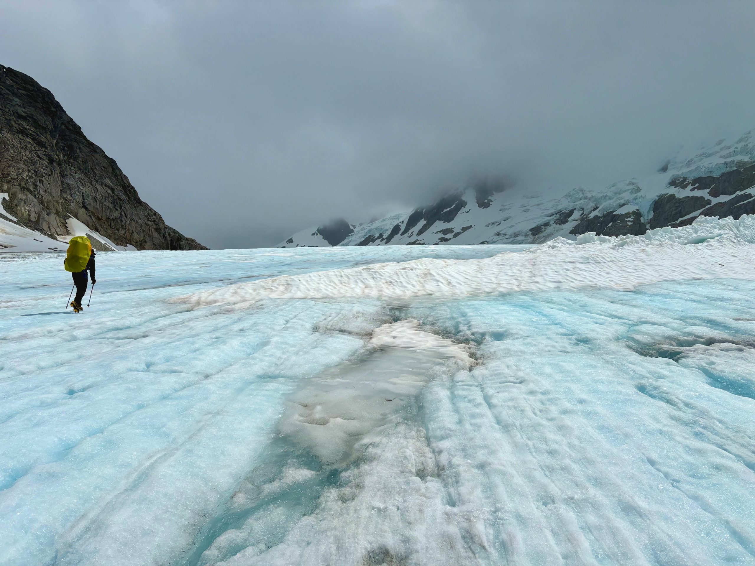
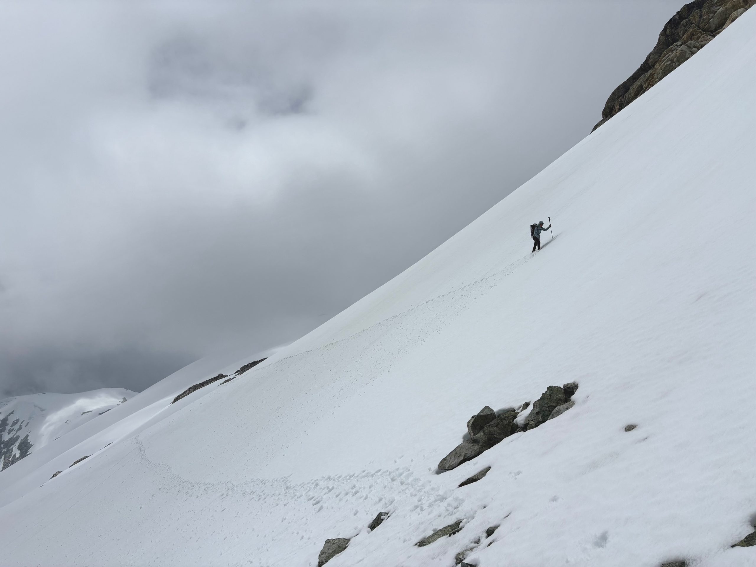
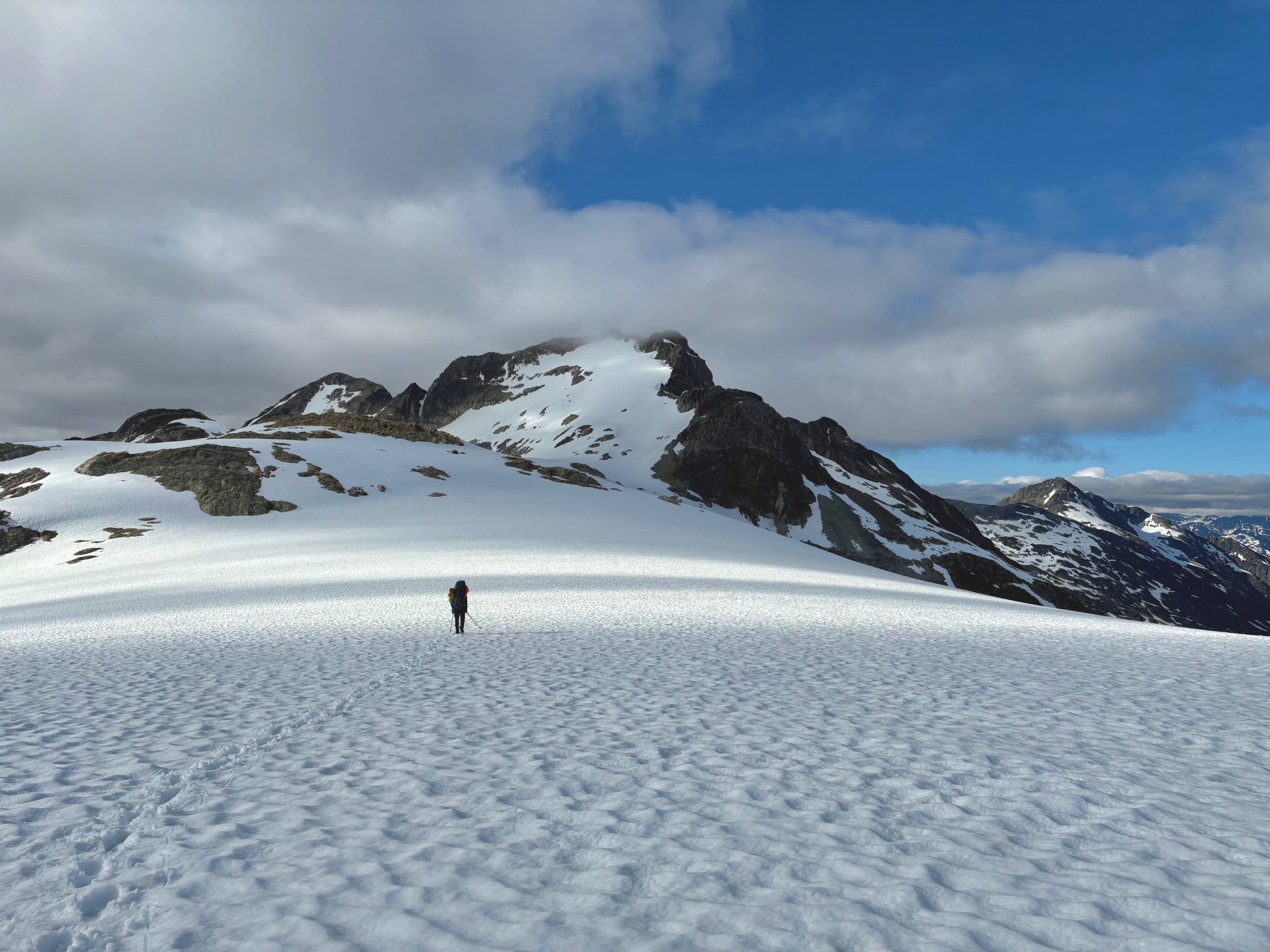
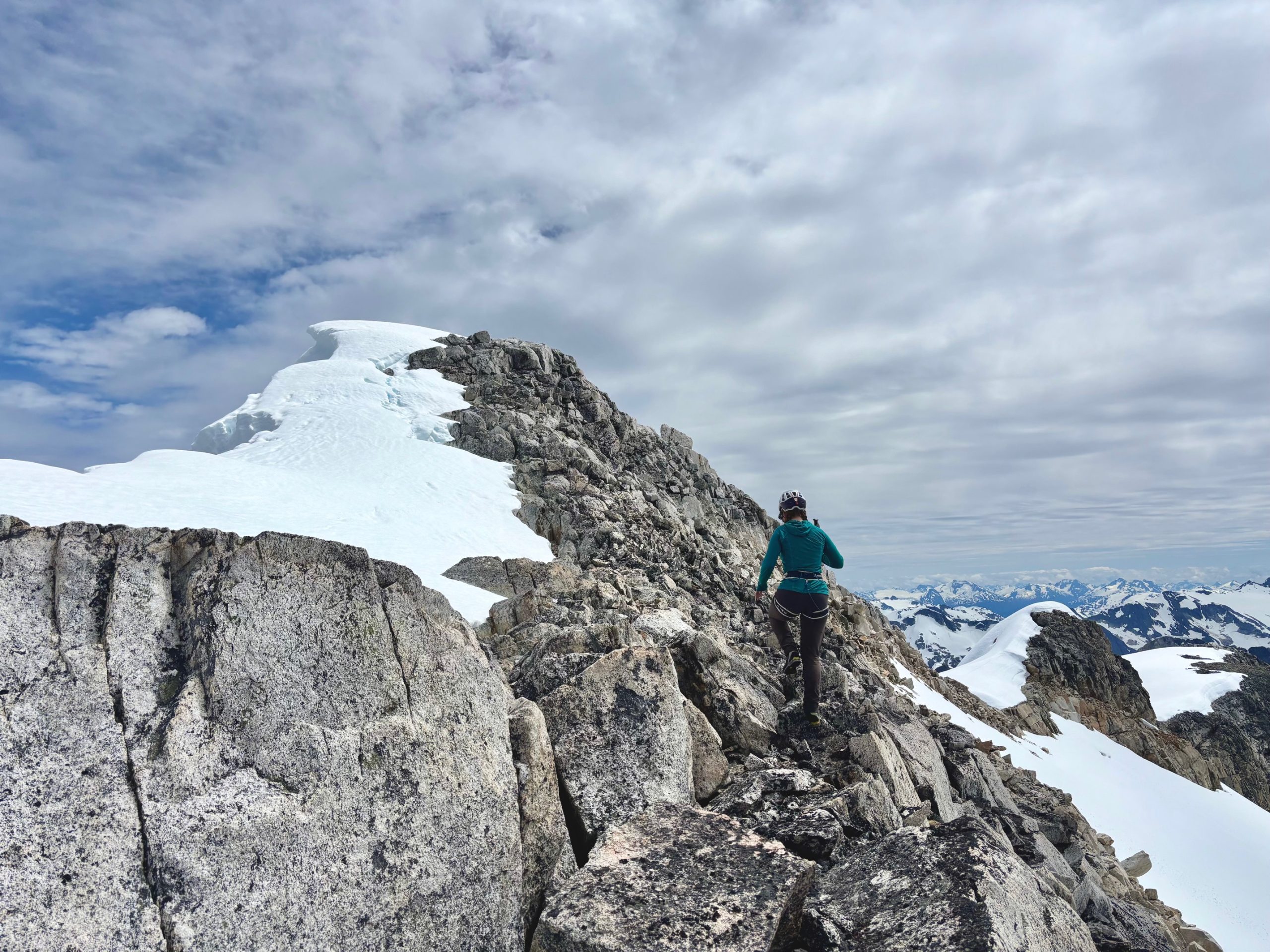
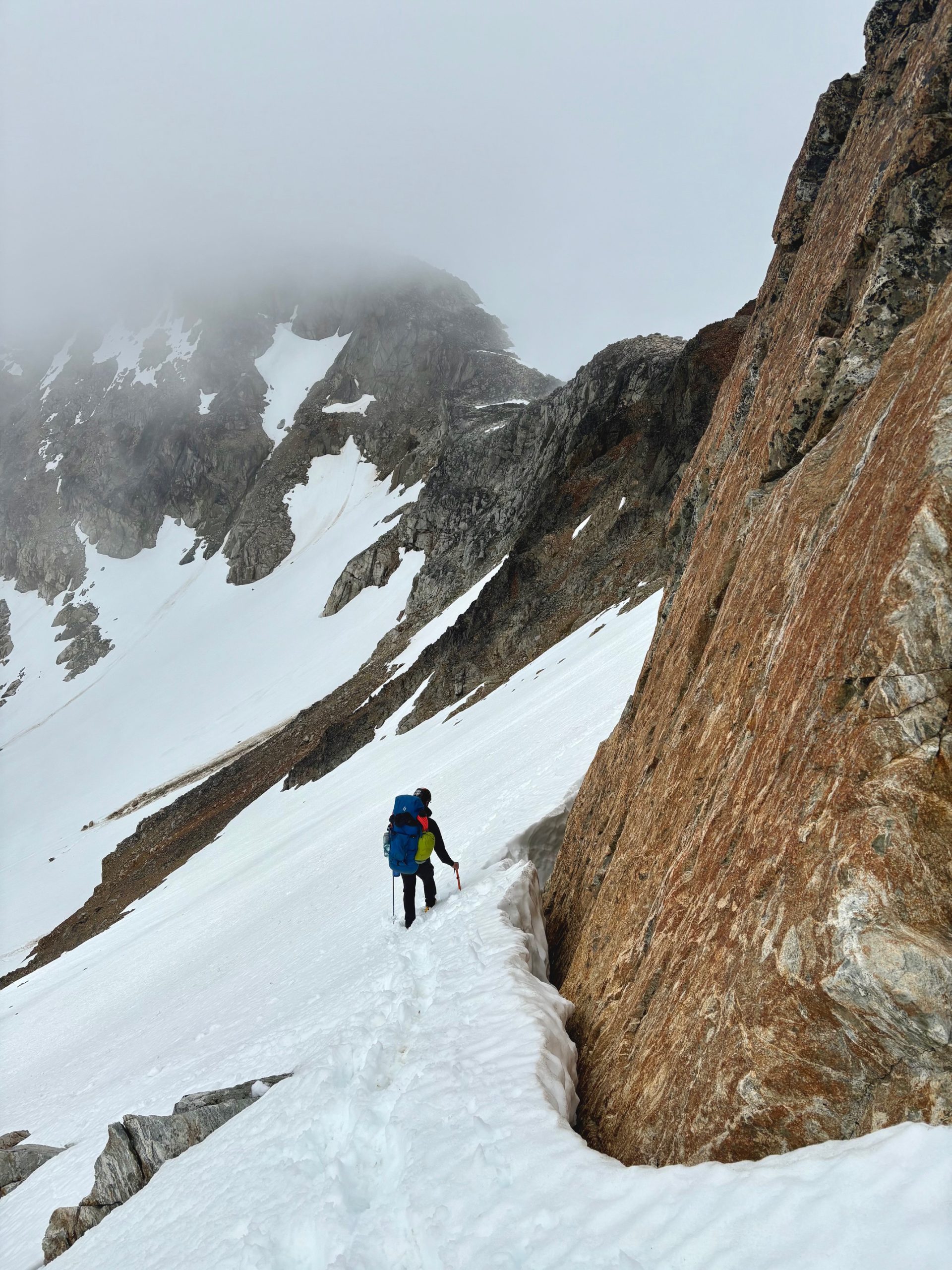
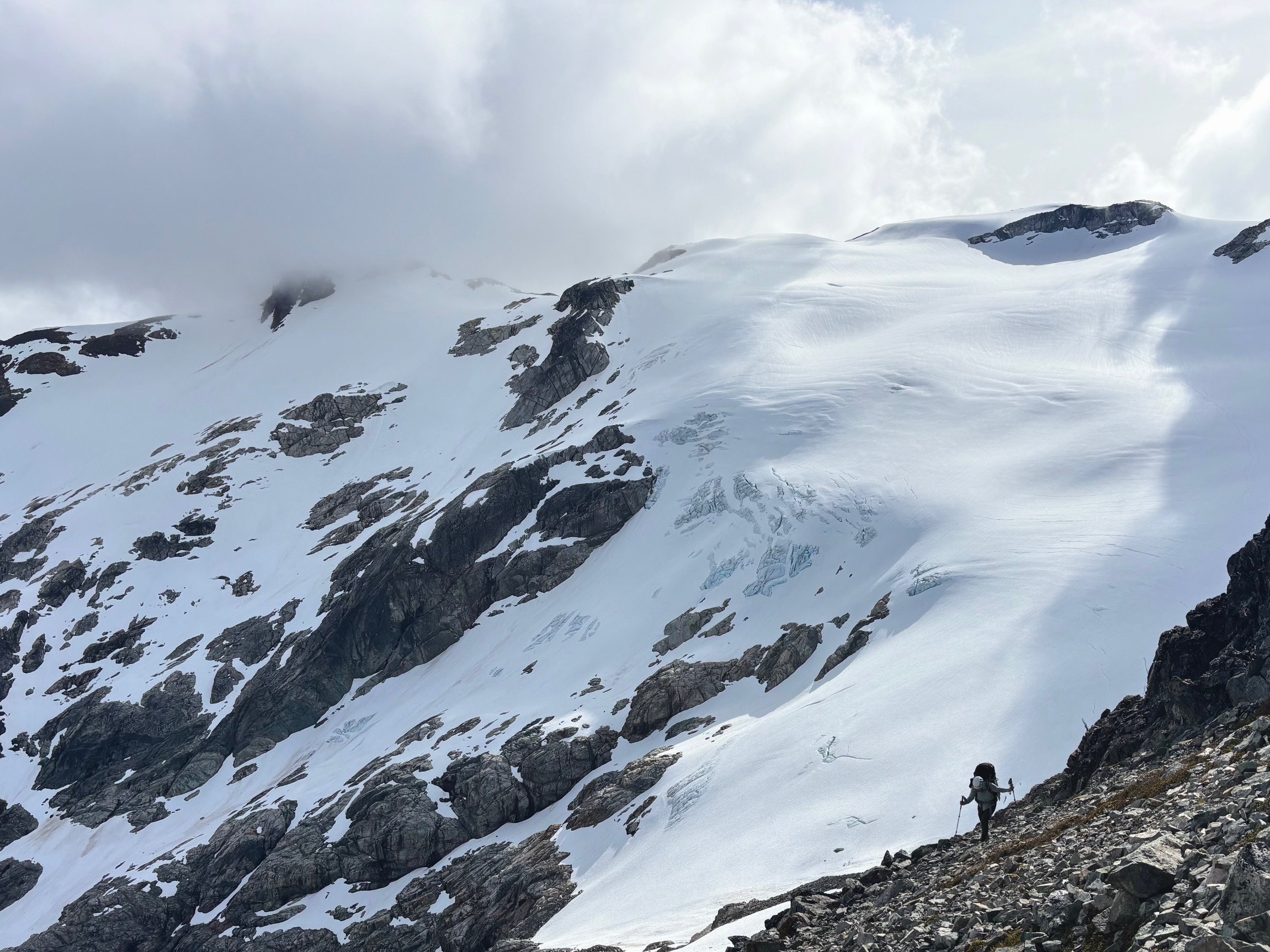
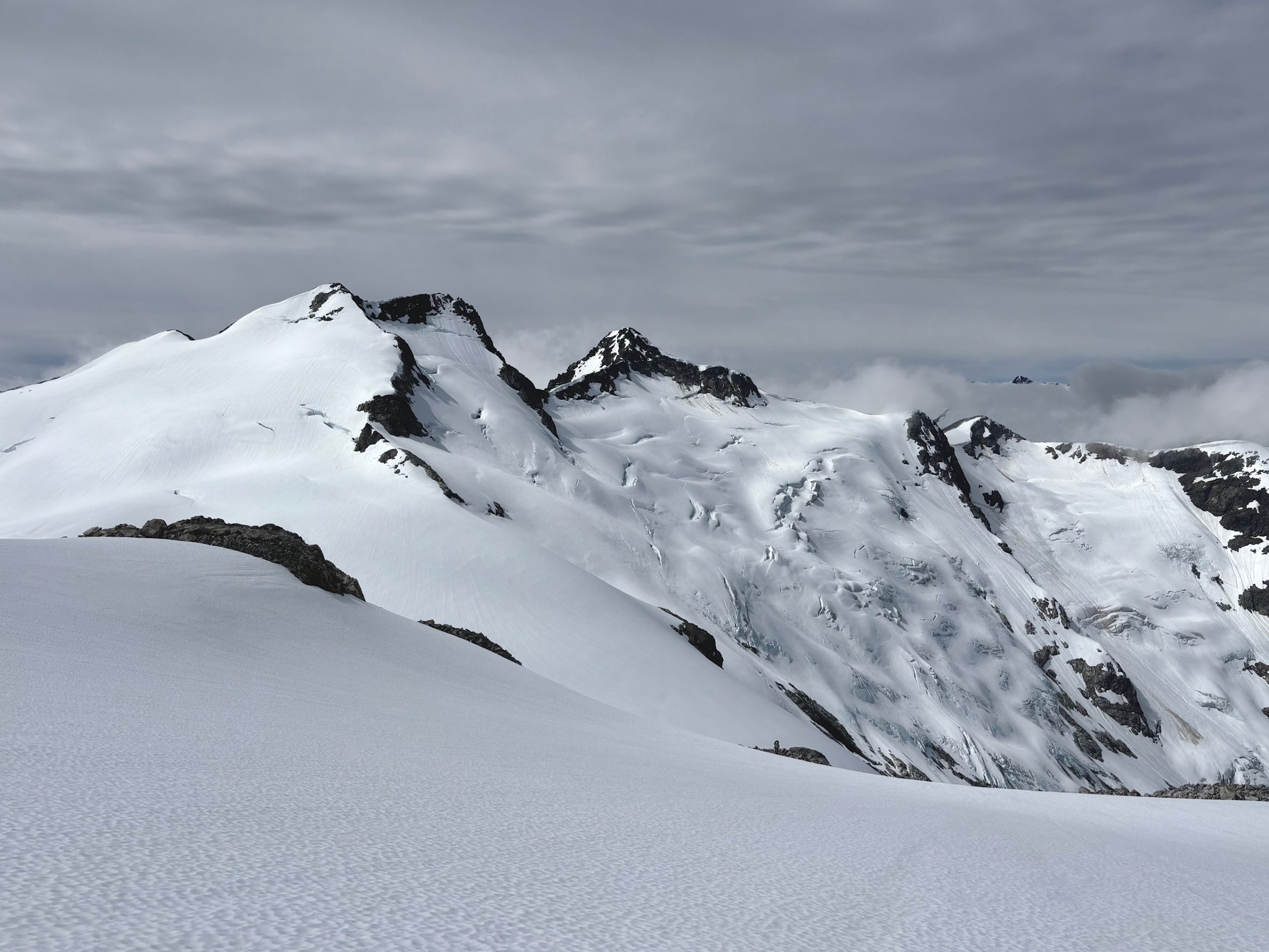
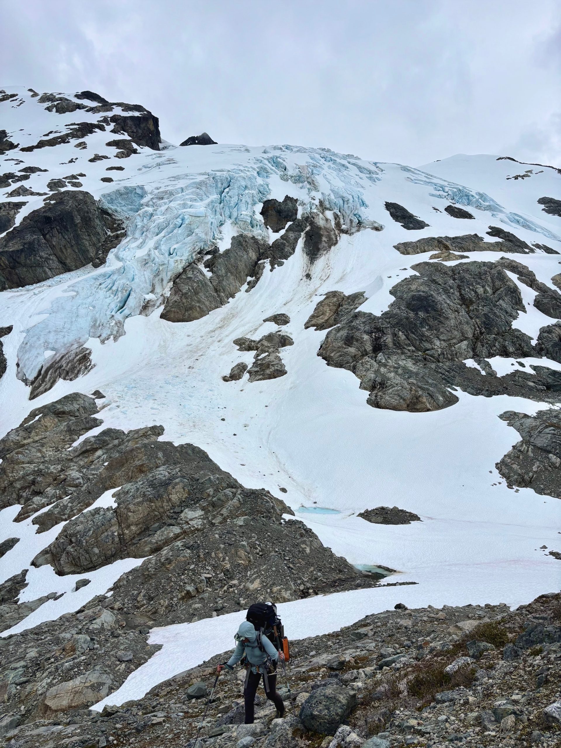
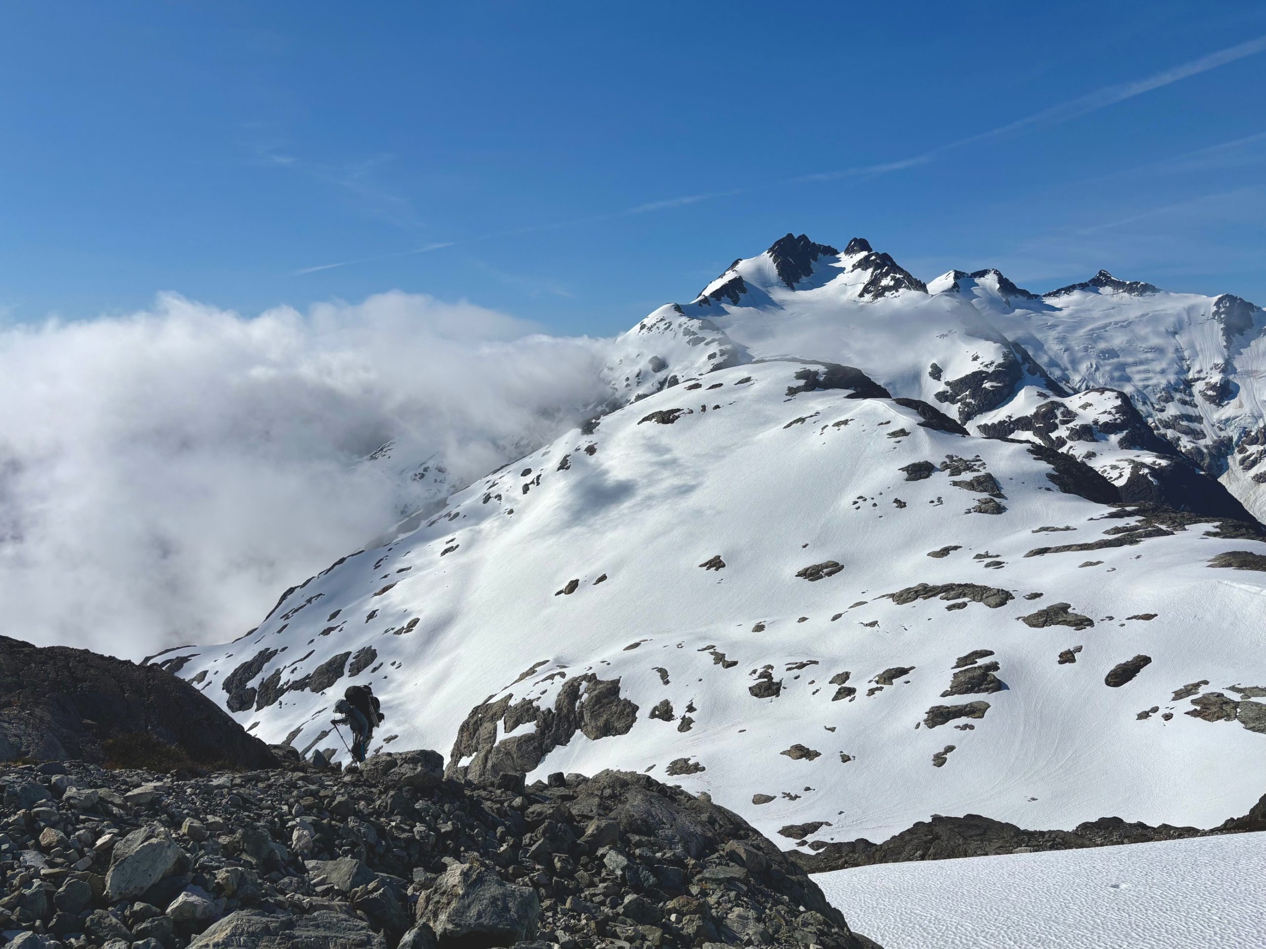
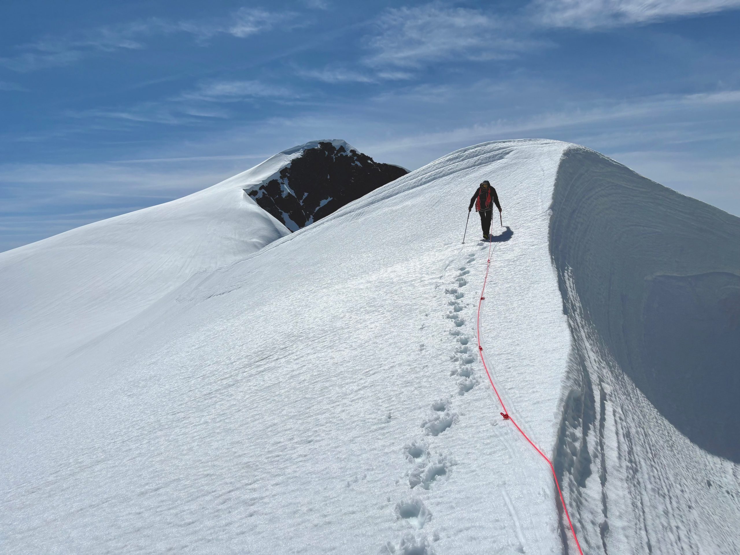
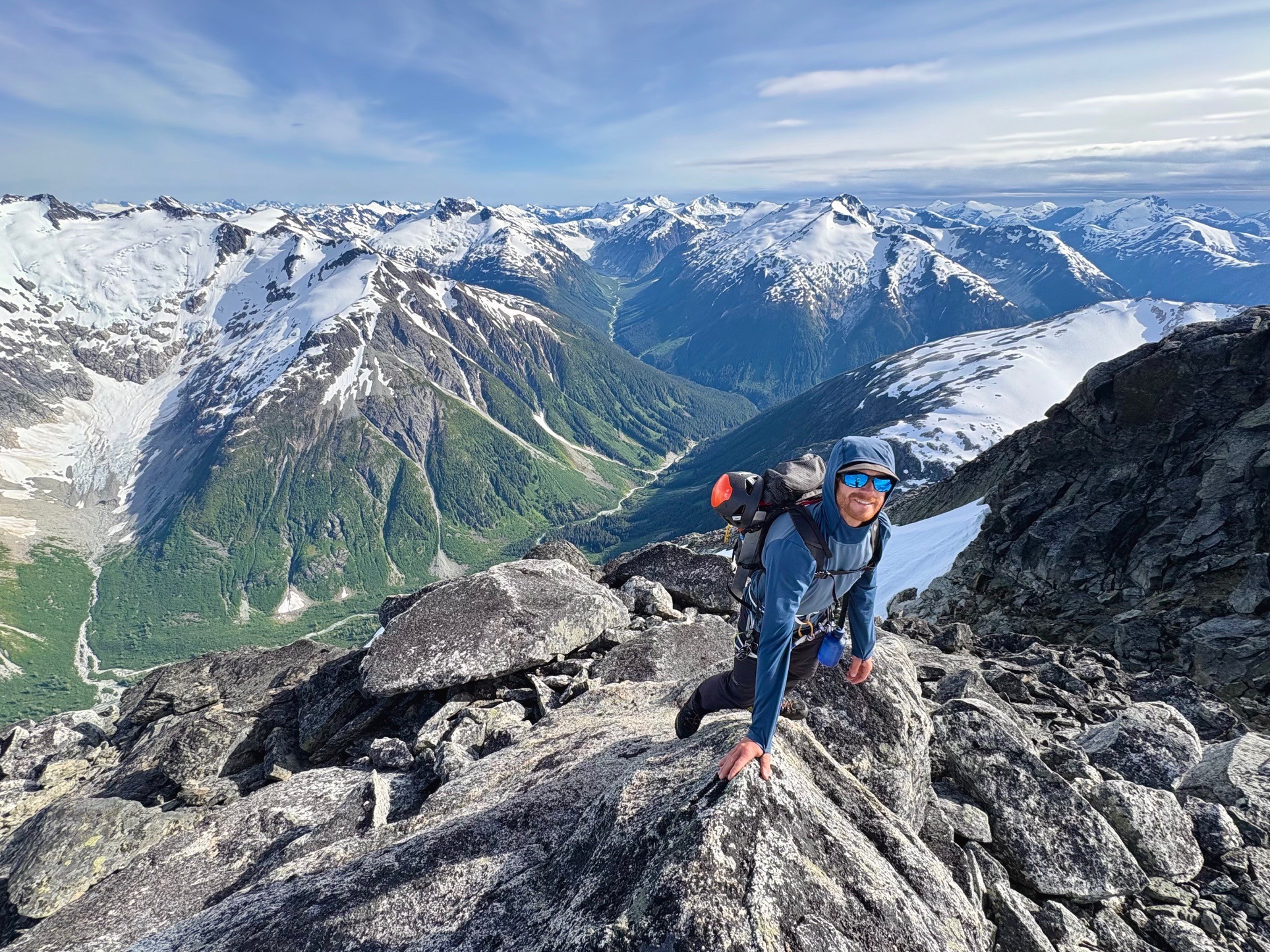
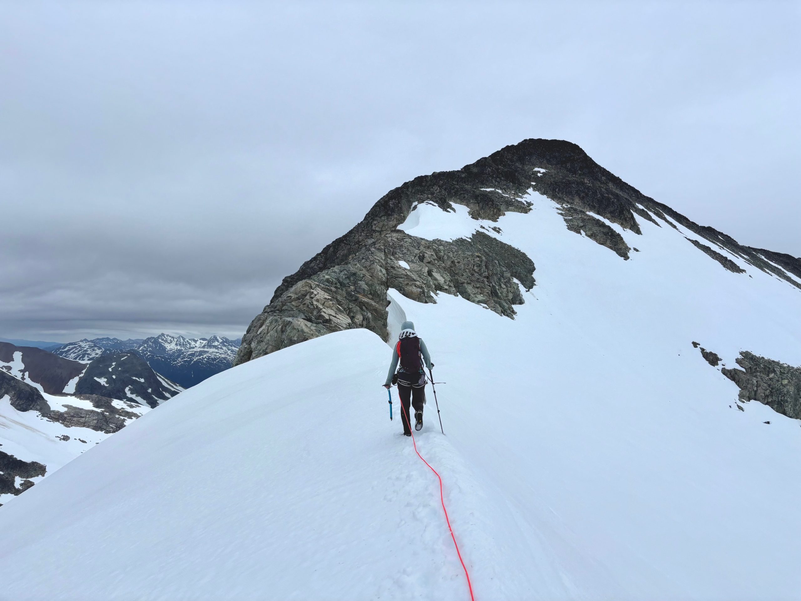
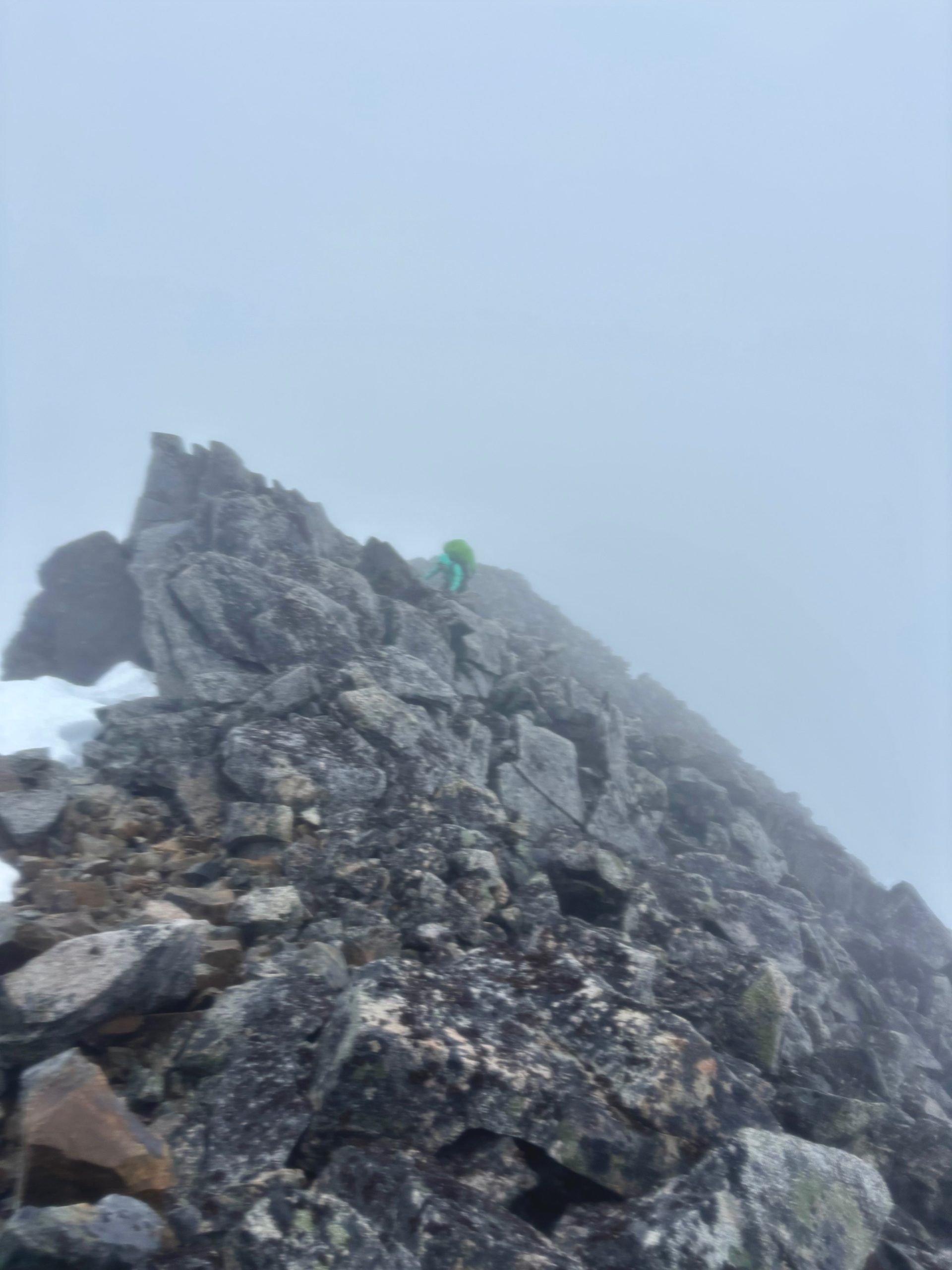
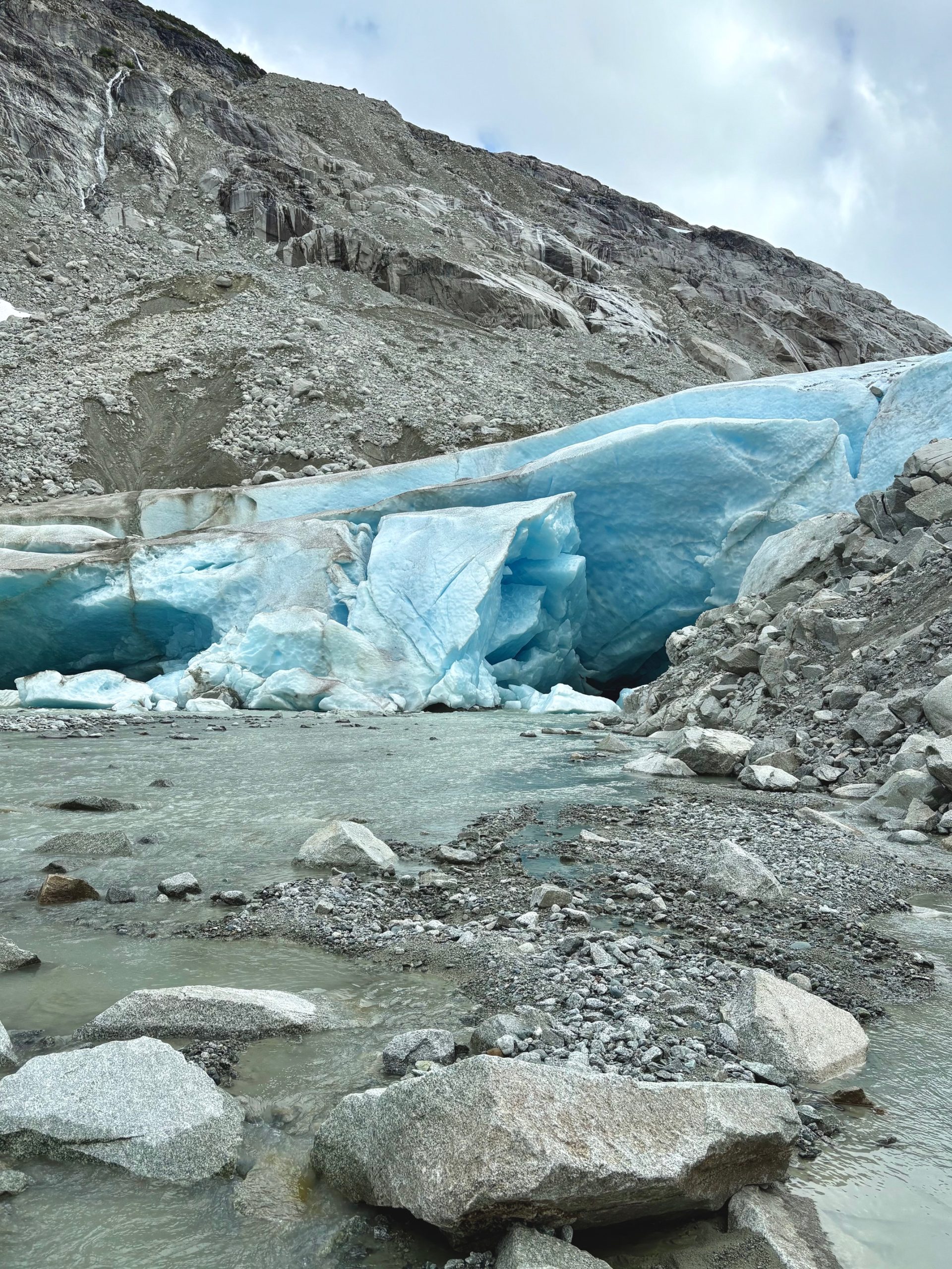
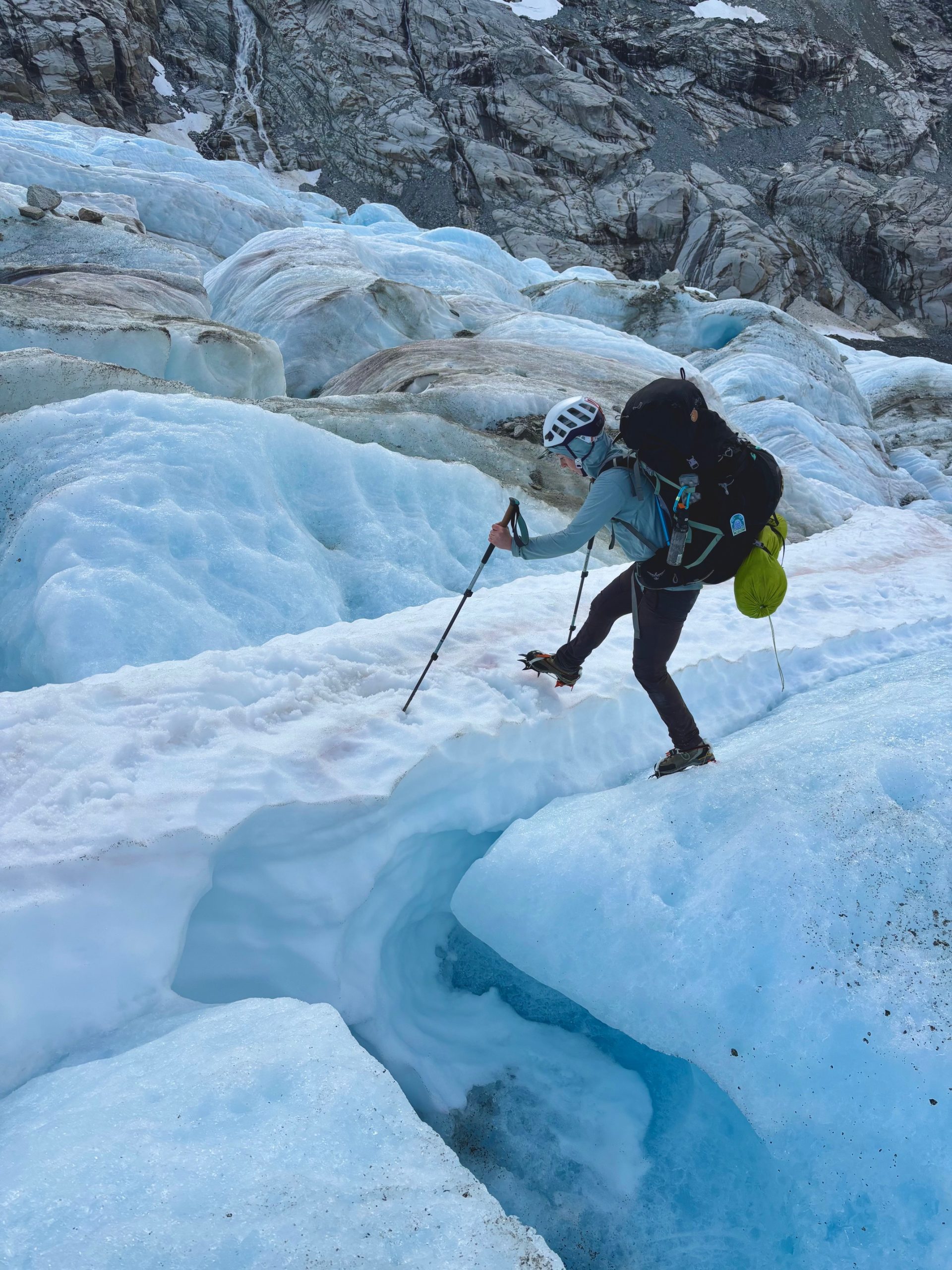
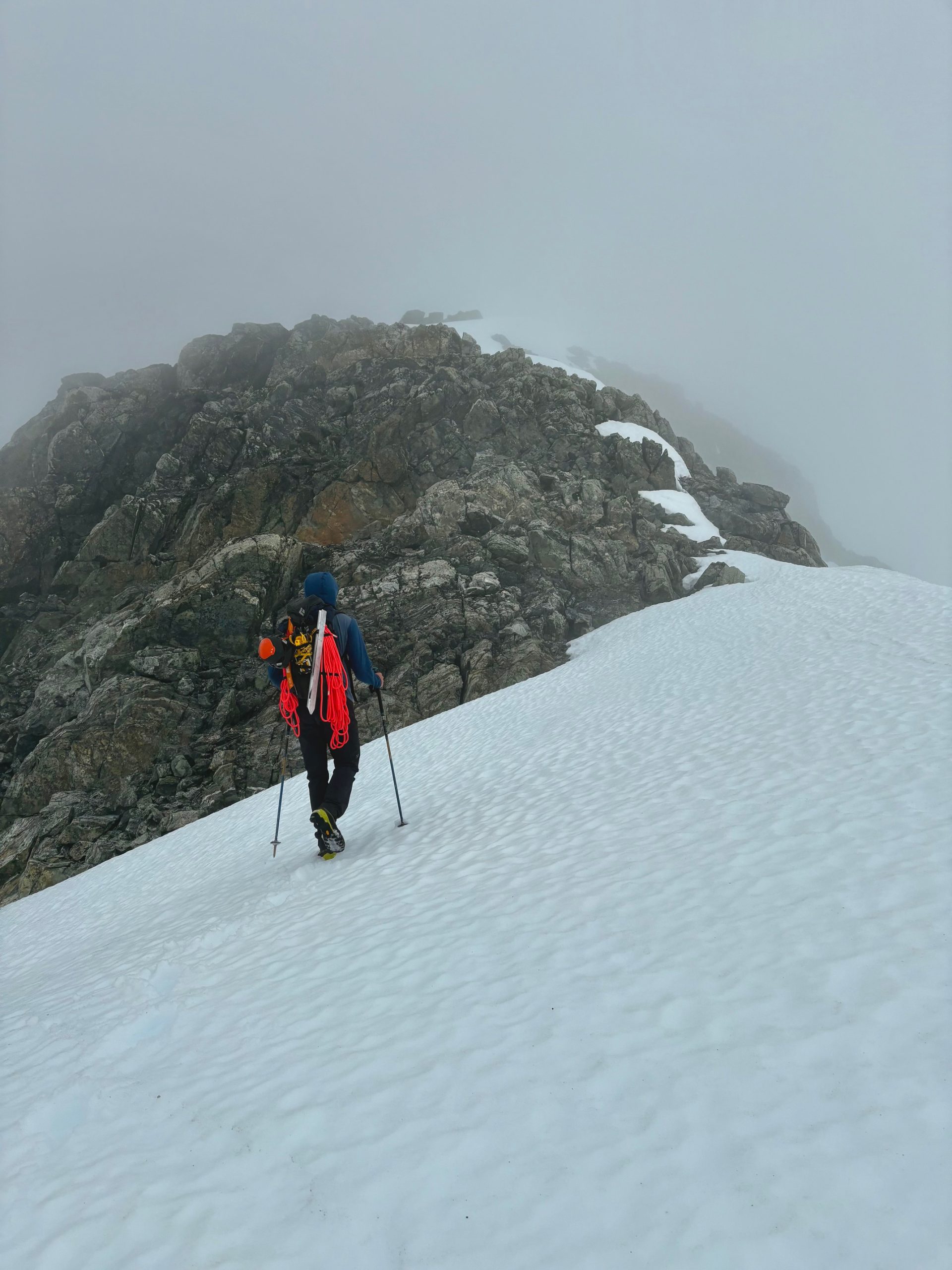
The glacier on the east of the summit looked steep – too steep to walk on – and we assumed the rocks on the west side would be as well, though we had no way to confirm this with the cloud layer we were in. We begrudgingly began scrambling up the ridgeline towards the summit, when we arrived at a steep and slippery slab. We looked at each other, and in that moment I knew we were thinking the same thing: another long, scary, and dangerous day of traversing these mountains in a storm.
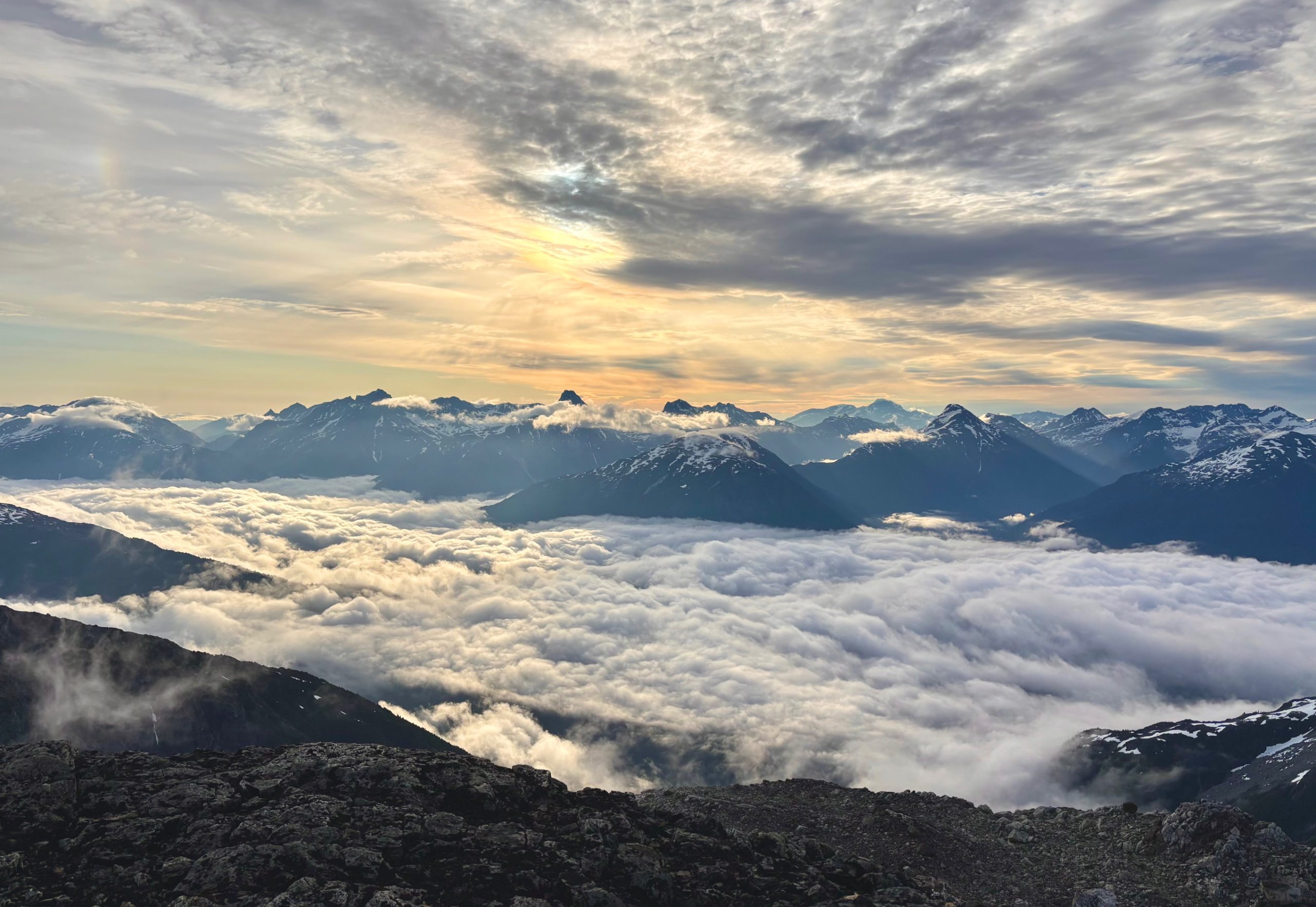
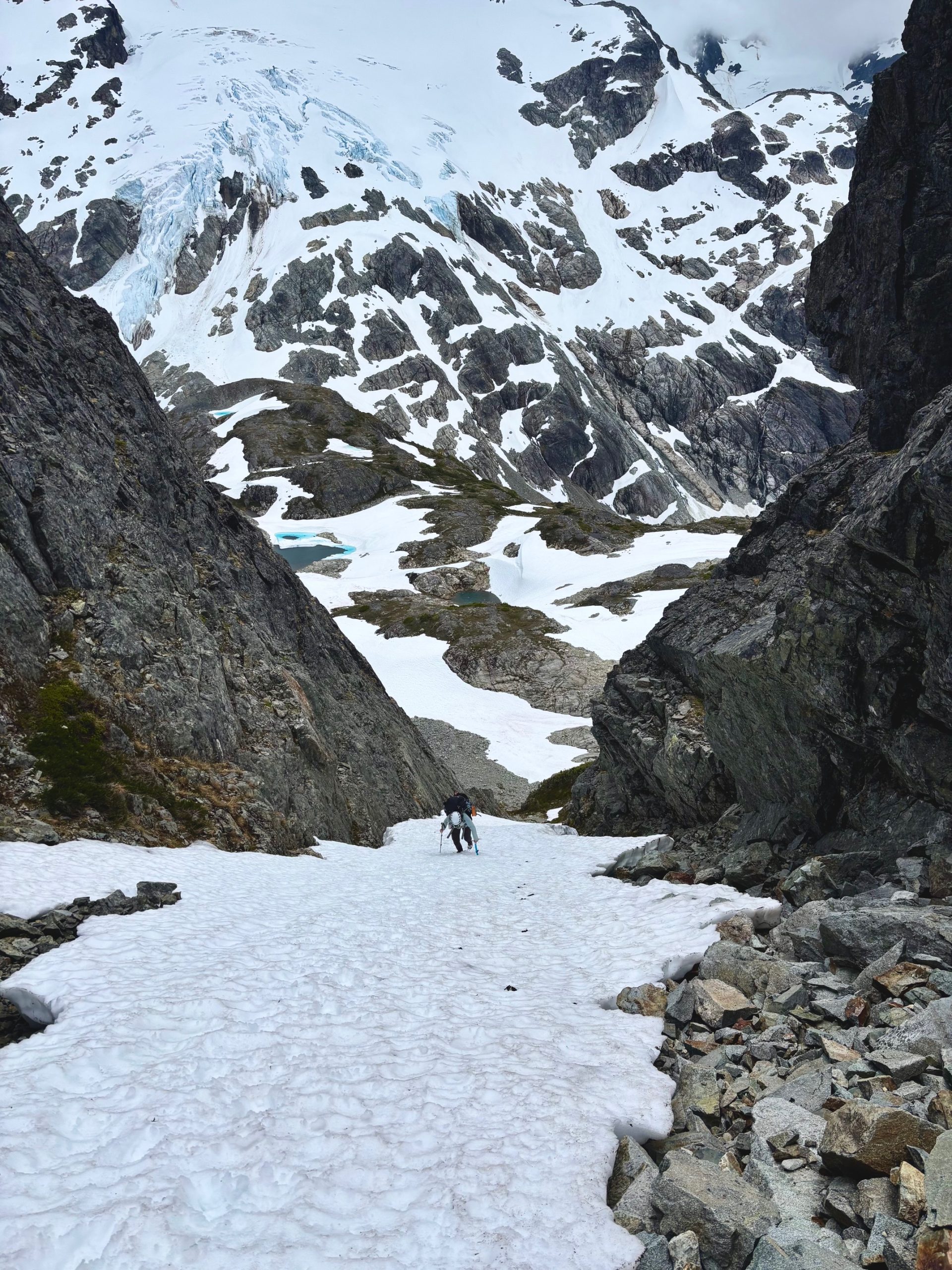
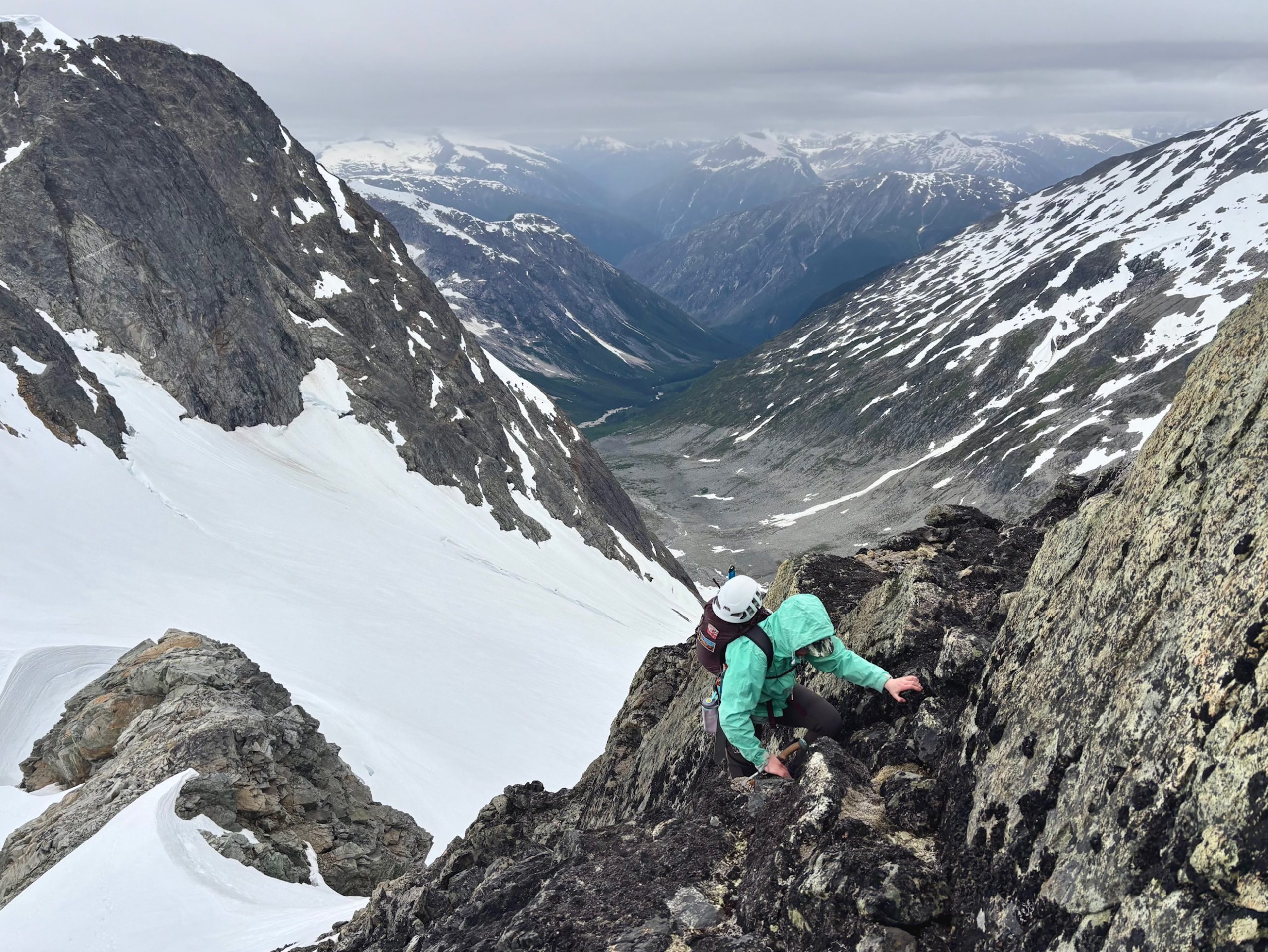
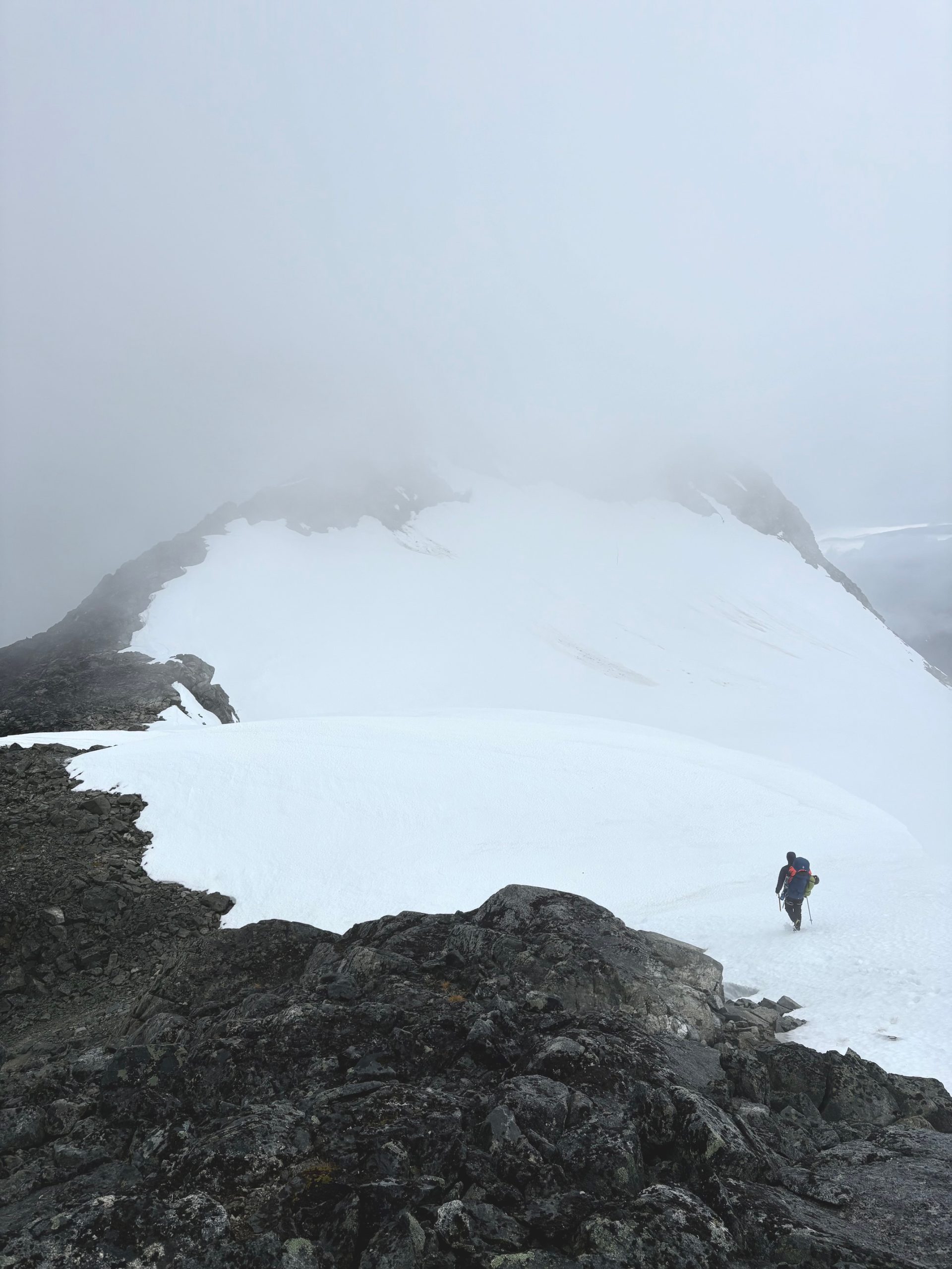
But – just as we were sharing that look, the clouds suddenly cleared completely below us – and we realized there WAS a way to get down to the lower angle bench below the summit. We made a full 180 turn, and began walking towards a narrow scree gully I’d spotted that would take us lower down.
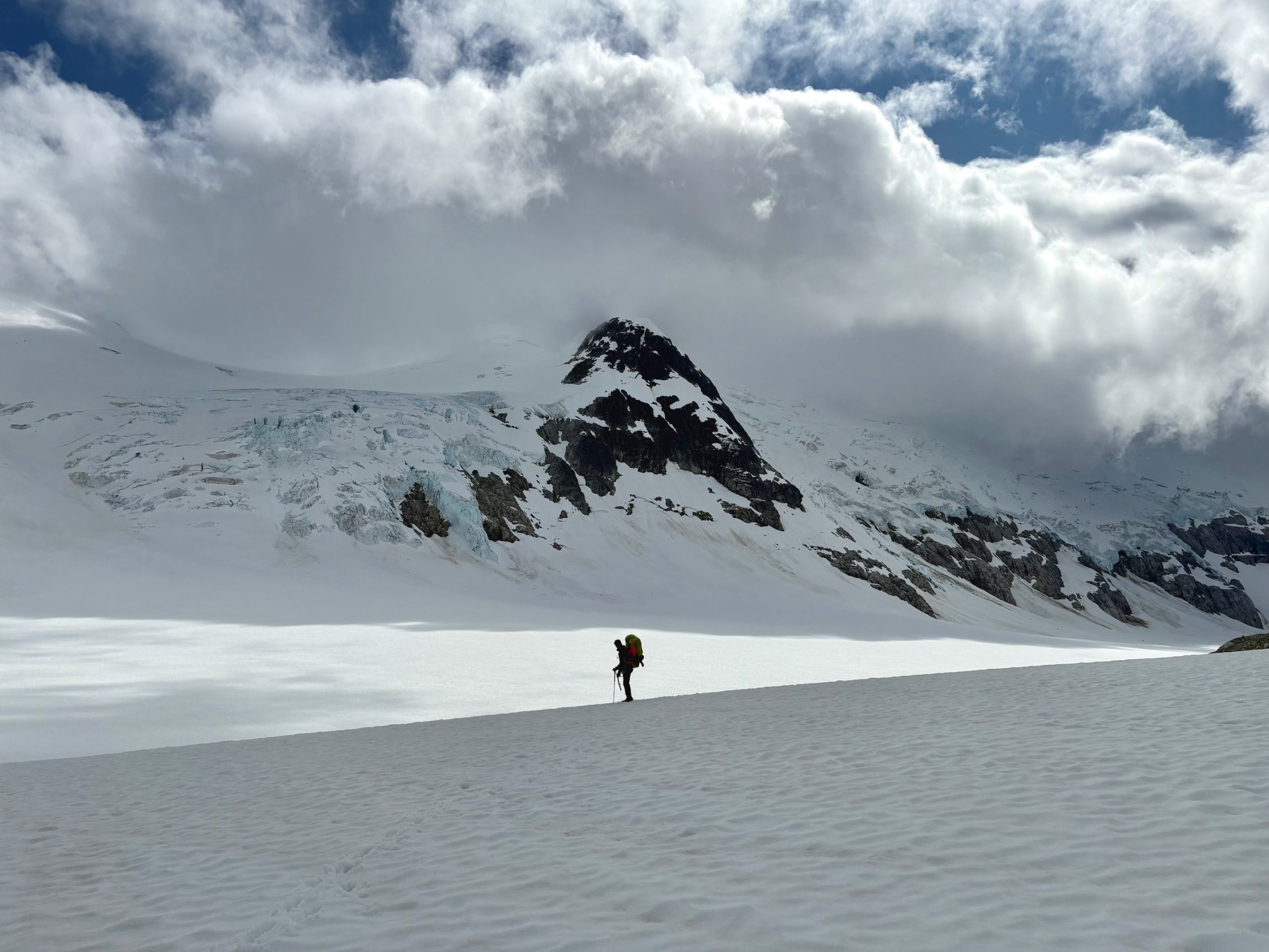
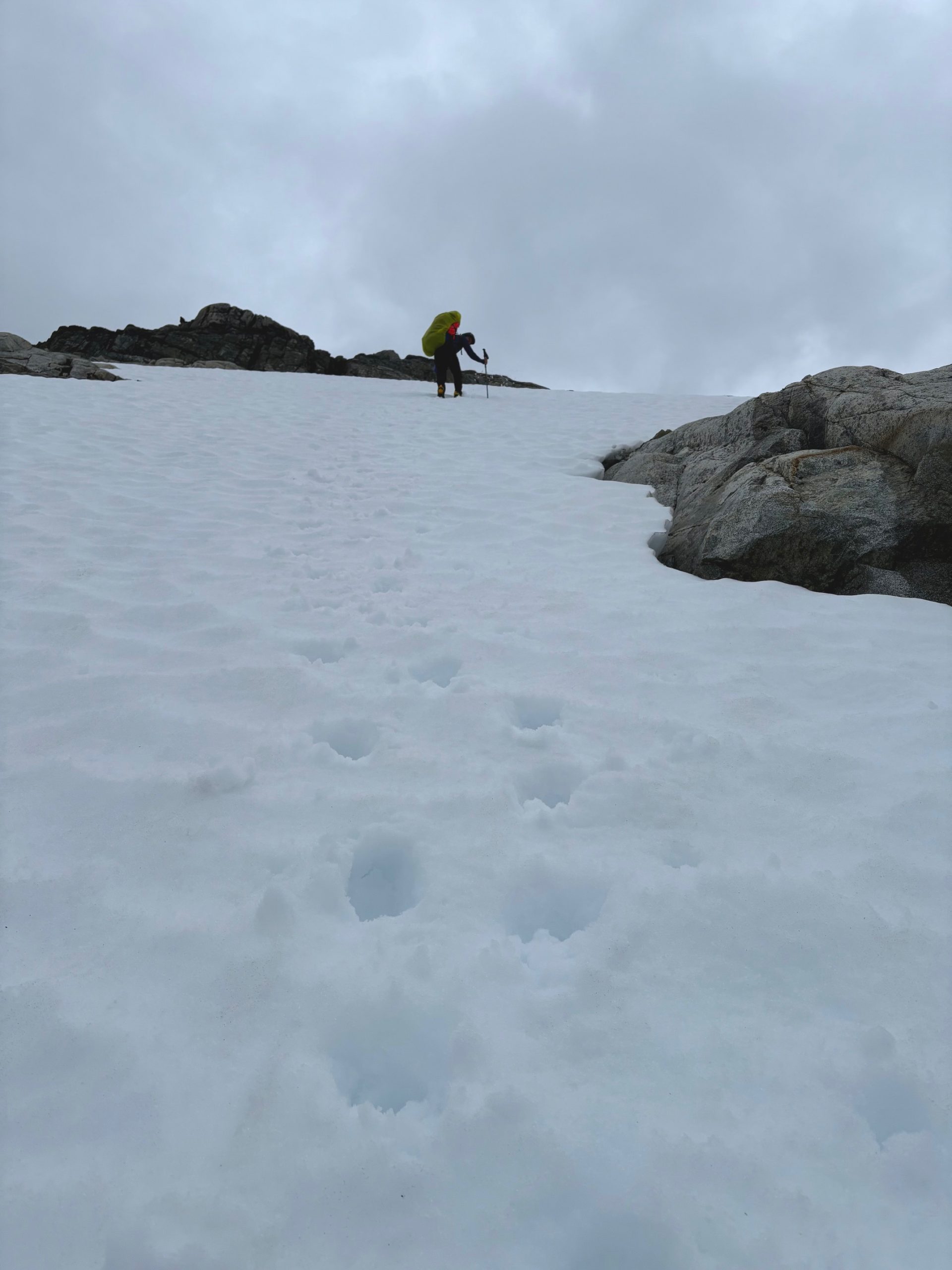
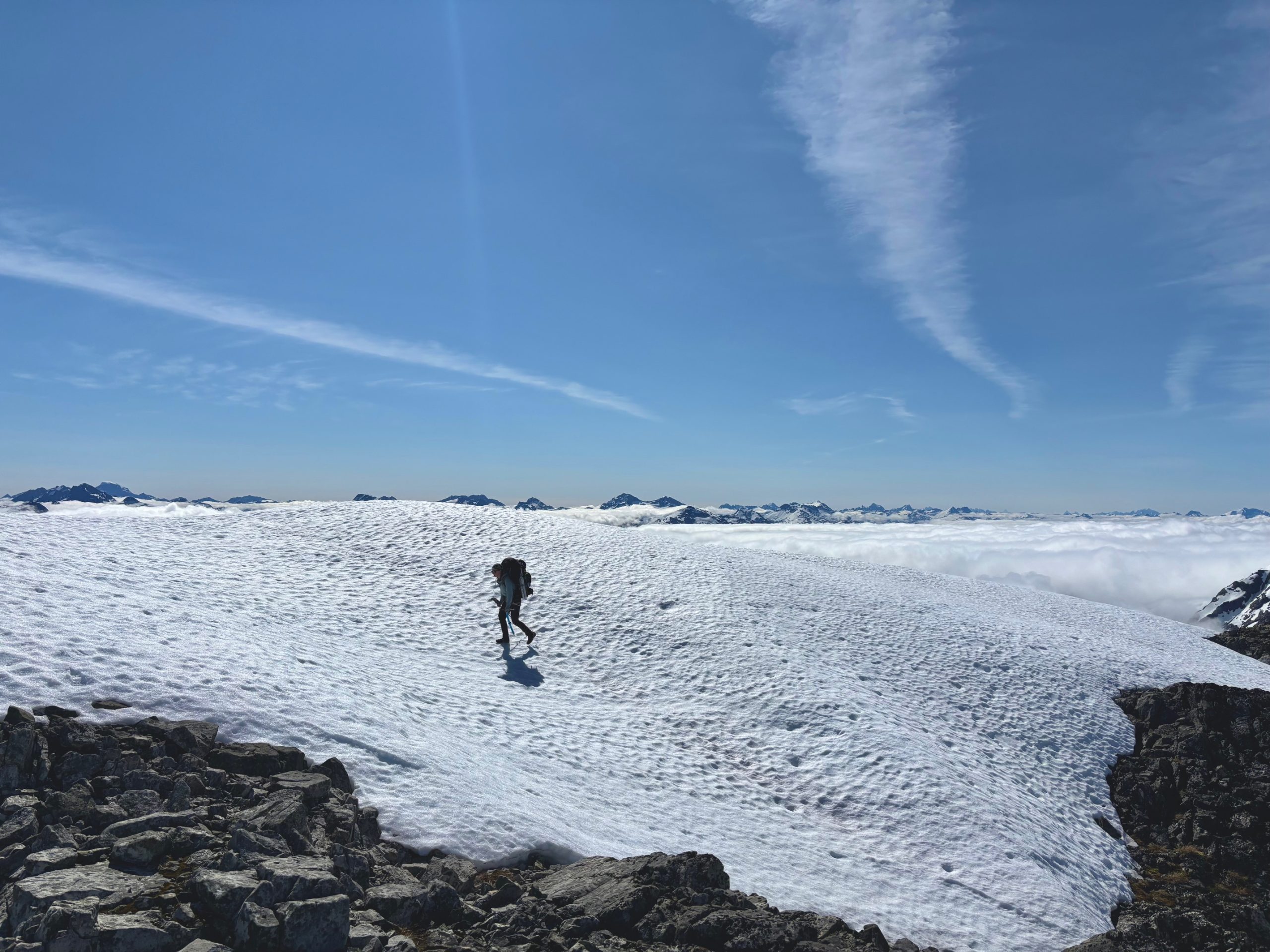
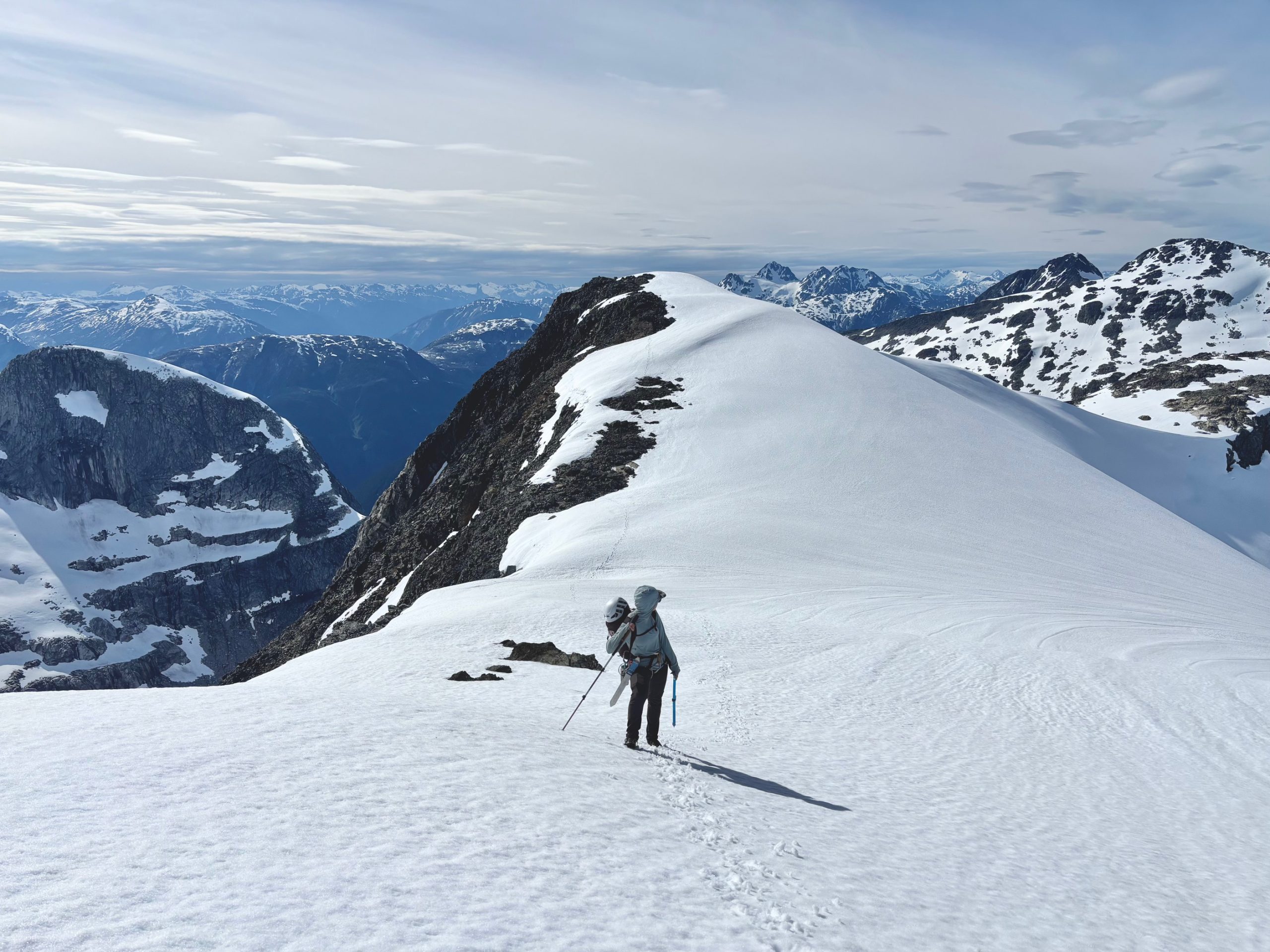
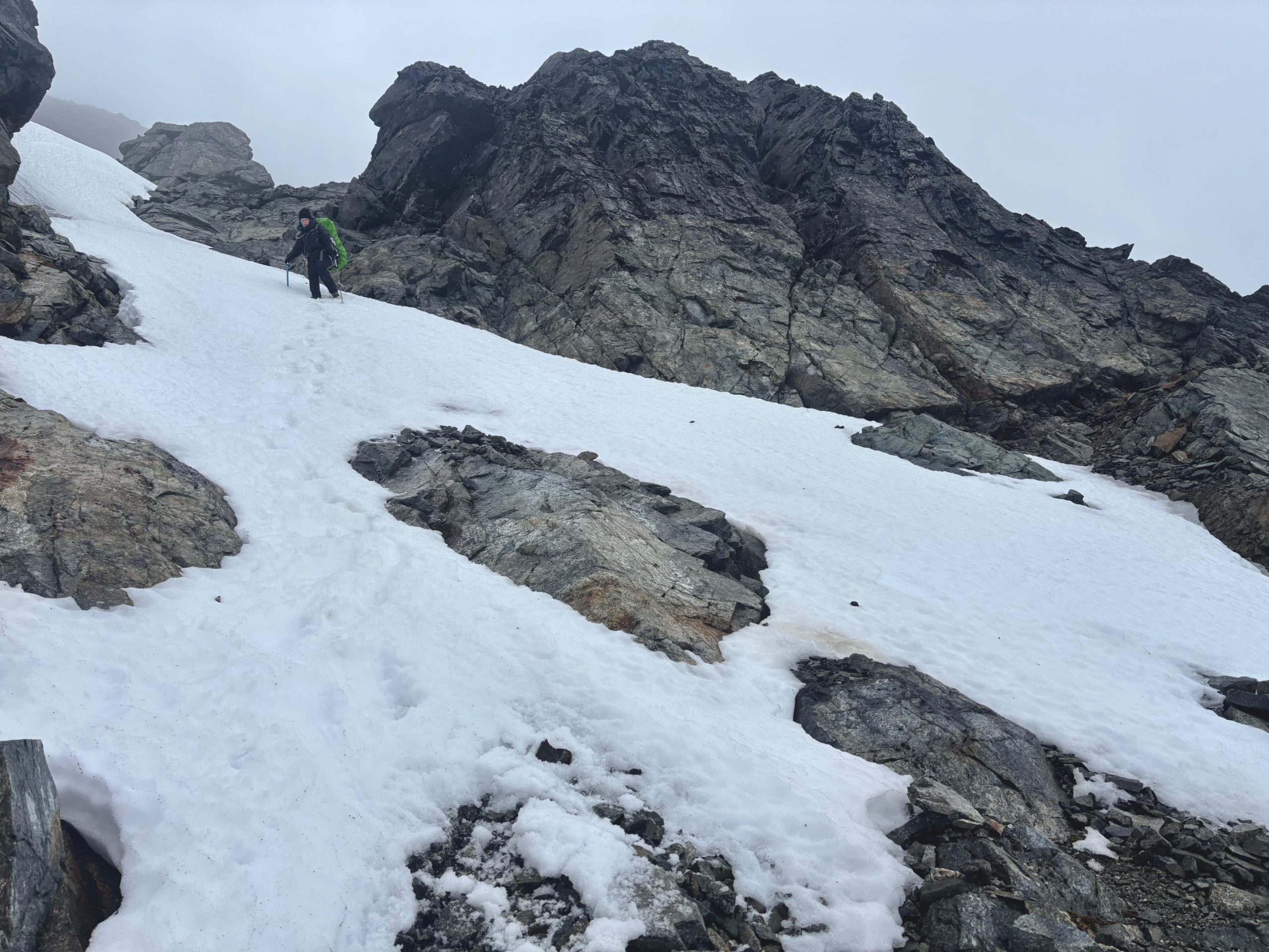
This gully – thank god – took us directly to easy terrain, and even better – under the clouds. It suddenly warmed up drastically, and I soon stopped to peel off all my warm layers. It was a strange feeling, I think for a minute the night before it sort of felt like I would never be warm ever again – haha!
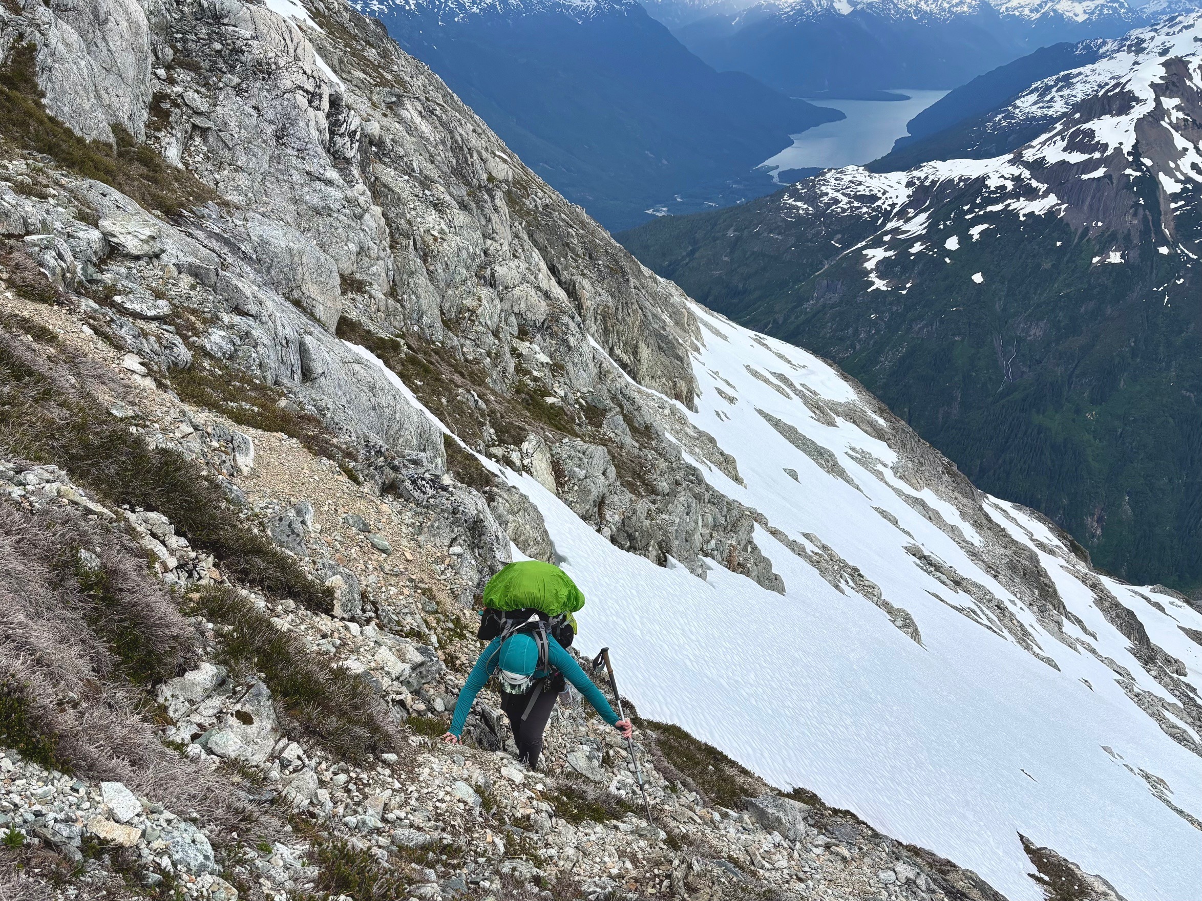
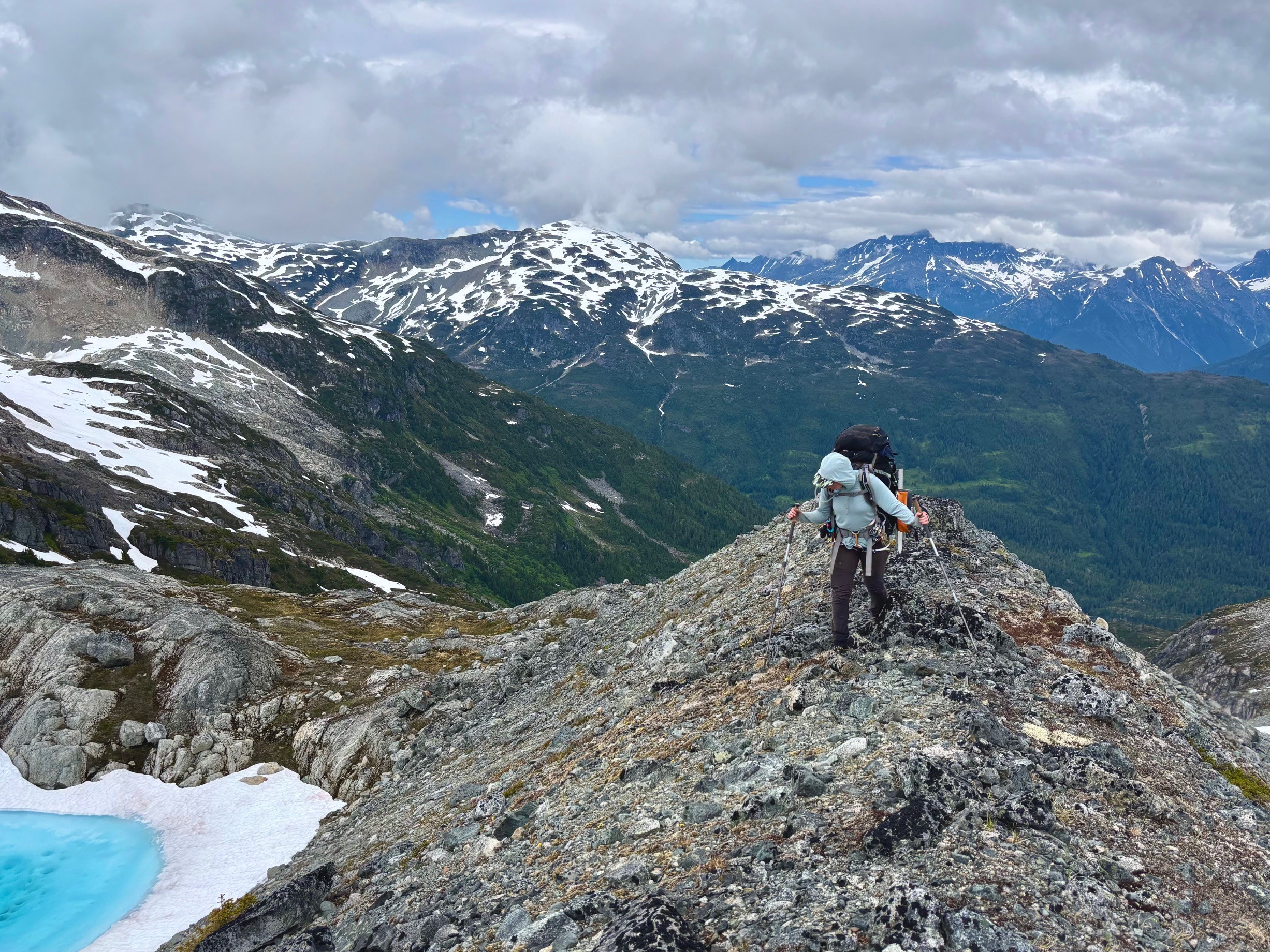
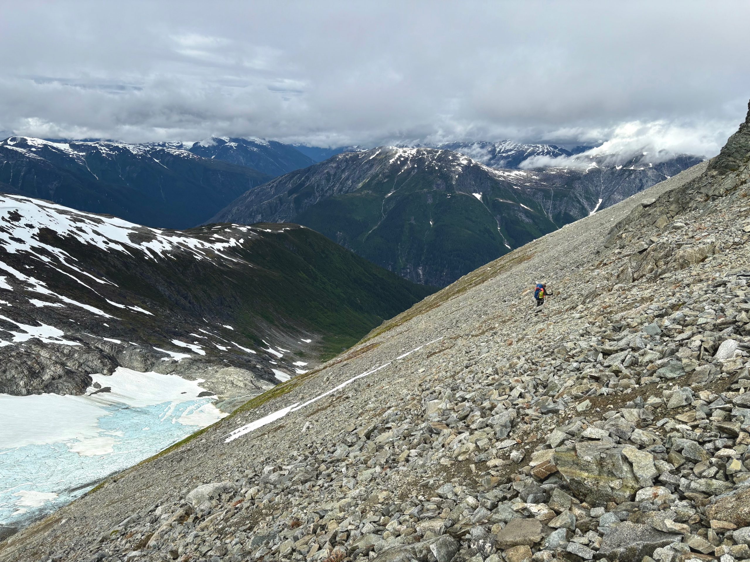
Francis confirmed with the pilot at this point that we could make our pickup time at 12:30pm, so we began a (finally) speedy walk through small rocks, and then eventually the heather meadows where we wish we could have camped the night before.
When we made it to the edge of the forest, we relaxed a little. We had about 2 hours to make it down 2km and 800m elevation, and the 2005 party had reported that this was nice, easy and open forest. Soon though, this was proved wrong too. Of course it was similar to any other coastal bushwhack – if anything it reminded me a lot of the terrain on Mount John Clarke, though also wet and somehow worse.
We descended through alder, spiky bushes, slippery moss covered boulders, large logs and occasional open trees. Francis tried to message the pilot that we wouldn’t make it until 1pm, but the inReach message couldn’t send a message through the dense layer of trees. About 400m (elevation) from the lake, we encountered a complete cliff and had to traverse sideways for quite some time to get around it. We were moving as fast as possible, but both of us were slipping and falling every few steps, accumulating bruises and scrapes all over. It was now 12:30pm, and I almost broke down, knowing we would certainly miss our plane and have to spend the night in the grizzly-infested forest.
As the float plane rocketed into the lake with its loud engine, I felt so much despair. I could not physically go any faster, my knees felt like they might give out after all the heavy days and long hours of walking on difficult terrain. Francis though, somehow had energy. With my “okay,” he sprinted off down the hill, half on his feet and half sliding or tumbling through the dense brush. It was actually genuinely impressive how fast he could move once he wasn’t trying to stay standing.
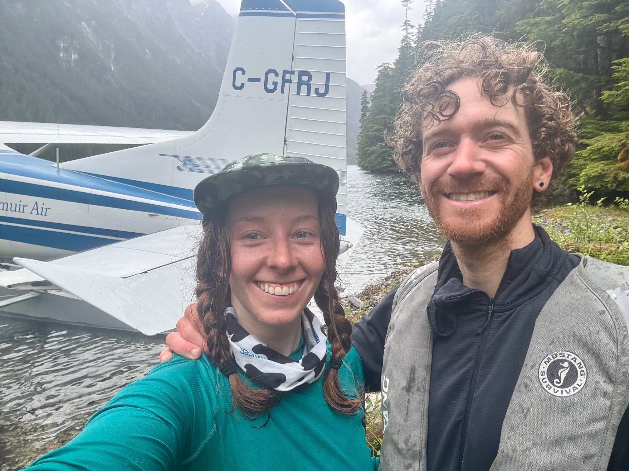
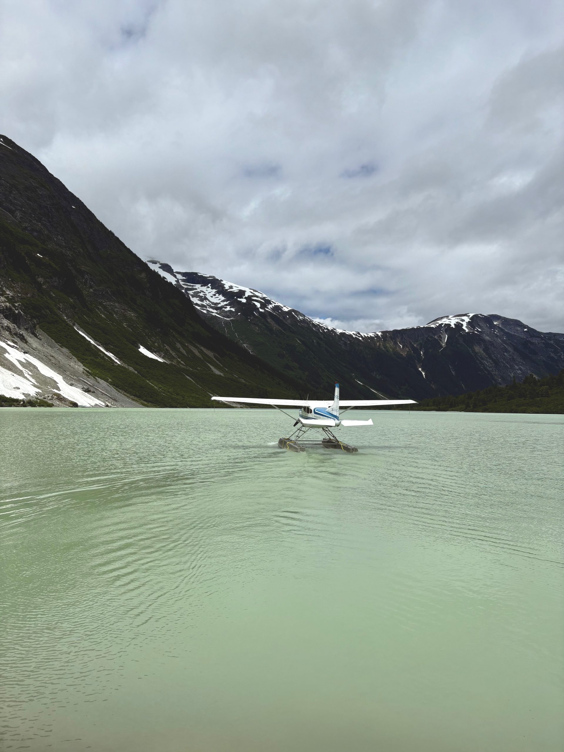
The plane coasted along the edge of the lake, clearly looking for signs of us, and Francis began screaming at it that we are here! We are coming! Eventually the pilot shut off the engine, and I heard them exchanging shouts, finally able to communicate. He directed the plane to a small beach at the end of the lake where it was able to dock on the shoreline.
A wide smile spread over my face with final confirmation that the trip was done, and I decided to tumble down too, not wanting to make the pilot wait too long for me. It hurt so bad as I bruised up all my limbs, and even grabbed spiky bushes with my bare hands. I tore two massive holes in my rain pants, but at this point I figured I would rather trash the pants than waste time getting to the plane gently.
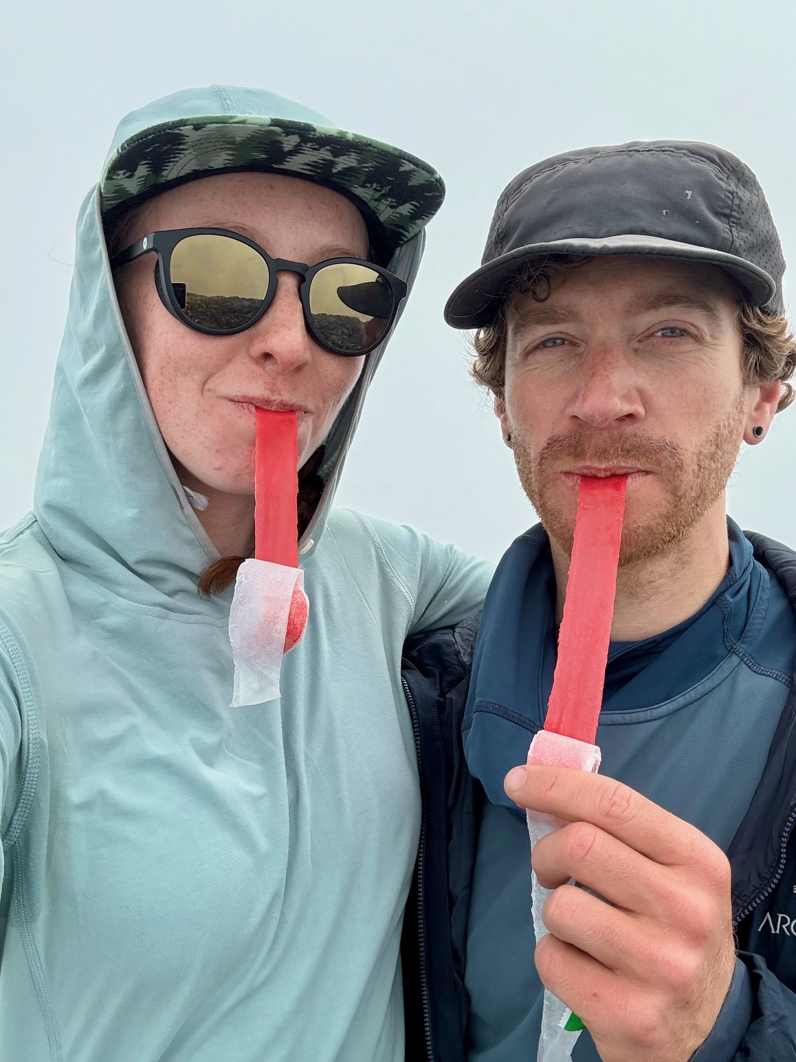
As I emerged from the forest, I must have looked insane. I was covered in leaves and mud, clothes torn, hair greasy, and wild eyes for sure. Francis looked about the same as me.. but we did it!! I will never complain about running for a plane in an airport ever again.
I wished we’d had a little while to swim, clean off and enjoy the lake, but our pilot was in a bit of a rush to fly out before (yet another!) storm hit in the afternoon. I instead opted to jump in at the much sunnier Nimpo Lake upon our return, and of course did so with all my clothes on, no longer caring what was wet or dry.
I’d love to say I have some big reflection for this trip, but honestly we went out there, we had a super cool adventure, and that is really all I wanted. Despite the many challenges, I have so many happy memories looking back at it, and will one thousand percent be back for another round of adventure in the coast mountains next year.
